1970s Maps of Tyler County, West Virginia
Explore 11 historic maps of Tyler County from the 1970s. These maps offer a rare glimpse into what life looked like during the 1970s — showing old roads, neighborhoods, homes, and landmarks that have changed or disappeared over time.
Whether you're researching your family's past, planning a metal detecting trip, or studying how Tyler County's landscape evolved across the 1970s, these high-resolution maps are a powerful tool for exploring the history of this region.
- Focus on a specific era: All maps on this page are from the 1970s, giving you a focused view of this time period.
- See what’s changed: Compare century-old streets, trails, and buildings to today's modern landscape using overlays and satellite layers.
- Research with precision: Use these maps for genealogy, historical research, land use analysis, or educational projects.
- View, download, or print: Maps are fully viewable online in high resolution, and can be downloaded or printed for your own records.
Start exploring Tyler County's history through authentic maps from the 1970s. This is your window into the past.
Tyler County, WV maps
(11)- 1975 Map of Ellenboro, 1979 Print
 1975 Ellenboro1979 Print · USGSEllenboro and the Ritchie County hills are shown in detail through mid-1970s aerial imagery. Researchers can trace the exact road layouts and land clearances around Hebron, Lamberton, and the winding path of Bonds Creek.
 - 1975 Map of New Matamoras, 1979 Print
 1975 New Matamoras1979 Print · USGSThe Ohio River valley in the mid-seventies is documented here through detailed aerial imagery, showing the relationship between steep river bluffs and rural settlements. Researchers can trace the riverfront layouts of New Matamoras and Grandview or locate the upland community of Brownsville.
 - 1975 Map of Bens Run, 1979 Print
 1975 Bens Run1979 Print · USGSThe Ohio River valley in the mid-seventies reveals a landscape defined by industrial riverfronts and winding inland waterways. Genealogists and local historians can trace the residential layouts of Bens Run and Beavertown or follow the deep loops of Middle Island Creek.
 - 1976 Map of West Union, 1978 Print
 1976 West Union1978 Print · USGSDoddridge County comes into sharp focus during the mid-1970s, showcasing the winding valleys and ridge-top life of this West Virginia region. Researchers can trace the sharp meanders of Middle Island Creek and locate historic centers like West Union and Central Station.
 - 1976 Map of Pennsboro, 1979 Print
 1976 Pennsboro1979 Print · USGSRitchie County's wooded ridges and valley settlements are seen here in the late 1970s via rectified aerial photography. Researchers can trace the exact 1976 footprints of Pennsboro and Greenwood along the winding North Fork Hughes River.
 - 1976 Map of Pine Grove, 1979 Print
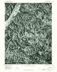
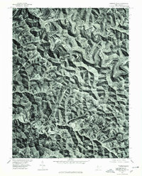
 1976 Pine Grove1979 Print · USGSWetzel County's narrow valleys and ridge-top forests are captured mid-century through high-resolution aerial photography. Researchers can trace the exact building footprints and rural roads connecting Reader, Pine Grove, and Jacksonburg along the winding Fishing Creek.
 - 1976 Map of Paden City, 1979 Print
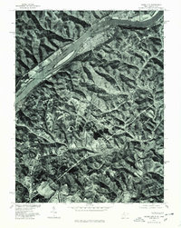 1976 Paden City1979 Print · USGSThe riverfront between West Virginia and Ohio is captured here during the mid-seventies, showing the density of Paden City along the banks. Genealogists and historians can trace property lines and river access near Sardis and Middle Island Creek.
 - 1976 Map of Porters Falls, 1979 Print
 1976 Porters Falls1979 Print · USGSWetzel County's winding valleys and sharp ridges are captured in the mid-1970s through detailed aerial orthophoto imagery. Genealogists and local historians can trace the exact layout of settlements like Porters Falls and Minnie along the banks of Fishing Creek.
 - 1976 Map of Middlebourne, 1979 Print
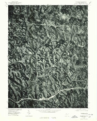
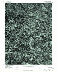
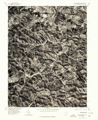 1976 Middlebourne1979 Print · USGSMiddlebourne and the surrounding Tyler County hills appear in sharp photographic detail during the mid-seventies. Local researchers can trace the course of Middle Island Creek and examine the layout of Middlebourne and Wick at this specific moment in time.
 - 1976 Map of Shirley, 1979 Print
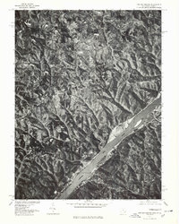
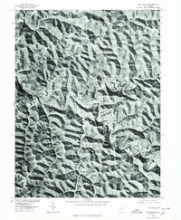
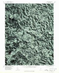 1976 Shirley1979 Print · USGSMid-1970s Tyler County is captured in this detailed orthophoto study of the West Virginia landscape. Genealogists and local historians can trace the rural layouts of Centerville and Shirley along the winding banks of Middle Island Creek.
 - 1976 Map of Center Point, 1979 Print
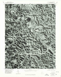
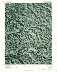 1976 Center Point1979 Print · USGSDoddridge County, West Virginia, is shown through late 1970s aerial imagery, revealing the tight relationship between topography and settlement. Trace the winding course of Mc Elroy Creek to find the small communities of Center Point and Stringtown.
End of results
Showing maps 1-11 of 11
Top cities of Tyler County
Frequently asked questions
- What are the different types of historical maps available for Tyler County?
- What is the oldest map of Tyler County?
- Where can I purchase historical maps of Tyler County for my home or office?
- Where can I download high-res historical maps of Tyler County?
- Are there historical topographic maps available for Tyler County?
- Is there historical aerial imagery available for Tyler County?
- Where are historical maps of Tyler County sourced from?