Old Maps of Tyler County, West Virginia for Genealogy
Trace your family roots with 116 historic maps of Tyler County. These high-res maps reveal old neighborhoods, homesites, landmarks, and streets — helping you uncover where your ancestors lived and how the area evolved over time.
- Explore historic neighborhoods: Identify where your relatives may have lived in the 1800s or 1900s.
- Compare maps over time: Trace the changes in streets, buildings, and landmarks for multi-generational research.
- Perfect for genealogy & ancestry research: Used by family historians and researchers to map out lineage and migration.
These maps are an incredible resource for exploring your personal connection to Tyler County's past.
Tyler County, WV maps
(116)- 1903 Map of Littleton
 1903 Littleton1903 Print · USGSThe West Virginia and Pennsylvania borderlands appear here at the turn of the century, marked by deep ridges and creek-side settlements. Trace the path of the B. and O. R. R. as it connects Littleton to outlying hamlets like Wileyville and Burchfield.
 - 1905 Map of Centerpoint
 1905 Centerpoint1905 Print · USGSWest Virginia's heartland at the peak of the railroad era is meticulously charted here, revealing a dense network of ridge-top settlements and valley post offices. Trace the paths of the Baltimore and Ohio RR through Salem and locate lost landmarks like Eagle Mills, Jockeycamp, and Big Battle.3 unique versions available
 - 1905 Map of West Union
 1905 West Union1905 Print · USGSDoddridge and Tyler Counties come to life at the turn of the century as the railroad and river define the local economy. Genealogists can trace family footprints near Josephs Mills, The Jug, and the early post offices at Little PO and Centerville Alma PO.2 unique versions available
 - 1905 Map of Littleton
 1905 Littleton1905 Print · USGSWetzel County and the surrounding borderlands appear here in the early twentieth century, showing a landscape defined by steep ridges and rail corridors. Researchers can trace the B and O RR through Littleton or find small settlements like Saint Joseph and Silver Hill.2 unique versions available
 - 1905 Map of New Matamoras, 1916 Print
 1905 New Matamoras1916 Print · USGSMonroe and Washington counties come alive in the decade after the century's turn, showing a world of river commerce and ridge-top farming. Genealogists can trace family footprints across old postal stops like Langs P.O. and Centerview P.O. or the milling sites at Rinard Mills.
 - 1906 Map of Saint Marys
 1906 Saint Marys1906 Print · USGSThe riverfront around St Marys and the Ohio River islands is captured here in the early 1900s. Genealogists and researchers can trace early rural life through landmarks like Ninemile Schoolhouse, Union Mills, and the Baltimore and Ohio RR corridor.3 unique versions available
 - 1906 Map of New Martinsville
 1906 New Martinsville1906 Print · USGSThe Ohio River valley at the turn of the century shows a landscape of busy rail lines and riverside towns. You can trace the Baltimore and Ohio railroad through Sistersville or locate early industrial sites like Winders Mill and Porters Falls.2 unique versions available
 - 1924 Map of St Marys, 1956 Print
 1924 St Marys1956 Print · USGSPleasants County and the Ohio River valley are shown here in the mid-twenties, just as the local rail and river networks reached their peak. Genealogists can trace hundreds of family sites near St Marys, including Bibbys Chapel, Ellenboro, and the Willow Island School.
 - 1924 Map of New Martinsville, 1956 Print
 1924 New Martinsville1956 Print · USGSThe Ohio River valley in the early twenties reveals a landscape of busy rail corridors and riverfront towns. Genealogists can locate family names and rural landmarks from Winders Mill to dozens of country schoolhouses like Democracy School and Wayne School.2 unique versions available
 - 1924 Map of Centerpoint, 1957 Print
 1924 Centerpoint1957 Print · USGSDoddridge and Harrison counties are shown here in the mid-1920s, when small-town life revolved around the railroad and local schoolhouses. Genealogists can locate family homesteads near landmarks like Alvy P O Stringtown, Smithton Smithburg Sta, and Fairview Church.2 unique versions available
 - 1924 Map of Littleton, 1957 Print
 1924 Littleton1957 Print · USGSWetzel County at the height of the rail era shows a landscape densely packed with small-town life and rural industry. Genealogists can trace family names and locations at Scheidler Run Church, Otter Den School, and along the Baltimore and Ohio line.
 - 1924 Map of New Matamoras, 1958 Print
 1924 New Matamoras1958 Print · USGSThe Ohio River borderlands are shown in detail during the mid-1920s, featuring the winding valleys of the Muskingum rivers. Genealogists can trace family locations through named schools and rural post offices like Rinard Mills, Salem Hall, and Zion Church.
 - 1924 Map of West Union, 1961 Print
 1924 West Union1961 Print · USGSThe hills of Tyler and Doddridge Counties are shown here during the mid-twenties, centered on the winding Middle Island Creek and the busy rail corridor. Genealogists can trace family landmarks like Mole Hill, Josephs Mills, and dozens of local schools from Rising Sun to Chestnut Grove.
 - 1925 Map of Centerpoint
 1925 Centerpoint1925 Print · USGSDoddridge and Harrison counties are shown here in the mid-1920s, highlighting a landscape of deep hollows and ridge-top farms. Researchers can trace the Baltimore and Ohio rail line through Salem or find small rural landmarks like Victory Church and Lima PO.4 unique versions available
 - 1926 Map of Littleton
 1926 Littleton1926 Print · USGSWetzel County in the mid-twenties is a landscape of high ridges and deep hollows where community life centered on countless rural schools and churches. Trace family roots and vanished landmarks from Saint Joseph down to Smithfield, including Higgins Chapel and Antioch School.2 unique versions available
 - 1926 Map of New Martinsville
 1926 New Martinsville1926 Print · USGSThe Ohio River valley in the mid-1920s reveals a bustling corridor of rail and river commerce connecting New Martinsville and Sistersville. Genealogists can trace hundreds of rural landmarks, from the County Infirmary to isolated hill schools like Rothlisberger School and Sugar Valley School.2 unique versions available
 - 1926 Map of New Matamoras
 1926 New Matamoras1926 Print · USGSThe Ohio River valley and the rugged interior of Monroe County appear here in the mid-1920s. Genealogists can trace early twentieth-century rural life through numerous small post offices and schools like Cochransville Centerview PO and Excelsior School.2 unique versions available
 - 1926 Map of West Union
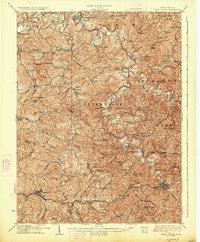 1926 West Union1926 Print · USGSDoddridge and Tyler counties are captured here in the mid-1920s, showing a landscape of ridge-top farms and creek-bottom settlements. You can trace the Baltimore and Ohio rail line or locate ancestral sites like Josephs Mills, Mole Hill, and Rising Sun School.3 unique versions available
 - 1927 Map of Saint Marys
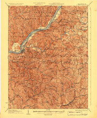 1927 Saint Marys1927 Print · USGSPleasants and Ritchie counties come into focus during the mid-twenties as the Baltimore and Ohio railroad skirts the Ohio River. Researchers can trace ancestral locations through dozens of rural landmarks, from the Northwestern Turnpike to the Willow Island School and Mt Carmel Church.3 unique versions available
 - 1949 Map of Clarksburg
 1949 Clarksburg1949 Print · USGSThe upper Ohio River valley and the industrial heart of West Virginia come into focus during this post-war period. Genealogists and researchers can trace the rail corridors of the Baltimore and Ohio and locate centers like Fairmont, Grafton, and Waynesburg.
 - 1956 Map of Clarksburg, 1966 Print
 1956 Clarksburg1966 Print · USGSThe Ohio River valley and the industrial heart of West Virginia are seen here in the mid-1950s as rail and river commerce thrived. Researchers can trace historic transport lines like the Baltimore and Ohio RR and locate ancestral homes in Clarksburg, Moundsville, or Parkersburg.2 unique versions available
 - 1960 Map of Paden City, 1961 Print
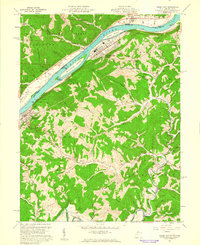 1960 Paden City1961 Print · USGSThe Ohio River valley thrives in the early sixties as a hub of industry and rail. Genealogists can trace family roots at Kidwell Ch, Stender Cem, and the riverfront communities of Paden City and Sistersville.4 unique versions available
 - 1960 Map of Porters Falls, 1962 Print
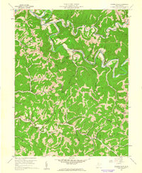 1960 Porters Falls1962 Print · USGSThe rugged valleys of Wetzel and Tyler counties are captured here in the early sixties, showing the vital link between Fishing Creek and the Baltimore and Ohio Railroad. Genealogists can locate family landmarks like Cherry Grove Cem, Mt Zion Ch, and the small settlement of Lonetree.2 unique versions available
 - 1960 Map of Bens Run, 1962 Print
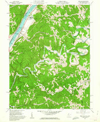 1960 Bens Run1962 Print · USGSThe West Virginia riverfront and rugged interior ridges are captured here in the early sixties, showing the industrial pulse of the Ohio River. Researchers can trace the Baltimore and Ohio rail line to the Salt Evaporator at Bens Run or locate rural family landmarks like Beech Run Ch and Oak Grove Cem.3 unique versions available
 - 1960 Map of Pine Grove, 1962 Print
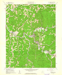 1960 Pine Grove1962 Print · USGSWetzel County's rugged ridge country is captured here in the early sixties, showing the tight relationship between the Baltimore and Ohio RR and the winding Fishing Creek. Local historians can trace family locations through sites like Mt Morris Ch, Kiger Cem, and the old settlement of Reader.2 unique versions available
Showing maps 1-25 of 116
Top cities of Tyler County
Frequently asked questions
- What are the different types of historical maps available for Tyler County?
- What is the oldest map of Tyler County?
- Where can I purchase historical maps of Tyler County for my home or office?
- Where can I download high-res historical maps of Tyler County?
- Are there historical topographic maps available for Tyler County?
- Is there historical aerial imagery available for Tyler County?
- Where are historical maps of Tyler County sourced from?