Old Maps of Crawford County, Wisconsin
Explore 50 old maps of Crawford County, spanning from 1902 to today. These high-resolution historic maps reveal how streets, neighborhoods, landmarks, and natural features evolved over time — perfect for genealogy, metal detecting, research, and local history exploration.
What you can do with these maps:
- See how Crawford County changed over time: Compare historical maps to modern-day views to trace roads, homesites, rail lines & more.
- View detailed metadata: Each map includes creators, publishers, year, scale, and archive source.
- Overlay maps with satellite & LiDAR: Visualize the past alongside modern tools to explore terrain & human change.
- Trusted historical sources: Maps sourced from the USGS, Library of Congress, and other archives.
- Access maps your way: View online, download high-res files, or order prints for personal or research use.
Start exploring old maps of Crawford County to uncover forgotten places, hidden landmarks, and the deep history beneath your feet.
Crawford County, WI maps
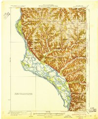
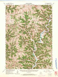
(50)- 1902 Map of Elkader
 1902 Elkader1902 Print · USGSCovers Crawford County, including Manchester, Dyersville, and other nearby areas4 unique versions available
 - 1903 Map of Waukon
 1903 Waukon1903 Print · USGSCovers Crawford County, including Prairie du Chien, Waukon, and other nearby areas5 unique versions available
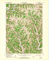
 - 1924 Map of Gays Mills, 1957 Print
 1924 Gays Mills1957 Print · USGSCovers Crawford County, including Seneca, Soldiers Grove, and other nearby areas
 - 1926 Map of Gays Mills
 1926 Gays Mills1926 Print · USGSCovers Crawford County, including Seneca, Soldiers Grove, and other nearby areas
 - 1926 Map of Wauzeka
 1926 Wauzeka1926 Print · USGSCovers Crawford County, including Seneca, Wauzeka, and other nearby areas2 unique versions available
 - 1929 Map of Ferryville, 1957 Print
 1929 Ferryville1957 Print · USGSCovers Crawford County, including Lansing, Seneca, and other nearby areas2 unique versions available
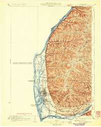
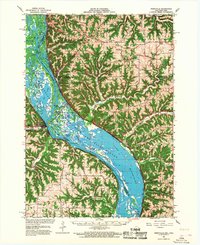
 - 1929 Map of Prairie Du Chien, 1963 Print
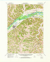
 1929 Prairie Du Chien1963 Print · USGSCovers Crawford County, including Prairie du Chien, Bridgeport, and other nearby areas
 - 1932 Map of Ferryville
 1932 Ferryville1932 Print · USGSCovers Crawford County, including Lansing, Seneca, and other nearby areas
 - 1932 Map of Prairie Du Chien
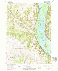
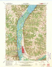
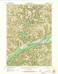
 1932 Prairie Du Chien1932 Print · USGSCovers Crawford County, including Prairie du Chien, Bridgeport, and other nearby areas4 unique versions available
 - 1933 Map of Boaz
 1933 Boaz1933 Print · USGSCovers Crawford County, including Soldiers Grove, Sylvan, and other nearby areas2 unique versions available
 - 1933 Map of Boscobel
 1933 Boscobel1933 Print · USGSCovers Crawford County, including Boscobel, Mount Ida, and other nearby areas2 unique versions available
 - 1958 Map of La Crosse, 1979 Print
 1958 La Crosse1979 Print · USGSCovers Crawford County, including La Crosse, Winona, and other nearby areas2 unique versions available
 - 1959 Map of Dubuque, 1982 Print
 1959 Dubuque1982 Print · USGSCovers Crawford County, including Cedar Rapids, Dubuque, and other nearby areas
 - 1961 Map of Dubuque
 1961 Dubuque1961 Print · USGSCovers Crawford County, including Cedar Rapids, Dubuque, and other nearby areas
 - 1961 Map of La Crosse
 1961 La Crosse1961 Print · USGSCovers Crawford County, including La Crosse, Winona, and other nearby areas
 - 1962 Map of Dubuque
 1962 Dubuque1962 Print · USGSCovers Crawford County, including Cedar Rapids, Dubuque, and other nearby areas2 unique versions available
 - 1962 Map of Clayton
 1962 Clayton1962 Print · USGSCovers Crawford County, including Bridgeport, Wyalusing, and other nearby areas3 unique versions available
 - 1962 Map of Bagley, 1964 Print
 1962 Bagley1964 Print · USGSCovers Crawford County, including Bridgeport, Wyalusing, and other nearby areas
 - 1965 Map of La Crosse
 1965 La Crosse1965 Print · USGSCovers Crawford County, including La Crosse, Winona, and other nearby areas
 - 1966 Map of Gays Mills, 1968 Print
 1966 Gays Mills1968 Print · USGSCovers Crawford County, including Seneca, Soldiers Grove, and other nearby areas
 - 1966 Map of Ferryville, 1968 Print
 1966 Ferryville1968 Print · USGSCovers Crawford County, including Lansing, Seneca, and other nearby areas2 unique versions available
 - 1966 Map of Boaz, 1968 Print
 1966 Boaz1968 Print · USGSCovers Crawford County, including Soldiers Grove, Sylvan, and other nearby areas
 - 1967 Map of Prairie Du Chien, 1969 Print
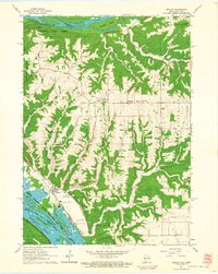
 1967 Prairie Du Chien1969 Print · USGSCovers Crawford County, including Prairie du Chien, Bridgeport, and other nearby areas
 - 1967 Map of Boscobel, 1970 Print
 1967 Boscobel1970 Print · USGSCovers Crawford County, including Boscobel, Mount Ida, and other nearby areas
 - 1967 Map of Wauzeka, 1970 Print
 1967 Wauzeka1970 Print · USGSCovers Crawford County, including Seneca, Wauzeka, and other nearby areas
Showing maps 1-25 of 50
Top cities of Crawford County
- Prairie du Chien historical maps
- Bridgeport historical maps
- Seneca historical maps
- Wauzeka historical maps
- Soldiers Grove historical maps
- Gays Mills historical maps
See more
Frequently asked questions
- What are the different types of historical maps available for Crawford County?
- What is the oldest map of Crawford County?
- Where can I purchase historical maps of Crawford County for my home or office?
- Where can I download high-res historical maps of Crawford County?
- Are there historical topographic maps available for Crawford County?
- Is there historical aerial imagery available for Crawford County?
- Where are historical maps of Crawford County sourced from?