Old Maps of Chippewa, Wisconsin for Hiking & Exploration
Hike through history with 89 historic maps of Chippewa. Explore old trails, ghost towns, and forgotten backroads — perfect for outdoor adventurers and local explorers.
- Rediscover forgotten places: Map out old mining camps, roads, and footpaths that no longer exist on modern maps.
- Layer with modern tools: Combine with LiDAR or satellite views to plan hikes through historical terrain.
- Made for exploration: Popular among hikers, overlanders, and local history lovers.
Use these maps to find adventure and explore the hidden past of Chippewa.
Chippewa, WI maps
(89)- 1940 Map of Butternut, 1961 Print
 1940 Butternut1961 Print · USGSAshland and Iron Counties come alive in this wartime-era survey of the Northwoods timber and rail country. Genealogists and historians can trace rural schoolhouses like Otto Sch, the local government at Agenda Town Hall, and the old rail paths of the Soo Line.
 - 1941 Map of Park Falls, 1952 Print
 1941 Park Falls1952 Print · USGSPrice County in the early 1940s is shaped by the river-and-rail economy centered on Park Falls and Fifield. Researchers can trace old rural schoolhouses like Sugarbush Sch and forgotten rail stops at Coolidge and Lugerville.2 unique versions available
 - 1941 Map of Kennedy, 1959 Print
 1941 Kennedy1959 Print · USGSIn the early 1940s, this portion of Price and Sawyer counties was a landscape of timber management and rail-side settlements. Genealogists can locate rural schoolhouses like Poplar Hill Sch and trace industrial sites such as Pixley Dam or the Old Mill Dam.2 unique versions available
 - 1942 Map of Glidden, 1956 Print
 1942 Glidden1956 Print · USGSAshland and Iron counties come alive in the early 1940s, showing a landscape shaped by the Minneapolis St Paul and Sault Ste Marie RR and the Chequamegon National Forest. Genealogists can locate family landmarks like the Morse Cem or several rural schools, including the Peeksville Sch and Washington Sch.
 - 1942 Map of Clam Lake, 1959 Print
 1942 Clam Lake1959 Print · USGSNorthern Wisconsin's deep woods are captured here during the early 1940s, showing the early infrastructure of the Chequamegon National Forest. Researchers can locate the Clam Lake CCC Camp, the NYA Camp, and the Clam Lake Fire Tower among dozens of named lakes and streams.2 unique versions available
 - 1943 Map of Park Falls
 1943 Park Falls1943 Print · USGSPrice County timber and river life are frozen in time during the early 1940s, showing the early development of Park Falls and Fifield. Genealogists and historians can trace dozens of rural schoolhouses like Divine Rapids Sch and old landmarks like the Fifield Fire Tower.
 - 1944 Map of Draper, 1952 Print
 1944 Draper1952 Print · USGSLogging and rail transport dominated the Sawyer County timberlands during the mid-forties. Genealogists and historians can locate former homesteads and work sites like Old Le May Camp, Loretta Cem, and the Barber Lake Sch.2 unique versions available
 - 1945 Map of Kennedy
 1945 Kennedy1945 Print · USGSThe Wisconsin Northwoods come alive in the 1940s, showing a landscape of timber, rail, and remote settlements. Genealogists and local historians can trace rural schoolhouses like Arnold Sch and family landmarks near Lugerville and Kaiser.2 unique versions available
 - 1945 Map of Clam Lake
 1945 Clam Lake1945 Print · USGSThe Northwoods of Ashland and Bayfield Counties are captured here in the mid-1940s, centered on the Clam Lake community. Genealogists and historians can locate federal project sites like the Clam Lake CCC Camp and NYA Camp alongside the Clam Lake Fire Tower.2 unique versions available
 - 1945 Map of Glidden
 1945 Glidden1945 Print · USGSThe Northwoods of Ashland County during the mid-forties show a landscape defined by timber history and early highway travel. Researchers can trace the Soo Line rail corridor through Glidden or locate rural landmarks like Shanagolden and the Morse Cem.
 - 1947 Map of Park Falls
 1947 Park Falls1947 Print · USGSThe Northwoods of Price County come alive in the 1940s, centered on the paper-milling hub of Park Falls and the Flambeau River. Genealogists and local historians can trace rural school districts like Sugarbush Sch or locate the site of the Fifield Fire Tower.
 - 1947 Map of Butternut
 1947 Butternut1947 Print · USGSThe village of Butternut and the surrounding timberlands are captured here in the late 1940s. Genealogists and local historians can trace rural schoolhouse locations like Tank Sch and Smart Sch alongside early industry at Teeter Camp.
 - 1947 Map of Draper
 1947 Draper1947 Print · USGSSawyer County is captured here in the late 1940s as its logging history gives way to reforestation and rural settlement. Genealogists can trace family footprints at Loretta Cem, Barber Lake Sch, and various sites like Old Savord Camp.2 unique versions available
 - 1950 Map of Butternut
 1950 Butternut1950 Print · USGSWisconsin's Northwoods were still defined by logging camps and rural school districts in the mid-twentieth century. Genealogists and local historians can trace the foundations of Butternut and the surrounding townships, locating sites like Agenda Town Hall, Old Camp, and Tank Sch.
 - 1953 Map of Ashland, 1964 Print
 1953 Ashland1964 Print · USGSNorthern Wisconsin's lakefront and timberlands are seen here in the mid-1950s, showing the intersection of industrial rail lines and vast wilderness. Genealogists and historians can trace the Soo Line through rail towns like Mellen or locate family roots in the Apostle Islands and Bad River Indian Reservation.3 unique versions available
 - 1953 Map of Rice Lake, 1967 Print
 1953 Rice Lake1967 Print · USGSNorthwest Wisconsin during the mid-fifties reveals a landscape defined by timber, rail, and water. Genealogists and historians can trace the development of river towns like Ladysmith and Rice Lake along the Soo Line and Chicago and North Western railroads.2 unique versions available
 - 1958 Map of Ashland
 1958 Ashland1958 Print · USGSCoastal Wisconsin and the Michigan borderlands meet here in the late fifties, dominated by the timbered expanses and iron-rich ranges. Genealogists can trace family footprints in settlements like Odanah and Montreal, or locate landmarks such as the Coast Guard Station and Agricultural Experiment Station.
 - 1959 Map of Rice Lake
 1959 Rice Lake1959 Print · USGSNorthwest Wisconsin in the late fifties was a land of expanding road networks and deep-seated timber history. Genealogists and historians can trace rail lines like the Soo Line RR and Chicago St Paul Minneapolis and Omaha Ry as they link settlements from Spooner to Medford.
 - 1968 Map of Glidden, 1971 Print
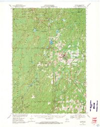 1968 Glidden1971 Print · USGSAshland and Iron County woods come to life in the late 1960s as the SOO LINE connects timber towns across a glacial landscape. Researchers can trace family roots at St Cecilia Cem or Morse Cem and locate vanished siding spots like Shanagolden and Popcorn Corners.
 - 1968 Map of Butternut, 1971 Print
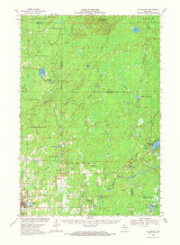 1968 Butternut1971 Print · USGSWisconsin's Northwoods come into focus in the late 1960s as a landscape defined by timber, rail, and water. Researchers can trace the Soo Line through Butternut, find the Union Cem, and locate river landmarks like Stubbs Rapids and Petes Landing.
 - 1968 Map of Park Falls, 1971 Print
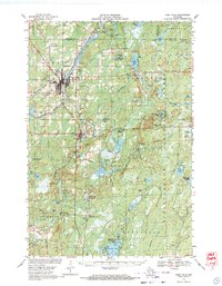 1968 Park Falls1971 Print · USGSPark Falls and Fifield sit at the heart of the northern timber country in the late sixties, where the Flambeau River meets a dense network of rail lines. Researchers can trace historic logging routes like the SMITH GRADE or locate local landmarks such as Nola Cem and Solberg Lake County Park.2 unique versions available
 - 1970 Map of Butternut Lake, 1972 Print
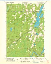 1970 Butternut Lake1972 Print · USGSThe Price County timberlands and lakefronts are frozen in time just as the seventies began. Researchers can trace the Chicago and North Western rail route or locate local landmarks like the Kennedy Lookout Tower and Pixley Dam.
 - 1970 Map of Kennedy, 1972 Print
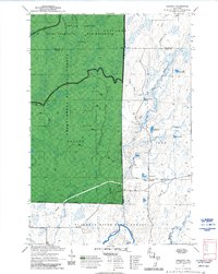 1970 Kennedy1972 Print · USGSSawyer and Ashland counties are shown in the early 1970s as centers of Wisconsin timber and recreation. Researchers can locate the settlement of Kennedy, follow the Tuscobia State Forest Trail, and trace the shoreline of Lake Alice.3 unique versions available
 - 1971 Map of Clam Lake SE, 1973 Print
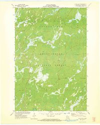 1971 Clam Lake SE1973 Print · USGSAshland County's northwoods were a dense wilderness of complex river systems in the early 1970s. Explorers and outdoorsmen can trace the marshy headwaters of the Moose River, Black Creek, and the isolated reaches of Hell Hole Creek through the forest.2 unique versions available
 - 1971 Map of Loretta, 1973 Print
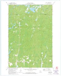 1971 Loretta1973 Print · USGSNorthern Sawyer County was a haven for timber and recreation in the early seventies, dominated by the sprawling Chequamegon National Forest. Researchers can locate historic structures in Loretta and Draper, or trace the winding course of the Brunet River and the Snowmobile Trail.2 unique versions available
Showing maps 1-25 of 89
Top cities near Chippewa
- Fifield historical maps
- Morse historical maps
- Butternut historical maps
- Draper historical maps
- Shanagolden historical maps
Frequently asked questions
- What are the different types of historical maps available for Chippewa?
- What is the oldest map of Chippewa?
- Where can I purchase historical maps of Chippewa for my home or office?
- Where can I download high-res historical maps of Chippewa?
- Are there historical topographic maps available for Chippewa?
- Is there historical aerial imagery available for Chippewa?
- Where are historical maps of Chippewa sourced from?