2020s Maps of Marengo, Wisconsin
Explore 6 historic maps of Marengo from the 2020s. These maps offer a rare glimpse into what life looked like during the 2020s — showing old roads, neighborhoods, homes, and landmarks that have changed or disappeared over time.
Whether you're researching your family's past, planning a metal detecting trip, or studying how Marengo's landscape evolved across the 2020s, these high-resolution maps are a powerful tool for exploring the history of this region.
- Focus on a specific era: All maps on this page are from the 2020s, giving you a focused view of this time period.
- See what’s changed: Compare century-old streets, trails, and buildings to today's modern landscape using overlays and satellite layers.
- Research with precision: Use these maps for genealogy, historical research, land use analysis, or educational projects.
- View, download, or print: Maps are fully viewable online in high resolution, and can be downloaded or printed for your own records.
Start exploring Marengo's history through authentic maps from the 2020s. This is your window into the past.
Marengo, WI maps
(6)- 2022 Map of Marengo Lake, 2022 Print
 2022 Marengo Lake2022 Print · USGSBayfield and Ashland counties meet in this Northwoods forest landscape during the early twenty-first century. Researchers can trace the rugged topography around Saint Peters Dome and locate the historic Birch Lake Cem near Birch Lake.
 - 2022 Map of Marengo, 2022 Print
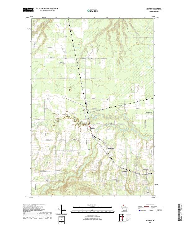 2022 Marengo2022 Print · USGSAshland County's rural townships are documented here during the early 2020s, showing the settlement patterns along the river forks. Researchers can locate family landmarks and burial sites like Maple Grove Cem or trace the paths of Minersville and Jolmaville.
 - 2022 Map of Clam Lake NE, 2022 Print
 2022 Clam Lake NE2022 Print · USGSThis part of the Ashland County woods is shown in recent detail as a territory defined by its rivers and national forest trails. Genealogists and outdoorsmen can trace the paths of the Brunsweiler River or locate remote camps near Spider Lake and Woodtick Lake.
 - 2022 Map of Sanborn, 2022 Print
 2022 Sanborn2022 Print · USGSThe borderlands of Bayfield and Ashland counties come into focus in this recent survey of the Northwoods. Genealogists can trace family names on rural routes and locate landmarks like Saint Anne Catholic Cem and the Moe Cem.
 - 2022 Map of Clam Lake, 2022 Print
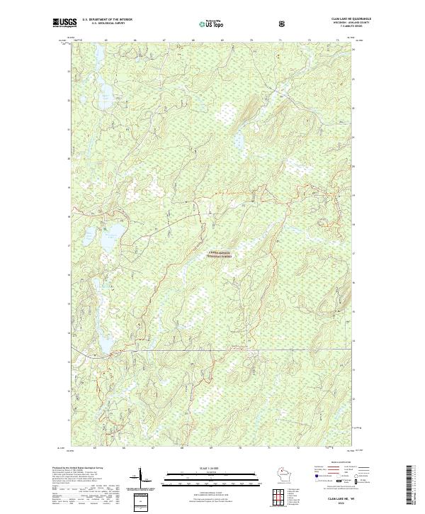
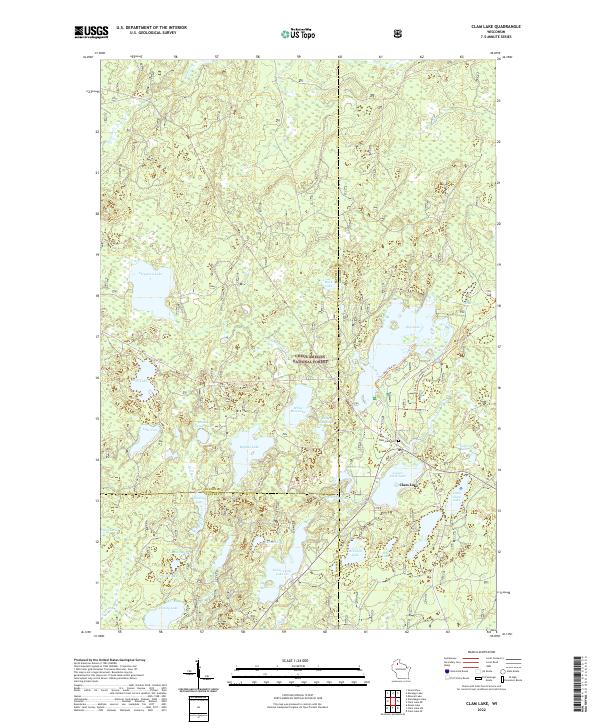 2022 Clam Lake2022 Print · USGSClam Lake and its surrounding Northwoods timberlands are captured here in the early 2020s, showcasing a landscape defined by glacial waters. Researchers can trace local landmarks like the Clam Lake Cem, the winding West Fork Chippewa River, and the recreational Day Lake Trl.
 - 2022 Map of Mineral Lake, 2022 Print
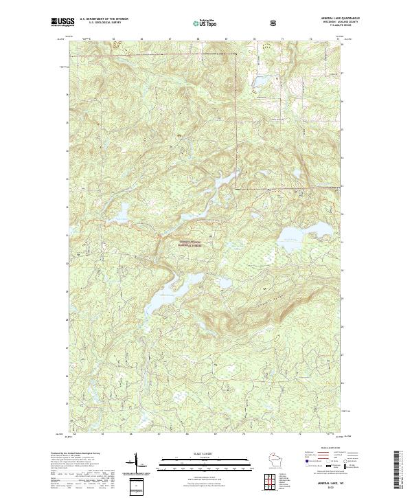 2022 Mineral Lake2022 Print · USGSAshland County's timberlands are showcased here in the 2020s, showing the intersection of the Gogebic Range and the Chequamegon National Forest. Researchers can trace the North Country National Scenic Trl past Mineral Lake and English Lake.
End of results
Showing maps 1-6 of 6
Top cities near Marengo
- Ashland historical maps
- Sanborn historical maps
- White River historical maps
- Mellen historical maps
- Marengo historical maps
- Shanagolden historical maps
See more
Frequently asked questions
- What are the different types of historical maps available for Marengo?
- What is the oldest map of Marengo?
- Where can I purchase historical maps of Marengo for my home or office?
- Where can I download high-res historical maps of Marengo?
- Are there historical topographic maps available for Marengo?
- Is there historical aerial imagery available for Marengo?
- Where are historical maps of Marengo sourced from?