2020s Maps of Shanagolden, Wisconsin
Explore 8 historic maps of Shanagolden from the 2020s. These maps offer a rare glimpse into what life looked like during the 2020s — showing old roads, neighborhoods, homes, and landmarks that have changed or disappeared over time.
Whether you're researching your family's past, planning a metal detecting trip, or studying how Shanagolden's landscape evolved across the 2020s, these high-resolution maps are a powerful tool for exploring the history of this region.
- Focus on a specific era: All maps on this page are from the 2020s, giving you a focused view of this time period.
- See what’s changed: Compare century-old streets, trails, and buildings to today's modern landscape using overlays and satellite layers.
- Research with precision: Use these maps for genealogy, historical research, land use analysis, or educational projects.
- View, download, or print: Maps are fully viewable online in high resolution, and can be downloaded or printed for your own records.
Start exploring Shanagolden's history through authentic maps from the 2020s. This is your window into the past.
Shanagolden, WI maps
(8)- 2022 Map of Clam Lake SW, 2022 Print
 2022 Clam Lake SW2022 Print · USGSNorthern Wisconsin's protected forest lands are shown here in the early 2020s, dominated by the expansive Chequamegon National Forest. Researchers can trace river routes like the West Fork Chippewa River or locate lake-side landmarks such as Ike Lake and Cattail Lake.
 - 2022 Map of Clam Lake NE, 2022 Print
 2022 Clam Lake NE2022 Print · USGSThis part of the Ashland County woods is shown in recent detail as a territory defined by its rivers and national forest trails. Genealogists and outdoorsmen can trace the paths of the Brunsweiler River or locate remote camps near Spider Lake and Woodtick Lake.
 - 2022 Map of Peeksville, 2022 Print
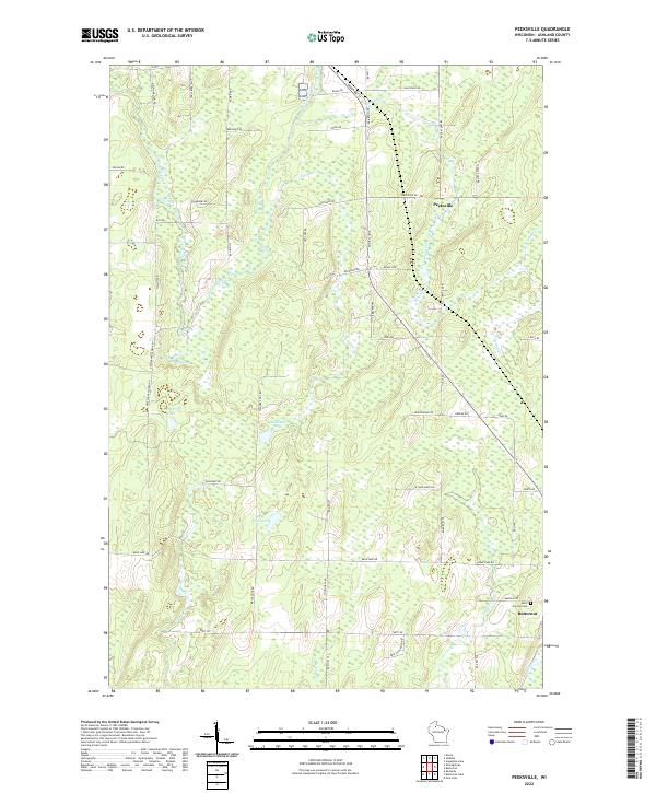 2022 Peeksville2022 Print · USGSAshland County's north woods are shown in fine detail during the early 2020s, revealing a landscape defined by the East Fork Chippewa River and rural family homesteads. Genealogists can locate family-named roads and burial sites at Saint Cecelia Cem near the town of Butternut.
 - 2022 Map of Clam Lake SE, 2022 Print
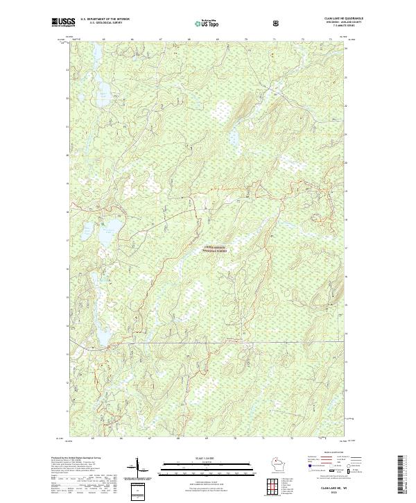
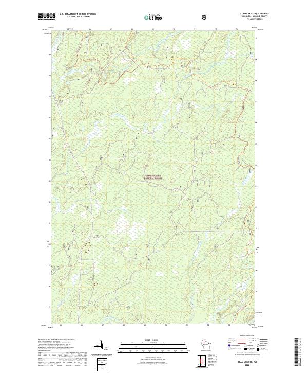 2022 Clam Lake SE2022 Print · USGSAshland County's deep woods and river headwaters are captured here in the early twenty-first century. Outdoorsmen and local historians can trace the winding Dead Horse Run Trl as it crosses the Moose River and Hungry Run.
 - 2022 Map of Clam Lake, 2022 Print
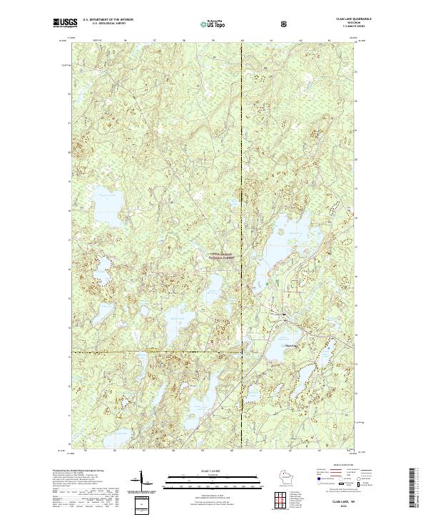 2022 Clam Lake2022 Print · USGSClam Lake and its surrounding Northwoods timberlands are captured here in the early 2020s, showcasing a landscape defined by glacial waters. Researchers can trace local landmarks like the Clam Lake Cem, the winding West Fork Chippewa River, and the recreational Day Lake Trl.
 - 2022 Map of Glidden, 2022 Print
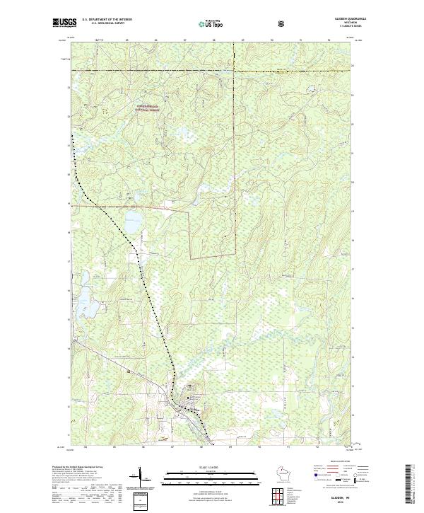 2022 Glidden2022 Print · USGSAshland County in the early 2020s remains a landscape of deep woods and interconnected waterways centered on the village of Glidden. Researchers can locate family landmarks at Mount Hope Cem or trace the winding paths of the East Fork Chippewa River and Bad River.
 - 2022 Map of Shanagolden, 2022 Print
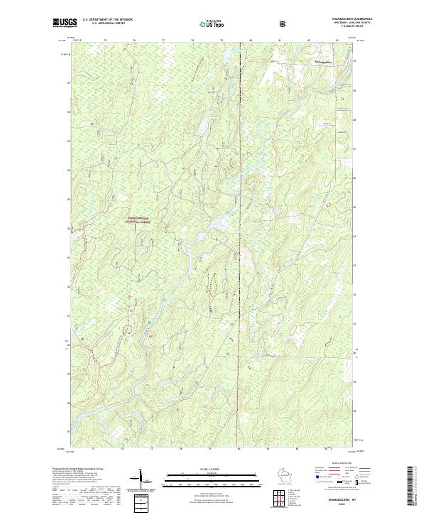 2022 Shanagolden2022 Print · USGSNorthern Wisconsin's deep woods and timber history are visible in this recent survey of the Ashland County forest. Trace the paths of Railroad Rd and Dead Horse Run Trl through the Chequamegon National Forest near Shanagolden.
 - 2023 Map of Morse, 2023 Print
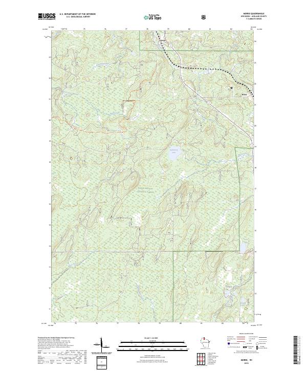 2023 Morse2023 Print · USGSAshland County's northern timberlands are documented here in the early twenty-first century as the landscape remains dominated by the Chequamegon National Forest. Researchers can locate the Morse Cem and trace the paths of the Bad River and Washashki-ziibiins through the dense woods.
End of results
Showing maps 1-8 of 8
Top cities near Shanagolden
Frequently asked questions
- What are the different types of historical maps available for Shanagolden?
- What is the oldest map of Shanagolden?
- Where can I purchase historical maps of Shanagolden for my home or office?
- Where can I download high-res historical maps of Shanagolden?
- Are there historical topographic maps available for Shanagolden?
- Is there historical aerial imagery available for Shanagolden?
- Where are historical maps of Shanagolden sourced from?