1900s (20th Century) Maps of Shanagolden, Wisconsin
Explore 16 historic maps of Shanagolden from the 1900s (20th Century). These maps offer a rare glimpse into what life looked like during the 1900s — showing old roads, neighborhoods, homes, and landmarks that have changed or disappeared over time.
Whether you're researching your family's past, planning a metal detecting trip, or studying how Shanagolden's landscape evolved across the 1900s, these high-resolution maps are a powerful tool for exploring the history of this region.
- Focus on a specific era: All maps on this page are from the 1900s, giving you a focused view of this time period.
- See what’s changed: Compare century-old streets, trails, and buildings to today's modern landscape using overlays and satellite layers.
- Research with precision: Use these maps for genealogy, historical research, land use analysis, or educational projects.
- View, download, or print: Maps are fully viewable online in high resolution, and can be downloaded or printed for your own records.
Start exploring Shanagolden's history through authentic maps from the 1900s. This is your window into the past.
Shanagolden, WI maps
(16)- 1942 Map of Glidden, 1956 Print
 1942 Glidden1956 Print · USGSAshland and Iron counties come alive in the early 1940s, showing a landscape shaped by the Minneapolis St Paul and Sault Ste Marie RR and the Chequamegon National Forest. Genealogists can locate family landmarks like the Morse Cem or several rural schools, including the Peeksville Sch and Washington Sch.
 - 1942 Map of Clam Lake, 1959 Print
 1942 Clam Lake1959 Print · USGSNorthern Wisconsin's deep woods are captured here during the early 1940s, showing the early infrastructure of the Chequamegon National Forest. Researchers can locate the Clam Lake CCC Camp, the NYA Camp, and the Clam Lake Fire Tower among dozens of named lakes and streams.2 unique versions available
 - 1945 Map of Clam Lake
 1945 Clam Lake1945 Print · USGSThe Northwoods of Ashland and Bayfield Counties are captured here in the mid-1940s, centered on the Clam Lake community. Genealogists and historians can locate federal project sites like the Clam Lake CCC Camp and NYA Camp alongside the Clam Lake Fire Tower.2 unique versions available
 - 1945 Map of Glidden
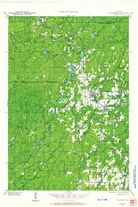
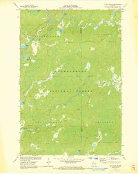
 1945 Glidden1945 Print · USGSThe Northwoods of Ashland County during the mid-forties show a landscape defined by timber history and early highway travel. Researchers can trace the Soo Line rail corridor through Glidden or locate rural landmarks like Shanagolden and the Morse Cem.
 - 1953 Map of Ashland, 1964 Print
 1953 Ashland1964 Print · USGSNorthern Wisconsin's lakefront and timberlands are seen here in the mid-1950s, showing the intersection of industrial rail lines and vast wilderness. Genealogists and historians can trace the Soo Line through rail towns like Mellen or locate family roots in the Apostle Islands and Bad River Indian Reservation.3 unique versions available
 - 1958 Map of Ashland
 1958 Ashland1958 Print · USGSCoastal Wisconsin and the Michigan borderlands meet here in the late fifties, dominated by the timbered expanses and iron-rich ranges. Genealogists can trace family footprints in settlements like Odanah and Montreal, or locate landmarks such as the Coast Guard Station and Agricultural Experiment Station.
 - 1968 Map of Glidden, 1971 Print
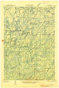
 1968 Glidden1971 Print · USGSAshland and Iron County woods come to life in the late 1960s as the SOO LINE connects timber towns across a glacial landscape. Researchers can trace family roots at St Cecilia Cem or Morse Cem and locate vanished siding spots like Shanagolden and Popcorn Corners.
 - 1971 Map of Clam Lake SE, 1973 Print
 1971 Clam Lake SE1973 Print · USGSAshland County's northwoods were a dense wilderness of complex river systems in the early 1970s. Explorers and outdoorsmen can trace the marshy headwaters of the Moose River, Black Creek, and the isolated reaches of Hell Hole Creek through the forest.2 unique versions available
 - 1971 Map of Clam Lake NE, 1973 Print
 1971 Clam Lake NE1973 Print · USGSAshland County's timberlands and glacial lakes are captured here in the early 1970s, showing a landscape shaped by conservation and former industry. Researchers can trace the Old RR Grade or locate historic water features like Dead Horse Slough and Moquah Lake.
 - 1971 Map of Clam Lake SW, 1973 Print
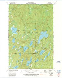
 1971 Clam Lake SW1973 Print · USGSSawyer and Ashland Counties are shown in the early seventies, a period when the timberlands and waterways remained largely undeveloped. Genealogists and outdoorsmen can trace the drainage of the West Fork Chippewa River past Shanagolden and Kelly Lake.2 unique versions available
 - 1971 Map of Clam Lake, 1990 Print
 1971 Clam Lake1990 Print · USGSThe Northwoods of Ashland and Bayfield Counties come alive in this early 1970s survey of the lake-studded forestry landscape. Researchers can locate the Clam Lake Lookout Tower, trace burials at Wildwood Cem, and find the Job Corps Camp near Chippewa Lake.
 - 1980 Map of Ironwood
 1980 Ironwood1980 Print · USGSThe Michigan-Wisconsin borderlands appear in the late twentieth century as a landscape defined by iron mining and deep forests. Researchers can trace the rail-and-river economy through the Soo Line and Chicago and North Western tracks connecting Mellen, Glidden, and Hurley.
 - 1984 Map of Morse
 1984 Morse1984 Print · USGSAshland County's timberlands and river headwaters are captured here in the mid-1980s. Local researchers can trace the roads around Morse and Cayuga, find the Morse Cem, or locate the crossroads at Popcorn Corners.
 - 1984 Map of Peeksville
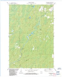
 1984 Peeksville1984 Print · USGSAshland County's timberlands and glacial lakes are shown here in the mid-1980s, centered on the Peeksville community. Researchers can trace the Old Railroad Grade, locate the St Cecelia Cem, or explore the many named backcountry routes like Mail Route Rd.
 - 1984 Map of Shanagolden
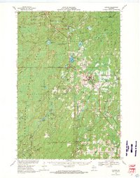
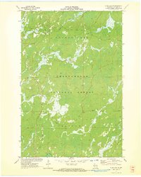
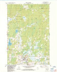
 1984 Shanagolden1984 Print · USGSWisconsin's Northwoods were characterized by deep forests and river-fed wetlands in the mid-1980s. Researchers can trace the winding East Fork Chippewa River and find local landmarks like Shanagolden, Pelican Lake, and the Stock Farm Bridge Recreation Site.2 unique versions available
 - 1984 Map of Glidden
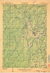
 1984 Glidden1984 Print · USGSNorthern Wisconsin timber and river country are captured here in the mid-1980s. Local researchers can trace the roads around Glidden, locate the Mt Hope Cem, and explore the hydrology of Zielke Lake and the Bad River.
End of results
Showing maps 1-16 of 16
Top cities near Shanagolden
Frequently asked questions
- What are the different types of historical maps available for Shanagolden?
- What is the oldest map of Shanagolden?
- Where can I purchase historical maps of Shanagolden for my home or office?
- Where can I download high-res historical maps of Shanagolden?
- Are there historical topographic maps available for Shanagolden?
- Is there historical aerial imagery available for Shanagolden?
- Where are historical maps of Shanagolden sourced from?