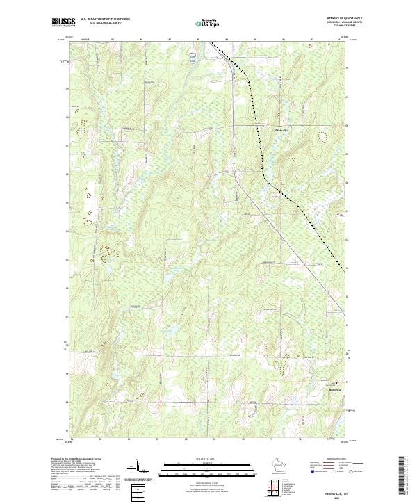
2022 Map of Peeksville
USGS Topo · Published 2022About this map
Peeksville and the northern outskirts of Butternut define the local settlement pattern of this northern Wisconsin landscape. The area is characterized by a dense network of water bodies and marshy terrain, most notably the East Fork Chippewa River which meanders through the northwest. Numerous named lakes such as Camp Four Lake, Bullhead Lake, and Slim Lake are joined by seasonal springs like Kempf Springs, indicating a complex hydrological environment that has likely shaped local land use and development over generations.
Find a feature on this map
65 named features on this map. Tap any name to fly to it.
Don’t see what you’re looking for? This feature index may not catch every label — zoom into the map to look around manually.
Map Details
Editions of this 2022 Peeksville Map
This is the sole edition of this map. No revisions or reprints were ever made.
Other maps of this area

1940 · Butternut
USGS Topo · 1:48,000

1941 · Park Falls
USGS Topo · 1:48,000

1941 · Kennedy
USGS Topo · 1:48,000

1942 · Glidden
USGS Topo · 1:48,000

1943 · Park Falls
USGS Topo · 1:48,000

1945 · Kennedy
USGS Topo · 1:48,000

1945 · Glidden
USGS Topo · 1:48,000

1947 · Park Falls
USGS Topo · 1:48,000

1947 · Butternut
USGS Topo · 1:48,000

1950 · Butternut
USGS Topo · 1:48,000