Old Maps of Columbia County, Wisconsin for Metal Detecting
Plan your next treasure hunt with 71 historic maps of Columbia County. Find old homesites, ghost towns, trails, and gathering spots that may be lost to time — perfect for identifying promising metal detecting locations.
- Locate forgotten sites: Uncover places like long-lost settlements, abandoned rail lines, or gathering spots.
- Plan better hunts: Use map overlays combined with LiDAR or satellite views to narrow in on historically rich areas.
- Made for detectorists: Thousands of hobbyists use these maps to discover relics, coins, and hidden history.
Use these historic maps to boost your research and find new opportunities beneath the surface of Columbia County.
Columbia County, WI maps
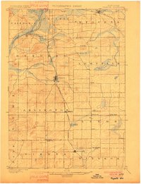
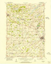
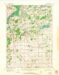
(71)- 1895 Map of Baraboo
 1895 Baraboo1895 Print · USGSSauk and Columbia counties meet along the winding river corridor during this late Victorian era of rail expansion and river commerce. Genealogists and local historians can trace old homesteads and rail stops through Merrimac, Okee, and Lodi while exploring the early footprints of Baraboo.9 unique versions available
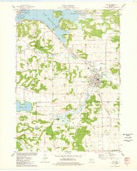
 - 1901 Map of Poynette
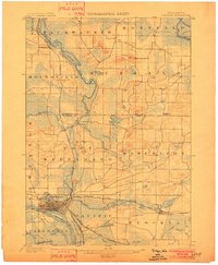
 1901 Poynette1901 Print · USGSWisconsin's rural heartland comes into focus at the dawn of the twentieth century, anchored by the railway corridor and the winding river. Researchers can trace the early footprints of Poynette, Wyocena, and Dekorra alongside small junctions like Morrisonville and Arlington.3 unique versions available
 - 1901 Map of The Dells
 1901 The Dells1901 Print · USGSSauk County and the Wisconsin River Dells were already becoming a destination at the turn of the century. Trace the early rail lines and river landmarks like Mirror Lake, Kilbourn, and the distinctive Elephants Back.6 unique versions available
 - 1902 Map of Portage
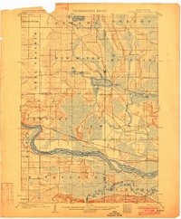
 1902 Portage1902 Print · USGSPortage and the surrounding marshlands of Columbia County appear here at the turn of the century, centered on the strategic divide between the Wisconsin River and Fox River. Genealogists and rail historians can trace the early footprints of Portage, the canal-era site of Fort Hope, and rural communities like Pardeeville and Marcellon.3 unique versions available
 - 1902 Map of Briggsville
 1902 Briggsville1902 Print · USGSThe Wisconsin River valley at the turn of the century shows a landscape of river-and-rail industry. Trace the early township developments of Lewiston and Douglas, or locate original landmarks like the Levee and Big Spring.4 unique versions available
 - 1908 Map of Baraboo
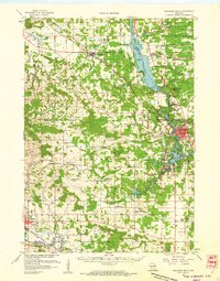
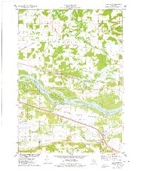
 1908 Baraboo1908 Print · USGSSauk and Columbia counties at the close of the nineteenth century reveal a landscape shaped by the Wisconsin River and early rail expansion. Trace the rail lines through Baraboo and Lodi, or locate old river landings near Merrimac and Sauk.
 - 1955 Map of Randolph, 1956 Print
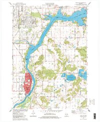
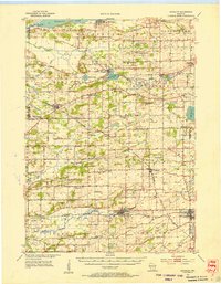 1955 Randolph1956 Print · USGSDodge and Columbia counties are seen here in the mid-fifties, dominated by prairie farming and the rail lines connecting towns like Friesland and Cambria. Researchers can trace the heritage of rural education and faith through sites like Penrhos Sch and Rosedale Ch.2 unique versions available
 - 1955 Map of Columbus, 1956 Print
 1955 Columbus1956 Print · USGSColumbia County’s dairy and rail corridor is captured here in the mid-fifties, centered on the growing community of Columbus. Genealogists can trace family names at St Joseph Cem or locate the many country schools like McKinley Sch and Hampden Sch.2 unique versions available
 - 1957 Map of Wisconsin Dells, 1959 Print
 1957 Wisconsin Dells1959 Print · USGSThe Wisconsin River corridor is captured here in the mid-fifties as tourism and rail transport shaped the local economy. Genealogists and historians can trace numerous rural school sites like Jopp Sch and family landmarks such as Louie Bluff or Webster Prairie Cem.
 - 1957 Map of Madison, 1967 Print
 1957 Madison1967 Print · USGSSouth-central Wisconsin in the mid-fifties reveals a landscape of industrial hubs and glacial lakes linked by a dense rail and highway network. Genealogists and historians can trace the development of lakeside communities and find notable sites like Badger Ordnance Works and the Horicon National Wildlife Refuge.3 unique versions available
 - 1958 Map of Briggsville, 1959 Print
 1958 Briggsville1959 Print · USGSThe rural landscapes of south-central Wisconsin are captured here in the late fifties, showcasing the crossroads of three counties. You can trace family history through numerous country schools like Stafford Sch and landmarks such as Douglas Ch.3 unique versions available
 - 1959 Map of Baraboo, 1961 Print
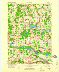
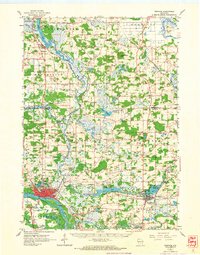
 1959 Baraboo1961 Print · USGSThe Baraboo Range and the winding Wisconsin River meet in this late-fifties study of Sauk and Columbia counties. Researchers can locate rural landmarks like Man Mound, the massive Badger Ordnance Works, and the grounds of Devils Lake State Park.4 unique versions available
 - 1960 Map of Madison
 1960 Madison1960 Print · USGSCentral and Southern Wisconsin are captured in the late fifties, showing the region as its rail-and-river network matured. Trace the paths of the Soo Line RR or locate family roots near Lake Mendota and Horicon National Wildlife Refuge.2 unique versions available
 - 1962 Map of Poynette, 1964 Print
 1962 Poynette1964 Print · USGSIn the early sixties, the farming communities of Columbia and Dane Counties were evolving alongside the new interstate highway. Genealogists can locate family sites and rural landmarks like Hillside Cem, Leeds Center, and the Arlington Prairie Ch.2 unique versions available
 - 1962 Map of Portage, 1964 Print
 1962 Portage1964 Print · USGSPortage and its surrounding river country are captured here in the early sixties, showing the vital connection between the Fox and Wisconsin Rivers. Genealogists can trace family roots through the Old Fort Winnebago Cem and rural settlements like Marcellon and Endeavor.
 - 1974 Map of Baraboo SE, 1976 Print
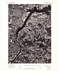
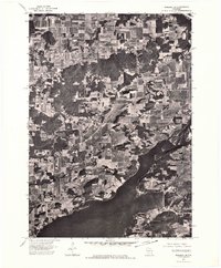
 1974 Baraboo SE1976 Print · USGSThe river valley and surrounding farmsteads are captured in this mid-1970s aerial survey as the region balanced its rural roots with growing town centers. Researchers can trace the layout of Lodi and the shoreline of Lake Wisconsin during this era.
 - 1974 Map of Baraboo SW, 1976 Print
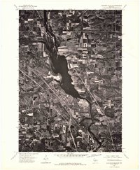
 1974 Baraboo SW1976 Print · USGSWisconsin riverfront life and mid-seventies agricultural patterns are frozen in time on this detailed orthophoto. Researchers can trace the street-level growth of Prairie Du Sac and the winding course of the Wisconsin River.
 - 1974 Map of Baraboo NE, 1976 Print
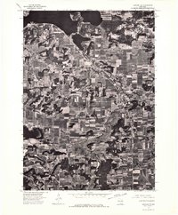
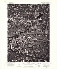
 1974 Baraboo NE1976 Print · USGSThe Wisconsin River valley comes into sharp focus in the mid-seventies, showing the rural landscape of Columbia County through detailed aerial photography. Local historians can trace the shoreline of Lake Wisconsin and the path of the Wisconsin River through a patchwork of family farms and wooded bluffs.
 - 1975 Map of Wisconsin Dells SE, 1976 Print
 1975 Wisconsin Dells SE1976 Print · USGSWisconsin Dells and the Sauk County countryside are documented in the mid-seventies just as the region’s modern footprint was taking shape. You can trace the exact 1975 shoreline of Lake Delton and see the early development of Wisconsin Dells along the Wisconsin River.3 unique versions available
 - 1975 Map of Wisconsin Dells NE, 1976 Print
 1975 Wisconsin Dells NE1976 Print · USGSThe northern reaches of the Dells region are captured in the mid-seventies, showing the vast Wisconsin River corridor and its surrounding agricultural plains. Genealogists and local historians can trace the rural landscape near Plainville and study original field patterns and timber stands from this period.2 unique versions available
 - 1975 Map of Sauk City, 1978 Print
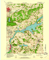
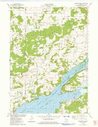
 1975 Sauk City1978 Print · USGSThe Wisconsin River valley in the mid-seventies shows a landscape shaped by military industry and rail transport. Researchers can trace the massive Badger Army Ammunition Plant or locate the village of Merrimac near the Wiegands Bay shoreline.
 - 1975 Map of Pine Island, 1978 Print
 1975 Pine Island1978 Print · USGSThe Wisconsin River and its intricate sloughs define this rural landscape in the mid-seventies, just as the local wildlife areas were becoming established. Researchers can find old community anchors like Lewiston Sch, the Welsh Cem, and the path of the Chicago Milwaukee St Paul and Pacific railroad.
 - 1975 Map of Lodi, 1978 Print
 1975 Lodi1978 Print · USGSLodi and the surrounding glacial valley are captured in the mid-seventies, showing a landscape defined by the railroad and the widening Wisconsin River. Researchers can trace family-named homesteads along Reynolds Road or locate historic burial sites like St Patricks Cem and Garden Bluff Cem.
 - 1975 Map of Durwards Glen, 1978 Print
 1975 Durwards Glen1978 Print · USGSColumbia County’s ridge-and-valley landscape is documented here in the mid-seventies, showing a mix of established family farms and riverfront growth. Genealogists can locate several historic burial grounds like St Johns Cem and Evangelical Cem alongside the Caledonia Sch.
 - 1975 Map of Lewiston, 1978 Print
 1975 Lewiston1978 Print · USGSThe Wisconsin River valley in the mid-1970s shows a landscape of small crossroads settlements and heavy rail infrastructure. Genealogists and local historians can trace family locations near Pecks Corners, the Fairfield Center Sch, and Hillcrest Cem.
Showing maps 1-25 of 71
Top cities of Columbia County
- Portage historical maps
- Columbus historical maps
- Lodi historical maps
- Poynette historical maps
- Dekorra historical maps
- Pardeeville historical maps
See more
Frequently asked questions
- What are the different types of historical maps available for Columbia County?
- What is the oldest map of Columbia County?
- Where can I purchase historical maps of Columbia County for my home or office?
- Where can I download high-res historical maps of Columbia County?
- Are there historical topographic maps available for Columbia County?
- Is there historical aerial imagery available for Columbia County?
- Where are historical maps of Columbia County sourced from?