2000s (21st Century) Maps of Chester, Wisconsin
Explore 20 historic maps of Chester from the 2000s (21st Century). These maps offer a rare glimpse into what life looked like during the 2000s — showing old roads, neighborhoods, homes, and landmarks that have changed or disappeared over time.
Whether you're researching your family's past, planning a metal detecting trip, or studying how Chester's landscape evolved across the 2000s, these high-resolution maps are a powerful tool for exploring the history of this region.
- Focus on a specific era: All maps on this page are from the 2000s, giving you a focused view of this time period.
- See what’s changed: Compare century-old streets, trails, and buildings to today's modern landscape using overlays and satellite layers.
- Research with precision: Use these maps for genealogy, historical research, land use analysis, or educational projects.
- View, download, or print: Maps are fully viewable online in high resolution, and can be downloaded or printed for your own records.
Start exploring Chester's history through authentic maps from the 2000s. This is your window into the past.
Chester, WI maps
(20)- 2010 Map of Buckhorn Corner, 2010 Print
 2010 Buckhorn Corner2010 Print · USGSCovers Chester, including Beaver Dam, Waupun, and other nearby areas
 - 2010 Map of Waupun North, 2010 Print
 2010 Waupun North2010 Print · USGSCovers Chester, including Waupun, Lamartine, and other nearby areas
 - 2010 Map of Brandon, 2010 Print
 2010 Brandon2010 Print · USGSCovers Chester, including Waupun, Alto, and other nearby areas
 - 2010 Map of Waupun South, 2010 Print
 2010 Waupun South2010 Print · USGSCovers Chester, including Waupun, Burnett, and other nearby areas
 - 2013 Map of Buckhorn Corner, 2013 Print
 2013 Buckhorn Corner2013 Print · USGSCovers Chester, including Beaver Dam, Waupun, and other nearby areas
 - 2013 Map of Brandon, 2013 Print
 2013 Brandon2013 Print · USGSCovers Chester, including Waupun, Alto, and other nearby areas
 - 2013 Map of Waupun North, 2013 Print
 2013 Waupun North2013 Print · USGSCovers Chester, including Waupun, Lamartine, and other nearby areas
 - 2013 Map of Waupun South, 2013 Print
 2013 Waupun South2013 Print · USGSCovers Chester, including Waupun, Burnett, and other nearby areas
 - 2015 Map of Waupun South, 2015 Print
 2015 Waupun South2015 Print · USGSCovers Chester, including Waupun, Burnett, and other nearby areas
 - 2015 Map of Waupun North, 2015 Print
 2015 Waupun North2015 Print · USGSCovers Chester, including Waupun, Lamartine, and other nearby areas
 - 2015 Map of Brandon, 2015 Print
 2015 Brandon2015 Print · USGSCovers Chester, including Waupun, Alto, and other nearby areas
 - 2015 Map of Buckhorn Corner, 2015 Print
 2015 Buckhorn Corner2015 Print · USGSCovers Chester, including Beaver Dam, Waupun, and other nearby areas
 - 2018 Map of Waupun South, 2018 Print
 2018 Waupun South2018 Print · USGSCovers Chester, including Waupun, Burnett, and other nearby areas
 - 2018 Map of Buckhorn Corner, 2018 Print
 2018 Buckhorn Corner2018 Print · USGSCovers Chester, including Beaver Dam, Waupun, and other nearby areas
 - 2018 Map of Brandon, 2018 Print
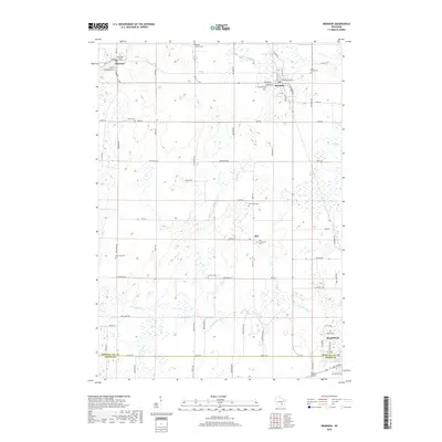 2018 Brandon2018 Print · USGSCovers Chester, including Waupun, Alto, and other nearby areas
 - 2018 Map of Waupun North, 2018 Print
 2018 Waupun North2018 Print · USGSCovers Chester, including Waupun, Lamartine, and other nearby areas
 - 2022 Map of Buckhorn Corner, 2022 Print
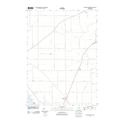
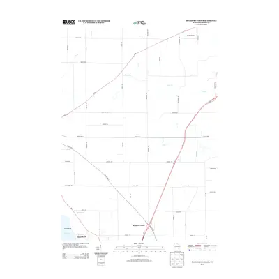
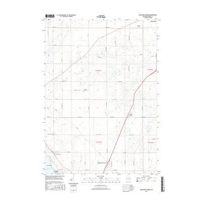
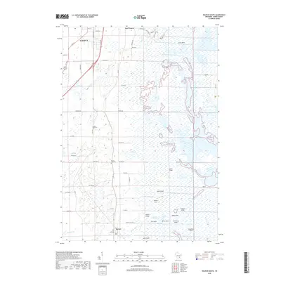
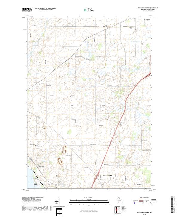 2022 Buckhorn Corner2022 Print · USGSThe rural corridor between Waupun and Beaver Dam is captured here in the early twenty-first century, showing a landscape of scattered family farms and quiet waterways. Researchers can trace local heritage at Trenton Cem, Annunciation Cem, or follow the shoreline of Beaver Dam Lake.
 - 2022 Map of Waupun North, 2022 Print
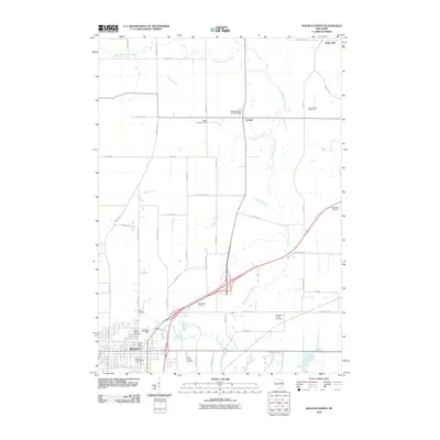
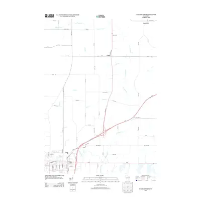
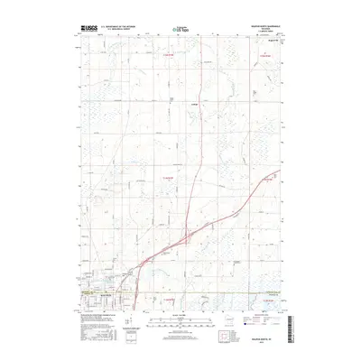
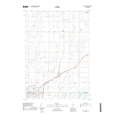
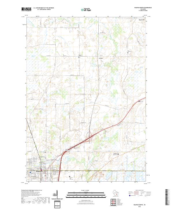 2022 Waupun North2022 Print · USGSThe agricultural landscape of Fond du Lac County is shown in detail during the early 2020s, centered on the city of Waupun. Local researchers can trace numerous rural burial grounds, including the Wisconsin State Prison Cem, Cattaraugus Cem, and East Ladoga Cem.
 - 2022 Map of Brandon, 2022 Print
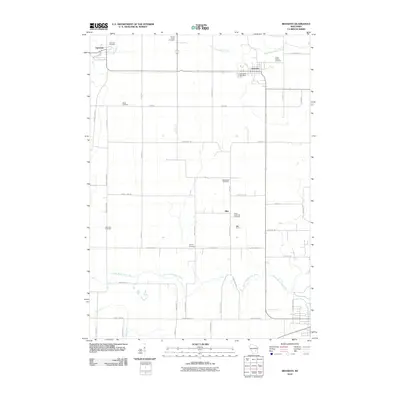
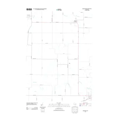
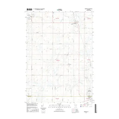
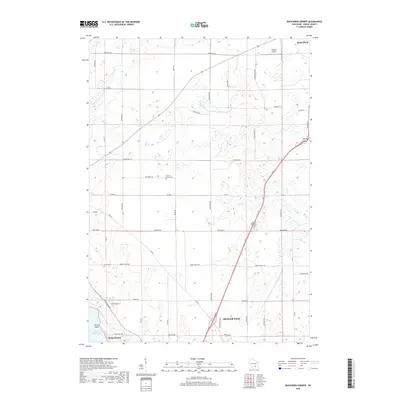
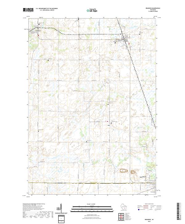 2022 Brandon2022 Print · USGSThe villages of Brandon and Fairwater sit amid the glacial wetlands of Fond du Lac County in the early twenty-first century. Genealogists can trace family landmarks across numerous sites like Union Prairie Cem and West Alto Cem.
 - 2022 Map of Waupun South, 2022 Print
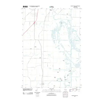
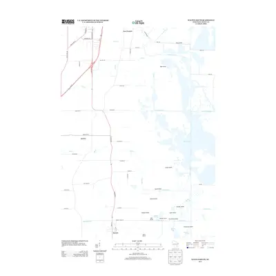
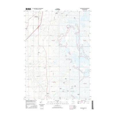
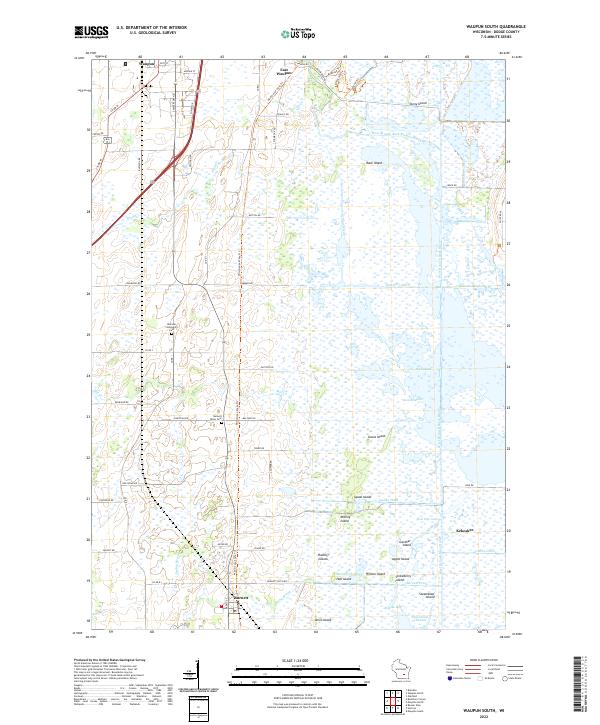 2022 Waupun South2022 Print · USGSThe extensive Dodge County wetlands take center stage in this recent survey, showcasing the intersection of the Horicon Marsh with local rural life. Researchers can trace historic burial sites like the Burnett Union Cem and navigate the intricate waterways of Mieske Bay or the Steamboat Channel.
End of results
Showing maps 1-20 of 20
Top cities near Chester
- Fond du Lac historical maps
- Beaver Dam historical maps
- Mayville historical maps
- North Fond du Lac historical maps
- Horicon historical maps
- Waupun historical maps
See more
Top neighborhoods of Chester
Frequently asked questions
- What are the different types of historical maps available for Chester?
- What is the oldest map of Chester?
- Where can I purchase historical maps of Chester for my home or office?
- Where can I download high-res historical maps of Chester?
- Are there historical topographic maps available for Chester?
- Is there historical aerial imagery available for Chester?
- Where are historical maps of Chester sourced from?