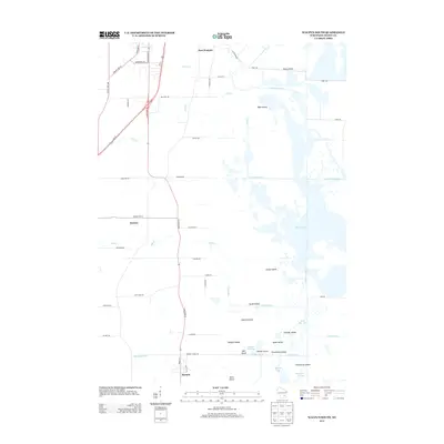
2013 Map of Waupun South
USGS Topo · Published 2013About this map
The lowlands of Dodge County, Wisconsin, define this 2013 landscape, where the W Br Rock River flows through an intricate network of marshes, ditches, and named islands. The settlement of Burnett anchors the southern portion of the map near the Burnett Flowage, while East Waupun and the industrial corridors of S Madison St and S Watertown St mark the northern reaches. The area is characterized by a managed aquatic environment, evidenced by numerous man-made channels like Sommers Ditch, Luebke Ditch, and Stub Ditch that drain the fertile agricultural lands.
Find a feature on this map
61 named features on this map. Tap any name to fly to it.
Don’t see what you’re looking for? This feature index may not catch every label — zoom into the map to look around manually.
Map Details
Editions of this 2013 Waupun South Map
This is the sole edition of this map. No revisions or reprints were ever made.
Other maps of this area

1955 · Beaver Dam
USGS Topo · 1:62,500

1955 · Waupun
USGS Topo · 1:62,500

1955 · Fox Lake
USGS Topo · 1:62,500

1955 · Horicon
USGS Topo · 1:62,500

1957 · Madison
USGS Topo · 1:250,000

1960 · Madison
USGS Topo · 1:250,000

1975 · Horicon NW
USGS Topo · 1:24,000

1975 · Beaver Dam NE
USGS Topo · 1:24,000

1975 · Waupun NW
USGS Topo · 1:24,000
1975 · Horicon NE
USGS Topo · 1:24,000