
1975 Map of Beaver Dam NE
USGS Topo · Published 1977About this map
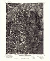
Beaver Dam Lake dominates the northwest corner of this 1975 orthophotomap, its dark waters providing a sharp contrast to the geometric patterns of the surrounding Wisconsin farmland. The city of Beaver Dam occupies the lake's eastern shore, showing the mid-1970s footprint of its residential streets and industrial corridors. Prepared from aerial photography taken in late September, the imagery reveals the intricate textures of the Dodge County landscape, from the dense grid of the urban center to the long, narrow agricultural plots that stretch across the southern half of the quadrangle. This specialized photo-map provides researchers with a precise visual record of land use and property boundaries, illustrating the transition between the developed lakeside community and the expansive dairy and crop lands that define the region's economy.
Find a feature on this map
2 named features on this map. Tap any name to fly to it.
Don’t see what you’re looking for? This feature index may not catch every label — zoom into the map to look around manually.
Map Details
Editions of this 1975 Beaver Dam NE Map
This is the sole edition of this map. No revisions or reprints were ever made.
Other maps of this area

1955 · Beaver Dam
USGS Topo · 1:62,500

1955 · Waupun
USGS Topo · 1:62,500

1955 · Fox Lake
USGS Topo · 1:62,500

1955 · Horicon
USGS Topo · 1:62,500

1957 · Madison
USGS Topo · 1:250,000

1960 · Madison
USGS Topo · 1:250,000

1975 · Horicon NW
USGS Topo · 1:24,000
1975 · Waupun SW
USGS Topo · 1:24,000

1980 · Fond Du Lac
USGS Topo · 1:100,000

1980 · Lost Lake
USGS Topo · 1:24,000