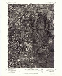
1975 Map of Waupun SW
USGS Topo · Published 1977About this map
Horicon National Wildlife Refuge dominates the eastern half of this 1975 orthophotograph, showing the intricate hydrology and vegetation patterns of this significant wetland system. Unlike standard topographic maps, this aerial imagery captures the actual texture of the marshlands and the geometric precision of the surrounding agricultural fields in Dodge County. To the south, the Horicon Marsh Wildlife Area continues the protected landscape, while the northern edge of the map shows the southern residential and industrial fringes of Waupun. The settlement of Burnett sits at the southern margin, surrounded by a dense grid of farmsteads and rural roads. This mid-1970s view provides a clear record of land use before modern suburban expansion, preserving the visual relationship between the established farming communities and the expansive wildlife preserves.
Find a feature on this map
4 named features on this map. Tap any name to fly to it.
Don’t see what you’re looking for? This feature index may not catch every label — zoom into the map to look around manually.
Map Details
Editions of this 1975 Waupun SW Map
This is the sole edition of this map. No revisions or reprints were ever made.
Other maps of this area

1955 · Beaver Dam
USGS Topo · 1:62,500

1955 · Waupun
USGS Topo · 1:62,500

1955 · Fox Lake
USGS Topo · 1:62,500

1955 · Horicon
USGS Topo · 1:62,500

1957 · Madison
USGS Topo · 1:250,000

1960 · Madison
USGS Topo · 1:250,000

1975 · Horicon NW
USGS Topo · 1:24,000

1975 · Beaver Dam NE
USGS Topo · 1:24,000

1975 · Waupun NW
USGS Topo · 1:24,000
1975 · Horicon NE
USGS Topo · 1:24,000