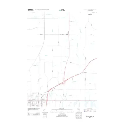
2013 Map of Waupun North
USGS Topo · Published 2013About this map
W Br Rock River and its various tributaries define the rural landscape north of Waupun in this 2013 survey. The terrain is a network of agricultural lands and waterways, with the S Br Rock River flowing through the southern portion of the map near the Juniper Hill settlement. Smaller drainages like Ladoga Cr and Willow Cr crisscross the region, highlighting the hydraulic complexity of this part of Fond du Lac County. Small rural hubs such as Ladoga and Rogersville are connected by a grid of named roads, including State Road 26 and Us-151, which intersect as the region transitions from quiet farmstead corridors to more modern highway infrastructure. The map serves as a detailed record of local land divisions and the naming of secondary routes like Cattaraugus Rd and Hollander Dr in the early 21st century.
Find a feature on this map
64 named features on this map. Tap any name to fly to it.
Don’t see what you’re looking for? This feature index may not catch every label — zoom into the map to look around manually.
Map Details
Editions of this 2013 Waupun North Map
This is the sole edition of this map. No revisions or reprints were ever made.
Other maps of this area

1916 · Ripon
USGS Topo · 1:48,000

1918 · Ripon
USGS Topo · 1:62,500

1955 · Waupun
USGS Topo · 1:62,500

1955 · Fox Lake
USGS Topo · 1:62,500

1956 · Ripon
USGS Topo · 1:62,500

1956 · Rosendale
USGS Topo · 1:62,500

1957 · Madison
USGS Topo · 1:250,000

1960 · Madison
USGS Topo · 1:250,000

1975 · Waupun NW
USGS Topo · 1:24,000
1975 · Waupun NE
USGS Topo · 1:24,000