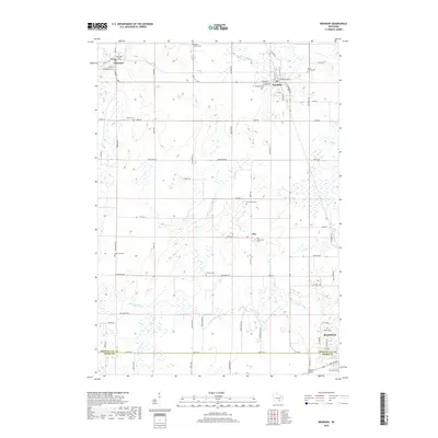
2018 Map of Brandon
USGS Topo · Published 2018About this map
Agricultural lands and prairie pockets define the landscape between the villages of Fairwater and Brandon. This region of Fond du Lac County is marked by a high concentration of established burial grounds, including the Round Prairie Cem and Union Prairie Cem, reflecting a long-settled rural community. The terrain is drained by branches of the Rock River, with the W Br Rock River flowing through the northern sections and the S Br Rock River cutting across the south toward the city of Waupun.
Find a feature on this map
69 named features on this map. Tap any name to fly to it.
Don’t see what you’re looking for? This feature index may not catch every label — zoom into the map to look around manually.
Map Details
Editions of this 2018 Brandon Map
This is the sole edition of this map. No revisions or reprints were ever made.
Other maps of this area

1916 · Ripon
USGS Topo · 1:48,000

1918 · Ripon
USGS Topo · 1:62,500

1955 · Waupun
USGS Topo · 1:62,500

1955 · Fox Lake
USGS Topo · 1:62,500

1956 · Ripon
USGS Topo · 1:62,500

1956 · Rosendale
USGS Topo · 1:62,500

1957 · Madison
USGS Topo · 1:250,000

1960 · Madison
USGS Topo · 1:250,000

1975 · Waupun NW
USGS Topo · 1:24,000
1975 · Waupun SW
USGS Topo · 1:24,000