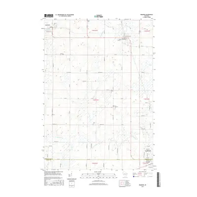
2015 Map of Brandon
USGS Topo · Published 2015About this map
The Grand River and various branches of the Rock River define this agricultural landscape in Fond du Lac and Dodge counties. Rural life centers on the villages of Brandon and Fairwater, the latter of which features Fairwater Pond at its western edge. The map reflects a deeply rooted community structure, evidenced by the high density of small cemeteries scattered across the townships, such as Round Prairie Cem, Wood Cem, and Oak Mound Cem.
Find a feature on this map
68 named features on this map. Tap any name to fly to it.
Don’t see what you’re looking for? This feature index may not catch every label — zoom into the map to look around manually.
Map Details
Editions of this 2015 Brandon Map
This is the sole edition of this map. No revisions or reprints were ever made.
Other maps of this area

1916 · Ripon
USGS Topo · 1:48,000

1918 · Ripon
USGS Topo · 1:62,500

1955 · Waupun
USGS Topo · 1:62,500

1955 · Fox Lake
USGS Topo · 1:62,500

1956 · Ripon
USGS Topo · 1:62,500

1956 · Rosendale
USGS Topo · 1:62,500

1957 · Madison
USGS Topo · 1:250,000

1960 · Madison
USGS Topo · 1:250,000

1975 · Waupun NW
USGS Topo · 1:24,000
1975 · Waupun SW
USGS Topo · 1:24,000