Old Maps of Highland, Wisconsin for Academic Research
Study the evolution of Highland with 46 high-resolution historic maps. Whether you're teaching, researching, or modeling changes in land use, these maps provide essential visual documentation of urban, environmental, and geographic change.
- Analyze long-term change: Track patterns in development, transportation, and natural features.
- Ideal for environmental or urban studies: Support academic projects with primary historical map data.
- Use in the classroom or lab: Educators and researchers rely on these maps to bring historical context to life.
These maps are a powerful tool for teaching, research, and visualizing how Highland has changed over the decades.
Highland, WI maps
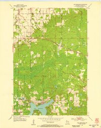
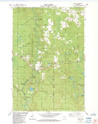
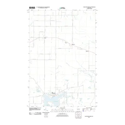
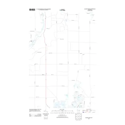
(46)- 1945 Map of Highland, 1956 Print
 1945 Highland1956 Print · USGSNorthwestern Wisconsin at the end of the war is revealed here through its intricate network of glacial lakes and northern forests. Researchers can pinpoint mid-century local landmarks like the Frances Willard Sch, Barnes Cem, and the path of the Brule River.
 - 1947 Map of Brule
 1947 Brule1947 Print · USGSDouglas and Bayfield counties are seen here in the mid-1940s, where the legendary trout waters of the Bois Brule River meet the Lake Superior shoreline. Genealogists and local historians can locate early homesteading landmarks like Rest Haven Cem, St Ann Ch, and the rural community hubs of Cloverland and Maple.2 unique versions available
 - 1949 Map of Highland
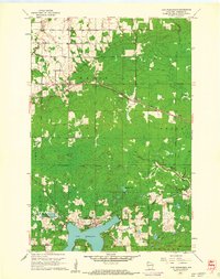
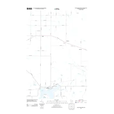
 1949 Highland1949 Print · USGSDouglas County’s lake-strewn interior is captured here just after the war, showing a landscape defined by glacial waters and forestry. Genealogists can locate rural landmarks like the Frances Willard Sch, Barnes Cem, and the Barnes Town Hall.
 - 1953 Map of Ashland, 1964 Print
 1953 Ashland1964 Print · USGSNorthern Wisconsin's lakefront and timberlands are seen here in the mid-1950s, showing the intersection of industrial rail lines and vast wilderness. Genealogists and historians can trace the Soo Line through rail towns like Mellen or locate family roots in the Apostle Islands and Bad River Indian Reservation.3 unique versions available
 - 1954 Map of Lake Nebagamon, 1955 Print
 1954 Lake Nebagamon1955 Print · USGSDouglas County was a landscape of timber and transit in the mid-1950s, centered on the growing community at Lake Nebagamon. Genealogists and historians can trace rail history along the Northern Pacific or locate local landmarks like the Finnish Ch and Corner Sch.
 - 1958 Map of Ashland
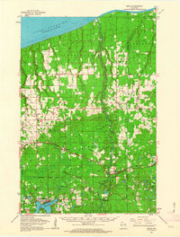
 1958 Ashland1958 Print · USGSCoastal Wisconsin and the Michigan borderlands meet here in the late fifties, dominated by the timbered expanses and iron-rich ranges. Genealogists can trace family footprints in settlements like Odanah and Montreal, or locate landmarks such as the Coast Guard Station and Agricultural Experiment Station.
 - 1961 Map of Lake Nebagamon, 1962 Print
 1961 Lake Nebagamon1962 Print · USGSWisconsin's northern timber and rail country is captured here during the early sixties, centered on the village of Lake Nebagamon. Genealogists and historians can trace local landmarks like Finnish Ch, the Blueberry Cem, and the Northern Pacific rail line.2 unique versions available
 - 1961 Map of Ellison Lake, 1963 Print
 1961 Ellison Lake1963 Print · USGSNorthern Wisconsin's lake country is captured in the early sixties as a center for conservation and recreation. Researchers can trace family history at the Barnes Cem or explore the wilderness around the Bois Brule River and Lake Nebagamon.2 unique versions available
 - 1961 Map of Brule, 1963 Print
 1961 Brule1963 Print · USGSNorthern Wisconsin's lake country and timberlands are captured here in the early sixties, showing the transition from the Brule River valley to the big lake. Researchers can trace family roots at Rest Haven Cem, locate the State Fish Hatchery, and follow the Northern Pacific Railroad through Blueberry.2 unique versions available
 - 1980 Map of Port Wing
 1980 Port Wing1980 Print · USGSThe Lake Superior shoreline and the deep forests of Bayfield and Douglas counties are captured here in the early eighties. Genealogists and historians can trace the rail lines through Iron River or locate the lakeside landings at Cornucopia and Port Wing.
 - 1980 Map of Solon Springs
 1980 Solon Springs1980 Print · USGSNorthern Wisconsin in the early eighties was a landscape of dense timber and sprawling glacial waters. Trace the legacy of the Chicago and North Western rail line through Solon Springs, Hayward, and Minong at this pivotal moment.
 - 1984 Map of Metzger Lake
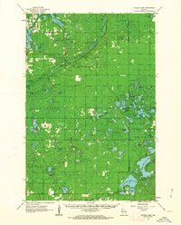
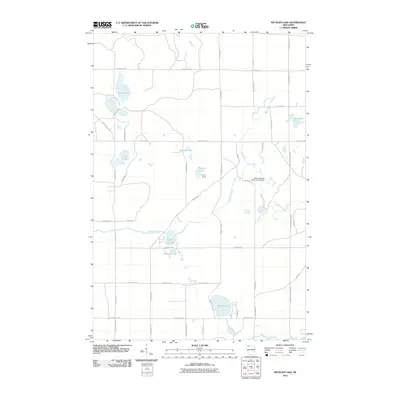
 1984 Metzger Lake1984 Print · USGSDouglas County’s glacial lakes and timberlands are documented in the mid-1980s, showcasing a network of primitive fire lanes and scenic corridors. Trace the path of the North Country National Scenic Trail and find landmarks like Camp Bovey or the shores of Simms Lake.
 - 1984 Map of Ellison Lake
 1984 Ellison Lake1984 Print · USGSIn the mid-1980s, this portion of Douglas and Bayfield counties shows a dense network of water bodies and local township life. Researchers can trace family history at Barnes Cem or explore early land use near Mooney Dam County Park and the Lookout Tower.
 - 1984 Map of Brule
 1984 Brule1984 Print · USGSIn the mid-1980s, the Brule River valley was a landscape of forestry, fishing, and rail transit. Researchers can trace the Burlington Northern tracks as they pass through Brule or locate local landmarks like Pine Ridge Cem and the State Fish Hatchery.
 - 1984 Map of Lake Minnesuing
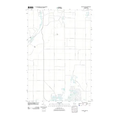
 1984 Lake Minnesuing1984 Print · USGSDouglas County’s river-carved timberlands are captured here in the mid-eighties, showing the intersection of state forest conservation and lakeside settlement. You can trace family history at Highland Memorial Cem or follow the Bois Brule River past Stories Bridge Landing and McDougal Springs.
 - 1984 Map of Island Lake
 1984 Island Lake1984 Print · USGSThe Brule River corridor and its famed whitewater rapids define this 1980s survey of the northern Wisconsin woods. Researchers can trace the layout of the Cedar Island Estate, locate the Brule Lookout Tower, and identify dozens of named glacial waters like Lucius Lake.
 - 2010 Map of Brule, 2010 Print
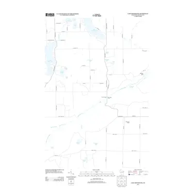
 2010 Brule2010 Print · USGSCovers Highland, including Brule, Oulu, and other nearby areas
 - 2010 Map of Lake Minnesuing, 2010 Print
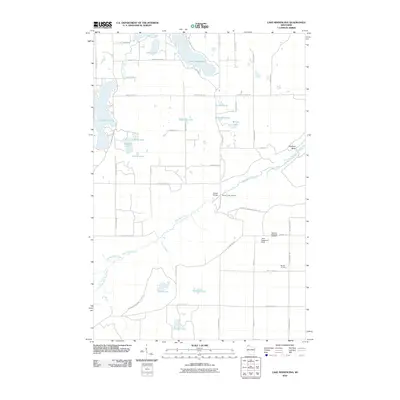 2010 Lake Minnesuing2010 Print · USGSCovers Highland, including Hawthorne, Lake Nebagamon, and other nearby areas
 - 2010 Map of Ellison Lake, 2010 Print
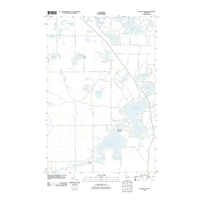 2010 Ellison Lake2010 Print · USGSCovers Highland, including Gordon, Barnes, and other nearby areas
 - 2010 Map of Lake Nebagamon, 2010 Print
 2010 Lake Nebagamon2010 Print · USGSCovers Highland, including Hawthorne, Lake Nebagamon, and other nearby areas
 - 2010 Map of Metzger Lake, 2010 Print
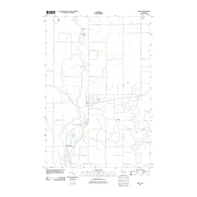
 2010 Metzger Lake2010 Print · USGSCovers Highland, including Gordon, Solon Springs, and other nearby areas
 - 2010 Map of Island Lake, 2010 Print
 2010 Island Lake2010 Print · USGSCovers Highland, including Barnes, Hughes, and other nearby areas
 - 2013 Map of Lake Nebagamon, 2013 Print
 2013 Lake Nebagamon2013 Print · USGSCovers Highland, including Hawthorne, Lake Nebagamon, and other nearby areas
 - 2013 Map of Island Lake, 2013 Print
 2013 Island Lake2013 Print · USGSCovers Highland, including Barnes, Hughes, and other nearby areas
 - 2013 Map of Lake Minnesuing, 2013 Print
 2013 Lake Minnesuing2013 Print · USGSCovers Highland, including Hawthorne, Lake Nebagamon, and other nearby areas
Showing maps 1-25 of 46
Top cities near Highland
- Hawthorne historical maps
- Iron River historical maps
- Lake Nebagamon historical maps
- Cable historical maps
- Gordon historical maps
- Wascott historical maps
See more
Frequently asked questions
- What are the different types of historical maps available for Highland?
- What is the oldest map of Highland?
- Where can I purchase historical maps of Highland for my home or office?
- Where can I download high-res historical maps of Highland?
- Are there historical topographic maps available for Highland?
- Is there historical aerial imagery available for Highland?
- Where are historical maps of Highland sourced from?