1970s Maps of Wabeno, Wisconsin
Explore 6 historic maps of Wabeno from the 1970s. These maps offer a rare glimpse into what life looked like during the 1970s — showing old roads, neighborhoods, homes, and landmarks that have changed or disappeared over time.
Whether you're researching your family's past, planning a metal detecting trip, or studying how Wabeno's landscape evolved across the 1970s, these high-resolution maps are a powerful tool for exploring the history of this region.
- Focus on a specific era: All maps on this page are from the 1970s, giving you a focused view of this time period.
- See what’s changed: Compare century-old streets, trails, and buildings to today's modern landscape using overlays and satellite layers.
- Research with precision: Use these maps for genealogy, historical research, land use analysis, or educational projects.
- View, download, or print: Maps are fully viewable online in high resolution, and can be downloaded or printed for your own records.
Start exploring Wabeno's history through authentic maps from the 1970s. This is your window into the past.
Wabeno, WI maps
(6)- 1972 Map of Laona, 1974 Print
 1972 Laona1974 Print · USGSLaona and the surrounding timberlands in the early seventies reveal a landscape deeply integrated with the Nicolet National Forest. Genealogists and historians can trace the rail-driven economy via the Chicago and North Western line and locate sites like Starks Settlement and the Laona Cem.
 - 1972 Map of Blackwell, 1974 Print
 1972 Blackwell1974 Print · USGSForest County during the 1970s reveals a landscape of dense woods and winding waterways managed under the Nicolet National Forest. You can trace the community at Blackwell, find the local Cem, and follow the Old Railroad Grade along the Rat River.
 - 1972 Map of Goodman SW, 1974 Print
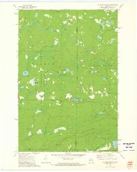
 1972 Goodman SW1974 Print · USGSForest and Marinette counties during the early seventies reveal a landscape of timber and trout streams deep within the Nicolet National Forest. Outdoor enthusiasts and historians can trace the course of the Peshtigo River past the Burnt Bridge Campground and remote rapids.2 unique versions available
 - 1972 Map of Mc Caslin Mountain, 1975 Print
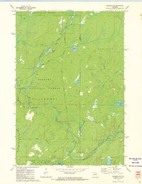
 1972 Mc Caslin Mountain1975 Print · USGSThe borderlands of Forest and Marinette County in the early seventies reveal a landscape of managed timber and remote glacial lakes. You can trace the Rat River rapids, locate the McCaslin Lookout Tower, and find small landmarks like the Cem or the Deer Lake Flowage.2 unique versions available
 - 1972 Map of Wabeno, 1975 Print
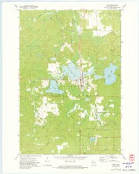
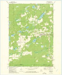 1972 Wabeno1975 Print · USGSForest County in the early 1970s is characterized by the timber-belt communities of Wabeno and Soperton within the Nicolet National Forest. Genealogists and historians can trace rail-side developments, numerous lakefronts, and several local cemeteries like St Ambrose Cem and Roseland Cem.
 - 1972 Map of Otter Lake, 1975 Print
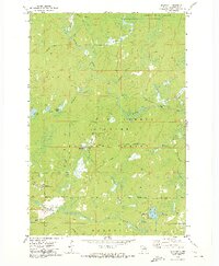
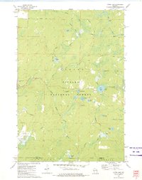 1972 Otter Lake1975 Print · USGSThe deep Northwoods of Forest County are captured in the early seventies, dominated by the sprawling Nicolet National Forest. Researchers can trace old timber access routes like Kufner Road and locate remote water features such as Johnson Spring and Otter Lake.
End of results
Showing maps 1-6 of 6
Top cities near Wabeno
- Laona historical maps
- Townsend historical maps
- Lakewood historical maps
- Goodman historical maps
- Armstrong Creek historical maps
- Blackwell historical maps
Top neighborhoods of Wabeno
Frequently asked questions
- What are the different types of historical maps available for Wabeno?
- What is the oldest map of Wabeno?
- Where can I purchase historical maps of Wabeno for my home or office?
- Where can I download high-res historical maps of Wabeno?
- Are there historical topographic maps available for Wabeno?
- Is there historical aerial imagery available for Wabeno?
- Where are historical maps of Wabeno sourced from?