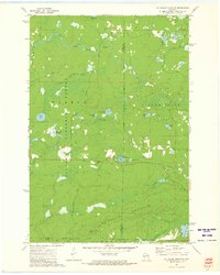
1972 Map of Mc Caslin Mountain
USGS Topo · Published 1975About this map
Mc Caslin Mountain dominates the southern landscape of this 1972 survey, an era when this portion of the Nicolet National Forest served primarily as a managed timber and recreation resource. The map captures the complex drainage patterns of the Rat River as it winds through the northern sections, passing several Rapids and a secluded Cem near the valley floor. To the east, the Silver Cliff area is defined by numerous glacial lakes including Berry Lake and Crane Lake. Human activity in these woods is anchored by the McCaslin Lookout Tower and scattered resource extraction sites like the Gravel Pit near Spruce Lake. The abundance of named water bodies, from the Deer Lake Flowage to the curiously named Swede John Lake, illustrates the dense hydrography of the Forest and Marinette County borderlands.
Find a feature on this map
33 named features on this map. Tap any name to fly to it.
Don’t see what you’re looking for? This feature index may not catch every label — zoom into the map to look around manually.
Map Details
Editions of this 1972 Mc Caslin Mountain Map
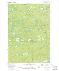
2 editions found
Other maps of this area

1939 · Goodman
USGS Topo · 1:48,000

1939 · Laona
USGS Topo · 1:48,000

1940 · Thunder Mtn.
USGS Topo · 1:48,000

1942 · Wabeno
USGS Topo · 1:48,000

1946 · Laona
USGS Topo · 1:48,000

1946 · Goodman
USGS Topo · 1:48,000

1950 · Wabeno
USGS Topo · 1:48,000

1951 · Wabeno
USGS Topo · 1:48,000

1951 · Thunder Mountain
USGS Topo · 1:48,000

1954 · Iron Mountain
USGS Topo · 1:250,000