Old Maps of Cassville, Wisconsin for Hiking & Exploration
Hike through history with 26 historic maps of Cassville. Explore old trails, ghost towns, and forgotten backroads — perfect for outdoor adventurers and local explorers.
- Rediscover forgotten places: Map out old mining camps, roads, and footpaths that no longer exist on modern maps.
- Layer with modern tools: Combine with LiDAR or satellite views to plan hikes through historical terrain.
- Made for exploration: Popular among hikers, overlanders, and local history lovers.
Use these maps to find adventure and explore the hidden past of Cassville.
Cassville, WI maps
(26)- 1900 Map of Lancaster
 1900 Lancaster1900 Print · USGSGrant County and the Mississippi River bluffs are captured at the close of the nineteenth century, showing a landscape of river towns and ridge-top farms. Researchers can trace the early rail corridors and vanished river landings from Cassville and Potosi to the county seat at Lancaster.
 - 1902 Map of Elkader
 1902 Elkader1902 Print · USGSNortheast Iowa at the turn of the century is defined by the deep river valleys of the Mississippi, Turkey, and Volga. Genealogists and historians can trace rail lines and early settlements like Elkader, Guttenberg, and Elkport as they appeared in 1898.4 unique versions available
 - 1904 Map of Lancaster, 1953 Print
 1904 Lancaster1953 Print · USGSSouthwest Wisconsin and its neighboring river lands are shown at the turn of the century as railroads began to dominate the ridge tops. Researchers can trace the development of the river-and-rail economy through sites like Spechts Ferry, Sinsinawa Mound, and Lancaster.
 - 1908 Map of Lancaster
 1908 Lancaster1908 Print · USGSGrant County and the Mississippi River border appear in the first decade of the twentieth century, when river crossings and new rail lines defined local commerce. Researchers can trace the landings at Spechts Ferry and Mc Cartney or locate early settlements like British Hollow and Beetown.5 unique versions available
 - 1955 Map of Cassville, 1957 Print
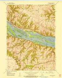 1955 Cassville1957 Print · USGSMid-century life along the Mississippi River bluffs is captured here as the transition from one-room schools to larger districts begins. Genealogists can trace family roots at St Charles Cem and Advent Ch or locate discontinued sites like Hefel Sch.2 unique versions available
 - 1957 Map of Turkey River, 1959 Print
 1957 Turkey River1959 Print · USGSNortheast Iowa at the confluence of the Turkey and Mississippi Rivers shows a landscape of deep hollows and river-bottom railroads in the late fifties. Genealogists can locate family landmarks like St Johns Cem, the settlement of Millville, and the Goshen Ch.3 unique versions available
 - 1959 Map of Dubuque, 1982 Print
 1959 Dubuque1982 Print · USGSThe Tri-State region comes alive in the mid-twentieth century as a hub of river commerce and rail transit. Genealogists and historians can trace the paths of the Illinois Central Gulf through Dubuque or locate the Savanna Ordnance Depot and Lock and Dam No 11.
 - 1961 Map of Dubuque
 1961 Dubuque1961 Print · USGSThe Tri-State region's river-and-rail landscape is captured here during the early sixties, showing the convergence of Iowa, Illinois, and Wisconsin. Trace mid-century rail lines like the Chicago Great Western Ry and explore sites like the Savanna Ordnance Depot and Backbone State Park.
 - 1962 Map of Dubuque
 1962 Dubuque1962 Print · USGSThe Tri-State region's river-and-rail economy is captured here in the early sixties, centered on the Mississippi River bluffs. Genealogists and historians can locate Numerous lead and zinc mines, the New Melleray Abbey Monastery, and rural hubs like Saint Olaf.2 unique versions available
 - 1962 Map of Beetown, 1964 Print
 1962 Beetown1964 Print · USGSGrant County’s Driftless Area remains a patchwork of valley farms and ridge-top roads during the early sixties. Genealogists and researchers can trace family lands near Beetown, identifying local landmarks like Flat Rock Sch, Dodge Cem, and several old Mines.2 unique versions available
 - 1962 Map of Guttenberg, 1964 Print
 1962 Guttenberg1964 Print · USGSThe Mississippi River corridor appears in transition during the early sixties, marking the state line between Iowa and Wisconsin. Trace old rail lines, family burial sites like Scott Cem, and river navigation landmarks including Lock and Dam No 10.2 unique versions available
 - 1976 Map of Dubuque
 1976 Dubuque1976 Print · USGSThe tri-state borderlands of Iowa, Wisconsin, and Illinois come alive during the mid-seventies, showing a region built on river commerce and mining. Genealogists and historians can trace the paths of the Illinois Central railroad or locate heritage sites like the New Melleray Abbey Monastery and Backbone State Park.
 - 1984 Map of Oelwein, 1985 Print
 1984 Oelwein1985 Print · USGSNortheast Iowa and the Mississippi riverfront appear in detail during the 1980s, showing a land defined by deep river valleys and high ridges. Genealogists and historians can trace the Chicago and North Western rail line and locate rural sites like St Sebald Ch and Quaker Mill Pond.2 unique versions available
 - 1984 Map of Dubuque North, 1985 Print
 1984 Dubuque North1985 Print · USGSThis Tri-State region was a hub of Midwestern mining and river commerce in the mid-eighties. Researchers can trace the legacy of the Lead District through specific sites like Annie Mine or locate early civic centers such as First Capitol State Park.2 unique versions available
 - 2010 Map of Guttenberg, 2010 Print
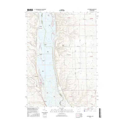
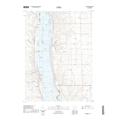
 2010 Guttenberg2010 Print · USGSCovers Cassville, including Guttenberg, Glen Haven, and other nearby areas
 - 2010 Map of Turkey River, 2010 Print
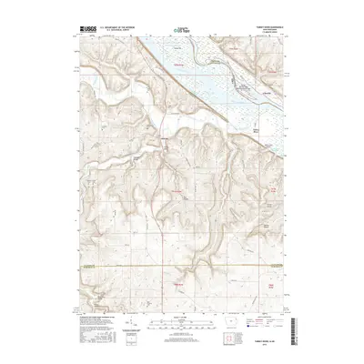
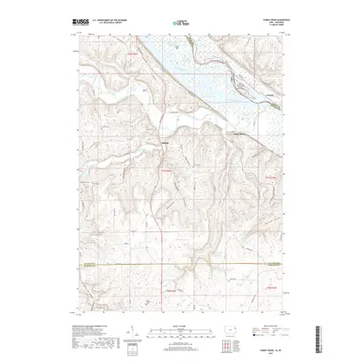
 2010 Turkey River2010 Print · USGSCovers Cassville, including Millville, Turkey River, and other nearby areas
 - 2013 Map of Guttenberg, 2013 Print
 2013 Guttenberg2013 Print · USGSCovers Cassville, including Guttenberg, Glen Haven, and other nearby areas
 - 2013 Map of Turkey River, 2013 Print
 2013 Turkey River2013 Print · USGSCovers Cassville, including Millville, Turkey River, and other nearby areas
 - 2015 Map of Turkey River, 2015 Print
 2015 Turkey River2015 Print · USGSCovers Cassville, including Millville, Turkey River, and other nearby areas
 - 2015 Map of Guttenberg, 2015 Print
 2015 Guttenberg2015 Print · USGSCovers Cassville, including Guttenberg, Glen Haven, and other nearby areas
 - 2018 Map of Turkey River, 2018 Print
 2018 Turkey River2018 Print · USGSCovers Cassville, including Millville, Turkey River, and other nearby areas
 - 2018 Map of Guttenberg, 2018 Print
 2018 Guttenberg2018 Print · USGSCovers Cassville, including Guttenberg, Glen Haven, and other nearby areas
 - 2022 Map of Cassville, 2022 Print
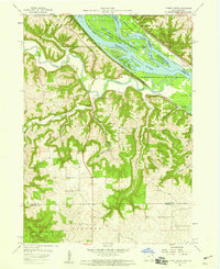
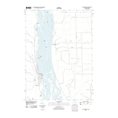
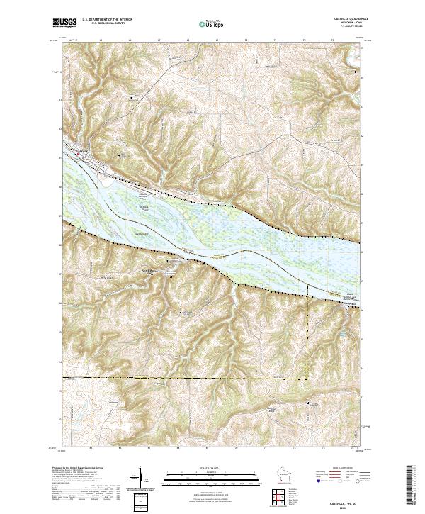 2022 Cassville2022 Print · USGSThe upper Mississippi River valley at the Wisconsin-Iowa border reveals a detailed network of islands and bluff-top settlements. Researchers can trace family history through sites like Saint Charles Cem or locate the Cassville Car Ferry and North Buena Vista.
 - 2022 Map of Beetown, 2022 Print
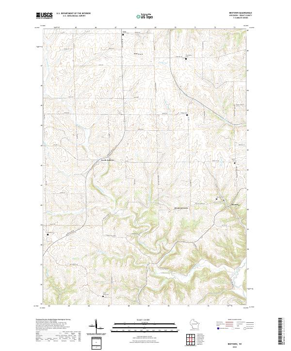 2022 Beetown2022 Print · USGSGrant County’s rolling agricultural and river landscapes are preserved in this recent survey of the Beetown area. Genealogists can locate family sites at Blakes Prairie Cem and Dodge Cem, or trace the winding course of Rattlesnake Cr.
 - 2022 Map of Turkey River, 2022 Print
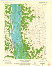
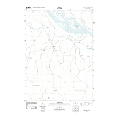
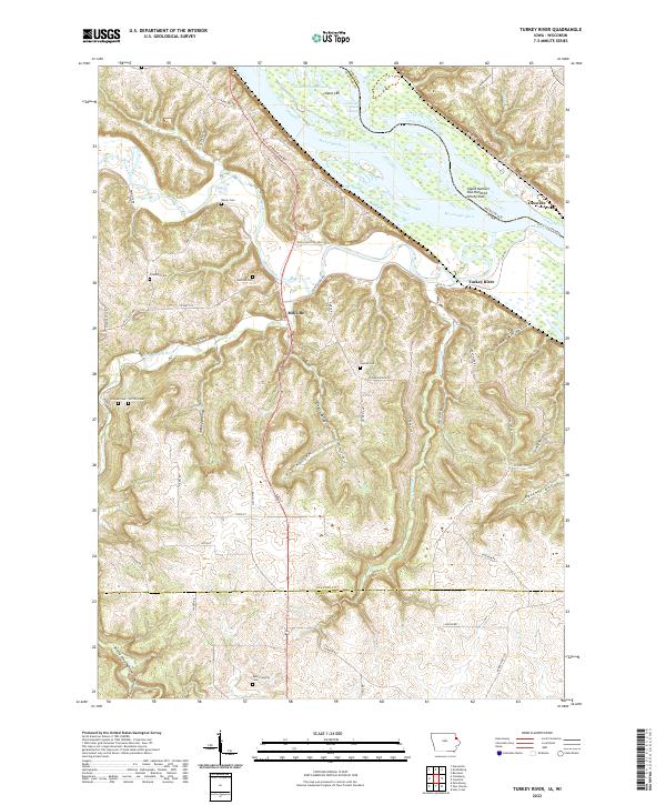 2022 Turkey River2022 Print · USGSThe Mississippi River and Turkey River meet at this tri-county border in the early 2020s, revealing a landscape of steep hollows and high ridges. Researchers can trace rural lineages through the Bierer and Redman cemeteries or locate the Cassville Car Ferry.
Showing maps 1-25 of 26
Top cities near Cassville
- Dubuque historical maps
- Asbury historical maps
- Dyersville historical maps
- Guttenberg historical maps
- Cassville historical maps
- Beetown historical maps
See more
Frequently asked questions
- What are the different types of historical maps available for Cassville?
- What is the oldest map of Cassville?
- Where can I purchase historical maps of Cassville for my home or office?
- Where can I download high-res historical maps of Cassville?
- Are there historical topographic maps available for Cassville?
- Is there historical aerial imagery available for Cassville?
- Where are historical maps of Cassville sourced from?