1980s Maps of Lincoln County, Wisconsin
Explore 16 historic maps of Lincoln County from the 1980s. These maps offer a rare glimpse into what life looked like during the 1980s — showing old roads, neighborhoods, homes, and landmarks that have changed or disappeared over time.
Whether you're researching your family's past, planning a metal detecting trip, or studying how Lincoln County's landscape evolved across the 1980s, these high-resolution maps are a powerful tool for exploring the history of this region.
- Focus on a specific era: All maps on this page are from the 1980s, giving you a focused view of this time period.
- See what’s changed: Compare century-old streets, trails, and buildings to today's modern landscape using overlays and satellite layers.
- Research with precision: Use these maps for genealogy, historical research, land use analysis, or educational projects.
- View, download, or print: Maps are fully viewable online in high resolution, and can be downloaded or printed for your own records.
Start exploring Lincoln County's history through authentic maps from the 1980s. This is your window into the past.
Lincoln County, WI maps
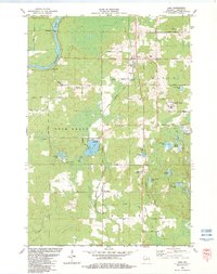
(16)- 1980 Map of Goodrich
 1980 Goodrich1980 Print · USGSTaylor County and Lincoln County meet in this northern Wisconsin landscape as it appeared in 1980. Local researchers can trace family landmarks like Goodrich Ch, explore the path of the Old Railroad Grade, and locate the small settlement of Interwald.2 unique versions available
 - 1980 Map of Athens
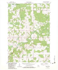
 1980 Athens1980 Print · USGSMarathon County at the end of the 1970s shows a landscape of steady agricultural and timber-linked growth centered on the village of Athens. Genealogists and historians can trace the Old Railroad Grade and locate family markers at the local Cem or along Potato Creek.2 unique versions available
 - 1980 Map of Park Falls
 1980 Park Falls1980 Print · USGSNorthern Wisconsin's timber and rail corridor is meticulously detailed here in the early eighties. Researchers can trace the Soo Line through forest-bound towns like Park Falls, Phillips, and Lugerville while exploring the vast Chequamegon National Forest.
 - 1980 Map of Medford
 1980 Medford1980 Print · USGSNorth-central Wisconsin in the early eighties shows a landscape of dense timber and rail-linked settlements. Genealogists and historians can trace the Soo Line through towns like Medford and Westboro or locate family homesteads near Perkinstown and Athens.
 - 1982 Map of Heafford Junction, 1983 Print
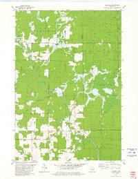
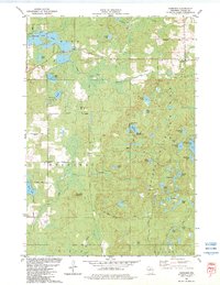
 1982 Heafford Junction1983 Print · USGSOneida and Lincoln Counties are defined by a vast network of glacial water in the early eighties. You can trace the railroad history of Heafford Junction and locate local landmarks like Hiawatha Sch and the Inshalla Country Club.
 - 1982 Map of Brokaw, 1983 Print
 1982 Brokaw1983 Print · USGSThe Wisconsin River valley comes into sharp focus in the early eighties as a hub of paper milling and rail transport. Genealogists can trace family roots through markers like Maple Grove Cem, St John Ch, and the small settlement at Taegesville.
 - 1982 Map of Nutterville, 1983 Print
 1982 Nutterville1983 Print · USGSMarathon County in the early eighties shows a landscape of river-fed valleys and quiet township life. Researchers can find old family landmarks and country congregations such as St Peter Ch, Mechanic Ridge Cem, and the settlement of Schuett.
 - 1982 Map of Woodboro, 1983 Print
 1982 Woodboro1983 Print · USGSOneida County's lakeland landscape is captured here in the early eighties as a hub for Northwoods recreation and settlement. Researchers can trace family history at the Woodboro Cem or locate seasonal landmarks like Ski Lifts and Whirlpool Rapids along the Wisconsin River.
 - 1982 Map of Lake Julia, 1983 Print
 1982 Lake Julia1983 Print · USGSOneida and Lincoln counties come together in this early 1980s portrait of the Wisconsin Northwoods, where recreation and industry meet. Researchers can pinpoint Nicolet College, the Powerplant at the rapids, and local landmarks like Our Saviour Ch and Almon County Park.
 - 1982 Map of Tomahawk, 1983 Print
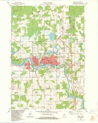
 1982 Tomahawk1983 Print · USGSThe industrial and riparian heart of Lincoln County is shown here in the early eighties, centered on the confluence of the Wisconsin and Spirit Rivers. Genealogists and local historians can trace the foundations of Tomahawk and Jersey City, alongside landmarks like Oak Hill Cem and the Kings Dam Powerplant.
 - 1982 Map of Bloomville, 1983 Print
 1982 Bloomville1983 Print · USGSGlacial lakes and river branches define this Lincoln County landscape in the early 1980s. Genealogists and local historians can trace the rural communities of Bloomville and Gleason, or locate family sites near St Johns Cem and the Old Railroad Grade.
 - 1982 Map of Merrill, 1983 Print
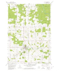
 1982 Merrill1983 Print · USGSThe city of Merrill at the start of the 1980s remains centered on the Wisconsin River and its rail connections. Researchers can trace local lineage through St John Cem and locate civic landmarks like the Courthouse and Lincoln Sch.
 - 1982 Map of Irma, 1983 Print
 1982 Irma1983 Print · USGSLincoln County in the early eighties was a landscape of dense glacial lakes and rural townships like Rock Falls. Trace family connections and local history at Bethany Ch, the Lincoln Hills School, and Woodlawn Cem.
 - 1982 Map of Pine Dells, 1983 Print
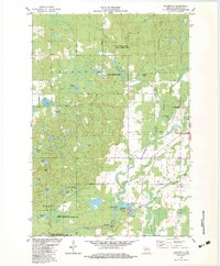
 1982 Pine Dells1983 Print · USGSThe rural landscape of Lincoln County comes into focus in the early eighties, centered on the Pine River and the community of Pine Dells. Genealogists can locate family landmarks like Trinity Cem, Springbrook Cem, and St Paul Ch among the winding creek beds.
 - 1982 Map of Harrison, 1983 Print
 1982 Harrison1983 Print · USGSLincoln County’s glacial lakelands are captured here in the early eighties, showcasing a region defined by its logging history and water. Genealogists and historians can trace former timber corridors like the Green Grade or locate the local Townhall and the settlement of Harrison.
 - 1989 Map of Rhinelander, 1990 Print
 1989 Rhinelander1990 Print · USGSThe Wisconsin Northwoods are captured here in the late eighties, showing a landscape defined by water and timber management. Researchers can trace the Soo Line rail corridors and find local landmarks like Rainbow Flowage, Pelican Lake, and the Rhinelander-Oneida Co Airport.
End of results
Showing maps 1-16 of 16
Top cities of Lincoln County
- Merrill historical maps
- Tomahawk historical maps
- Bradley historical maps
- Pine River historical maps
- Harrison historical maps
Frequently asked questions
- What are the different types of historical maps available for Lincoln County?
- What is the oldest map of Lincoln County?
- Where can I purchase historical maps of Lincoln County for my home or office?
- Where can I download high-res historical maps of Lincoln County?
- Are there historical topographic maps available for Lincoln County?
- Is there historical aerial imagery available for Lincoln County?
- Where are historical maps of Lincoln County sourced from?