Old Maps of Lincoln County, Wisconsin for Hiking & Exploration
Hike through history with 97 historic maps of Lincoln County. Explore old trails, ghost towns, and forgotten backroads — perfect for outdoor adventurers and local explorers.
- Rediscover forgotten places: Map out old mining camps, roads, and footpaths that no longer exist on modern maps.
- Layer with modern tools: Combine with LiDAR or satellite views to plan hikes through historical terrain.
- Made for exploration: Popular among hikers, overlanders, and local history lovers.
Use these maps to find adventure and explore the hidden past of Lincoln County.
Lincoln County, WI maps
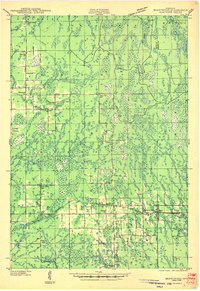
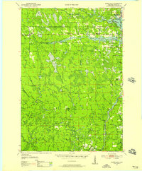
(97)- 1899 Map of Wausau, 1956 Print
 1899 Wausau1956 Print · USGSMarathon County was a bustling timber and rail corridor at the turn of the century, anchored by the river power of Wausau and Merrill. Researchers can trace early logging lines like the Bull Dessert Logging R R and find vanished stops such as Dessert Junction and Nutterville.
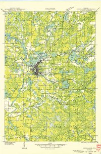
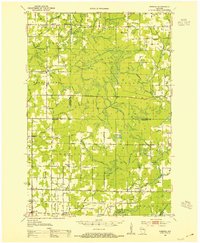
 - 1902 Map of Wausau
 1902 Wausau1902 Print · USGSWisconsin’s timber and rail heartland is meticulously documented at the turn of the century as Wausau and Merrill expand along the river. Genealogists can trace early homesteads and rail stops like Schofield, Granite Heights, and the grounds of the State Insane Asylum.2 unique versions available
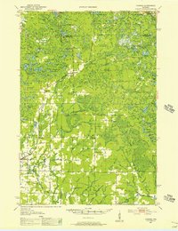
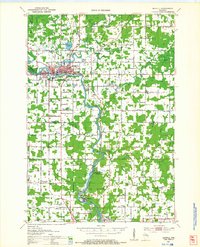
 - 1902 Map of Marathon, 1938 Print
 1902 Marathon1938 Print · USGSMarathon County is captured here at the height of the timber era, when a dense network of logging railroads and new settlements defined the central Wisconsin woods. Genealogists and historians can trace early town sites like Athens, Rib Falls, and the specialized Connors Logging R. R.
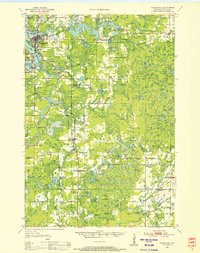
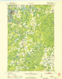
 - 1939 Map of Mc Cord
 1939 Mc Cord1939 Print · USGSOneida and Lincoln counties come into focus during the late 1930s as a land of timber, railroads, and nascent reservoirs. Genealogists and local historians can trace the foundations of settlements like Clifford and Tripoli or locate vanished rural schoolhouses such as Somo Lake Sch and Kelly Sch.3 unique versions available
 - 1939 Map of Cassian, 1946 Print
 1939 Cassian1946 Print · USGSOneida County's Northwoods come into focus in the late thirties, showing a landscape defined by glacial lakes and timber-country rail lines. Genealogists can trace rural life through scattered schoolhouses like Fernwood Sch and Stewart Sch or rail stops at Heafford Junction and Goodnow.4 unique versions available
 - 1940 Map of Parrish
 1940 Parrish1940 Print · USGSUpper Wisconsin during the early 1940s is captured here at the edges of Three counties. Researchers can trace the Chicago and Northwestern rail line and locate the Enterprise settlement near Shingle Mill Lake before the full survey was completed.
 - 1940 Map of Rhinelander, 1961 Print
 1940 Rhinelander1961 Print · USGSRhinelander and the surrounding lake country are captured here in the early 1940s, just as the rail-and-timber era had matured. Genealogists and local historians can trace rural school districts like Burkhart Sch and Clovernook Sch or locate the Our Saviour Ch among the region's many lakes.
 - 1941 Map of Brantwood, 1971 Print
 1941 Brantwood1971 Print · USGSNorth-central Wisconsin is captured here in the early 1940s as a landscape of timber and rail-line settlements. You can trace the rural school system through Lone Corner Sch and Dover 3-E Sch, or locate family sites at Emery Cem and Brantwood.
 - 1942 Map of Cassian
 1942 Cassian1942 Print · USGSOneida County's lake country is seen here in the late 1930s as a hub of rail activity and forestry. Genealogists and researchers can trace rural school sites like Crescent Flats Sch and follow the rail junctions at Heafford Junction and Cassian (Deer Trail Sta).
 - 1943 Map of Brantwood
 1943 Brantwood1943 Print · USGSPrice and Oneida counties are shown here just after the start of the war, when the Minneapolis St Paul and Sault Ste Marie rail line anchored a series of rural timber and farming hamlets. Genealogists can locate numerous local landmarks like St Marys Cem, the Knox Mills Sch, and the vanished site of Jordan.2 unique versions available
 - 1945 Map of Rib Lake
 1945 Rib Lake1945 Print · USGSNorthern Wisconsin lake country is captured here during the 1940s, showing a landscape of timber and township life. Genealogists can locate rural landmarks like Spirit Town Hall, Mission Ch, and schools like Ring Sch or Stone Lake Sch.
 - 1947 Map of Mc Cord
 1947 Mc Cord1947 Print · USGSOneida and Lincoln counties come into focus during the late 1930s and 1940s as a landscape of timber, rail, and water. Genealogists and historians can locate rural schoolhouses like Lund Sch, the CCC Camp at Mc Cord, and the Prairie Rapids Ch.
 - 1947 Map of Rib Lake, 1956 Print
 1947 Rib Lake1956 Print · USGSTaylor and Price Counties come into focus during the late 1940s, a period when the timber industry and small-town life shaped this north-central Wisconsin landscape. Genealogists can trace family footprints through rural landmarks like Mission Ch, Stone Lake Sch, and the village of Rib Lake.
 - 1949 Map of Rhinelander
 1949 Rhinelander1949 Print · USGSNorthern Wisconsin lake country comes alive in this late 1940s survey centered on the bustling hub of Rhinelander. Genealogists and historians can trace the paths of the Chicago and North Western Railway or locate rural landmarks like Trotier Sch and Emden Sch.
 - 1949 Map of Rib Lake
 1949 Rib Lake1949 Print · USGSRib Lake and the surrounding Northwoods townships appear here in the late 1940s, just as the rural schoolhouse system remained a central pillar of the community. Genealogists and historians can locate numerous local landmarks like Ring Sch, the Wilderness Lookout Tower, and the Mission Ch.
 - 1950 Map of Parrish, 1956 Print
 1950 Parrish1956 Print · USGSLanglade and Lincoln Counties are shown in the early fifties as a landscape of timber-era relics and rural immigrant communities. Researchers can trace the Old Railroad Grade and locate cultural landmarks like the Estonian Ch or the Liberty Bell Sch.2 unique versions available
 - 1950 Map of Tomahawk, 1956 Print
 1950 Tomahawk1956 Print · USGSThe river and rail networks of Lincoln County are captured here in the early fifties, centering on the industrial activity of the Wisconsin River. Genealogists and historians can trace family roots through numerous country schools and cemeteries like Calvary Cemetery, Little Pine Creek School, and the settlement at Irma.
 - 1950 Map of Spirit Falls, 1957 Print
 1950 Spirit Falls1957 Print · USGSLincoln County’s river valleys and timberlands are captured here in the early 1950s, documenting the era of hydroelectric power and forest management. Genealogists and historians can trace Old Railroad Grade, remote outposts like Camp 25, and local landmarks like Grandfather Falls.2 unique versions available
 - 1951 Map of Doering, 1954 Print
 1951 Doering1954 Print · USGSNorthwoods rural life is captured here in the early fifties across the intersection of Lincoln, Langlade, and Marathon counties. Genealogists can trace family footprints near Nutterville, Kalinke, and several country schools like Farrell Sch.2 unique versions available
 - 1951 Map of Athens, 1954 Print
 1951 Athens1954 Print · USGSMarathon and Taylor Counties are captured here in the early fifties, showing a rural landscape organized around the Soo Line railroad. Genealogists can locate dozens of country schools and churches like St Peter Ch, Goodrich Ch, and Corinth Sch.2 unique versions available
 - 1951 Map of Merrill, 1954 Print
 1951 Merrill1954 Print · USGSThe Wisconsin River valley comes alive in this midcentury survey, showing the growth of Merrill and the paper mill life at Brokaw. Genealogists can trace family roots through numerous rural landmarks like Dutch Corners, St James Cem, and the Taegesville Sch.
 - 1951 Map of Hamburg, 1969 Print
 1951 Hamburg1969 Print · USGSThe rural borderlands of Lincoln and Marathon counties come alive in this mid-century survey of Wisconsin dairy country. Genealogists and historians can trace family-named sites like the Lueck Cem, Mitchell Sch, and the unique crossroads of Little Chicago.
 - 1952 Map of Parrish
 1952 Parrish1952 Print · USGSLanglade and Lincoln Counties are shown in the early fifties during a period of transition for Northwoods timber and farming communities. You can trace early ethnic heritage through the Estonian Ch, locate old logging routes like the old railroad grade, and find schools like Good Luck Sch.
 - 1952 Map of Spirit Falls
 1952 Spirit Falls1952 Print · USGSLincoln County is captured during its mid-century transition from a timber-driven frontier to an era of hydroelectric power. Genealogists and researchers can trace rural school locations like Mitchell Sch and industrial sites including Averill Junction and the Grandfather Dam.
 - 1952 Map of Tomahawk
 1952 Tomahawk1952 Print · USGSWisconsin's timber country comes into focus in the early fifties as the river-driven economy of Lincoln County transitions toward modernization. Genealogists and historians can locate rural landmarks like Irma, the Dotter Sch (Abandoned), and Calvary Cem.
Showing maps 1-25 of 97
Top cities of Lincoln County
- Merrill historical maps
- Tomahawk historical maps
- Bradley historical maps
- Pine River historical maps
- Harrison historical maps
Frequently asked questions
- What are the different types of historical maps available for Lincoln County?
- What is the oldest map of Lincoln County?
- Where can I purchase historical maps of Lincoln County for my home or office?
- Where can I download high-res historical maps of Lincoln County?
- Are there historical topographic maps available for Lincoln County?
- Is there historical aerial imagery available for Lincoln County?
- Where are historical maps of Lincoln County sourced from?