Old Maps of Rothschild, Wisconsin for Hiking & Exploration
Hike through history with 16 historic maps of Rothschild. Explore old trails, ghost towns, and forgotten backroads — perfect for outdoor adventurers and local explorers.
- Rediscover forgotten places: Map out old mining camps, roads, and footpaths that no longer exist on modern maps.
- Layer with modern tools: Combine with LiDAR or satellite views to plan hikes through historical terrain.
- Made for exploration: Popular among hikers, overlanders, and local history lovers.
Use these maps to find adventure and explore the hidden past of Rothschild.
Rothschild, WI maps
(16)- 1899 Map of Wausau, 1956 Print
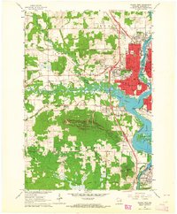
 1899 Wausau1956 Print · USGSMarathon County was a bustling timber and rail corridor at the turn of the century, anchored by the river power of Wausau and Merrill. Researchers can trace early logging lines like the Bull Dessert Logging R R and find vanished stops such as Dessert Junction and Nutterville.
 - 1902 Map of Wausau
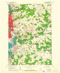
 1902 Wausau1902 Print · USGSWisconsin’s timber and rail heartland is meticulously documented at the turn of the century as Wausau and Merrill expand along the river. Genealogists can trace early homesteads and rail stops like Schofield, Granite Heights, and the grounds of the State Insane Asylum.2 unique versions available
 - 1953 Map of Wausau, 1955 Print
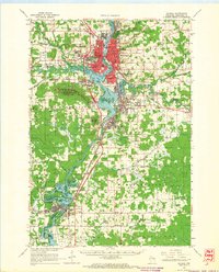
 1953 Wausau1955 Print · USGSThe Wisconsin River valley comes alive in the early 1950s, showing the paper-mill towns and rugged peaks of Marathon County. Trace the development of Wausau and Mosinee or locate rural landmarks like the Mosinee Lookout Tower and St Agnes Ch.
 - 1955 Map of Green Bay, 1968 Print
 1955 Green Bay1968 Print · USGSCentral and Eastern Wisconsin are captured here in the mid-fifties, showing the industrial growth of the Fox Valley and Wisconsin River corridors. Genealogists and historians can trace rail lines like the Green Bay and Western through settlements like Weyauwega, Clintonville, and Pulaski.2 unique versions available
 - 1963 Map of Wausau West, 1964 Print
 1963 Wausau West1964 Print · USGSWausau and the rugged Rib Mountain area are captured in the early sixties as the city expanded westward toward the township of Stettin. Local historians can trace the campuses of Newman High Sch and Mount View Sanatorium, or locate old rail lines of the Chicago and North Western.2 unique versions available
 - 1963 Map of Wausau East, 1964 Print
 1963 Wausau East1964 Print · USGSMarathon County is captured at a moment of mid-century growth as the urban center of Wausau extends south along the Wisconsin River. Genealogists and local historians can trace family locations near Schofield, the Pine Grove Cemetery, or schools like Everest Sch.2 unique versions available
 - 1963 Map of Wausau, 1965 Print
 1963 Wausau1965 Print · USGSMarathon County’s river valley is caught in a moment of mid-century growth, centered on the bustling Wisconsin River industrial corridor. Genealogists and local historians can trace family locations near landmarks like St Agnes Ch Cem, the Mount View Sanatorium, and the small settlement of Peplin.2 unique versions available
 - 1982 Map of Mosinee
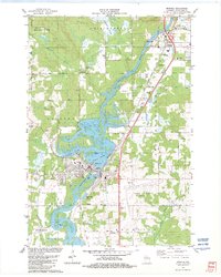 1982 Mosinee1982 Print · USGSCentral Wisconsin during the early eighties shows a landscape shaped by the Wisconsin River and growing aviation infrastructure. Genealogists and local historians can trace the foundations of Mosinee, identifying the Gate of Heaven Cem and the High Sch.
 - 1982 Map of Peplin
 1982 Peplin1982 Print · USGSThe rural landscape of Marathon County in the early eighties centers on the settlement of Peplin and its surrounding townships. Genealogists can locate St John the Baptist Ch, while others can trace industrial markers like the Benders Landing Strip and local Gravel Pits.
 - 1984 Map of Wausau, 1990 Print
 1984 Wausau1990 Print · USGSMarathon and Portage counties come into focus during the mid-eighties as industrial river towns and sprawling conservation areas define the Central Wisconsin landscape. Researchers can trace the rail corridors of the Soo Line or locate rural landmarks like Rib Mountain State Park and St Marys Cem.
 - 1993 Map of Wausau West
 1993 Wausau West1993 Print · USGSWausau and the surrounding townships of Maine and Stettin are shown here in the early nineties as the city expanded toward the Rib Mountain foothills. Researchers can trace local landmarks like Bethlehem Ch, the County Fairground, and the shoreline of Lake Wausau.
 - 1993 Map of Wausau East
 1993 Wausau East1993 Print · USGSMarathon County in the early nineties shows a thriving riverfront economy where the Wisconsin and Eau Claire rivers meet. Genealogists and historians can trace the development of Schofield, Rothschild, and Kelly alongside sites like Hebrew Cem and Everest High Sch.
 - 2022 Map of Peplin, 2022 Print
 2022 Peplin2022 Print · USGSMarathon County in the early 2020s shows the steady southern expansion of the Wausau area into the rural townships. Genealogists and local historians can trace the development of Kronenwetter and the small community of Peplin along the banks of Johnson Creek.
 - 2022 Map of Mosinee, 2022 Print
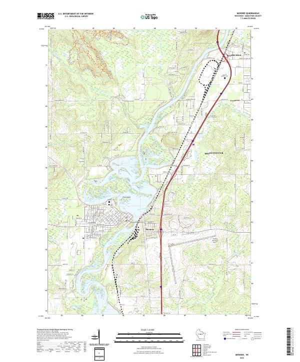 2022 Mosinee2022 Print · USGSThe Wisconsin River corridor in Marathon County reveals a landscape of industrial growth and riverine history in this 2020s survey. Researchers can trace the development of Mosinee and Rothschild or locate family sites at Saint Paul Cem and Gate of Heaven Cem.
 - 2022 Map of Wausau East, 2022 Print
 2022 Wausau East2022 Print · USGSThe Wausau urban corridor and the Wisconsin River valley are shown in comprehensive detail during the early 2020s. Researchers can locate the Marathon County Courthouse, trace the Eau Claire River, and find local burial sites like Saint Michael Cem.
 - 2022 Map of Wausau West, 2022 Print
 2022 Wausau West2022 Print · USGSMarathon County’s urban and natural landscapes meet along the Wisconsin River in this recent survey. Researchers can trace the development of the riverfront through Lake Wausau or locate institutional landmarks like Northcentral Technical College and the Wausau Downtown Airport.
End of results
Showing maps 1-16 of 16
Top cities near Rothschild
- Wausau historical maps
- Weston historical maps
- Kronenwetter historical maps
- Rib Mountain historical maps
- Mosinee historical maps
- Schofield historical maps
See more
Frequently asked questions
- What are the different types of historical maps available for Rothschild?
- What is the oldest map of Rothschild?
- Where can I purchase historical maps of Rothschild for my home or office?
- Where can I download high-res historical maps of Rothschild?
- Are there historical topographic maps available for Rothschild?
- Is there historical aerial imagery available for Rothschild?
- Where are historical maps of Rothschild sourced from?