2020s Maps of Beaver, Wisconsin
Explore 6 historic maps of Beaver from the 2020s. These maps offer a rare glimpse into what life looked like during the 2020s — showing old roads, neighborhoods, homes, and landmarks that have changed or disappeared over time.
Whether you're researching your family's past, planning a metal detecting trip, or studying how Beaver's landscape evolved across the 2020s, these high-resolution maps are a powerful tool for exploring the history of this region.
- Focus on a specific era: All maps on this page are from the 2020s, giving you a focused view of this time period.
- See what’s changed: Compare century-old streets, trails, and buildings to today's modern landscape using overlays and satellite layers.
- Research with precision: Use these maps for genealogy, historical research, land use analysis, or educational projects.
- View, download, or print: Maps are fully viewable online in high resolution, and can be downloaded or printed for your own records.
Start exploring Beaver's history through authentic maps from the 2020s. This is your window into the past.
Beaver, WI maps
(6)- 2022 Map of White Potato Lake, 2022 Print
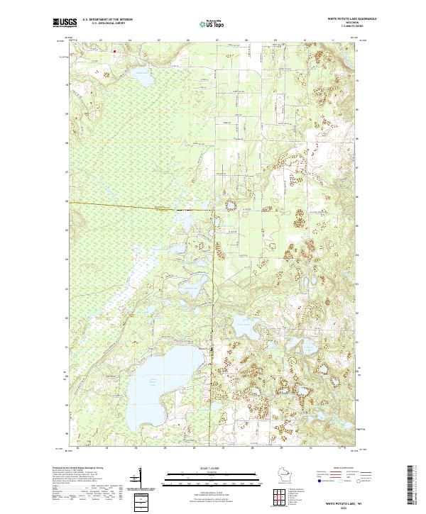 2022 White Potato Lake2022 Print · USGSMarinette and Oconto counties are shown in this modern survey, highlighting a landscape defined by the Peshtigo River and countless glacial lakes. Genealogists and historians can locate the Brazeau Cem and trace the shores of White Potato Lake and Ranch Lake.
 - 2022 Map of Loomis, 2022 Print
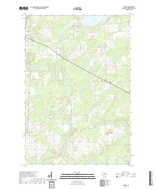 2022 Loomis2022 Print · USGSMarinette County comes into focus in this recent survey of the Northwoods, showcasing the riverside settlement and rural lakefront. Trace the winding Peshtigo River and locate properties near Crivitz, Loomis, and the shores of Lake Noquebay.
 - 2022 Map of Porterfield SW, 2022 Print
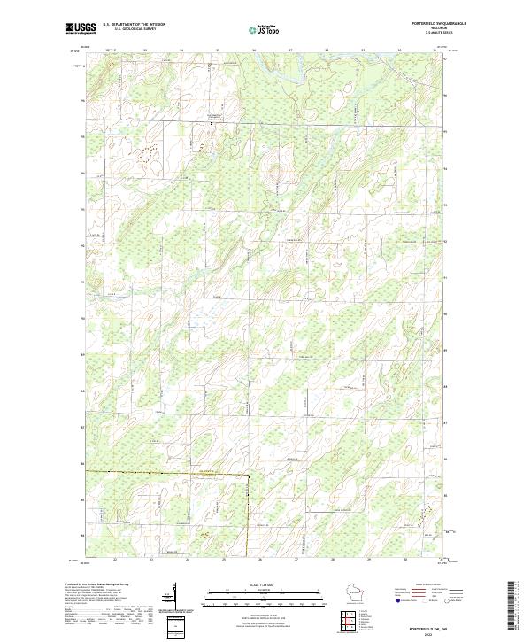 2022 Porterfield SW2022 Print · USGSNortheastern Wisconsin's river country is documented here as it appeared in the early 2020s, showing the intersection of Marinette and Oconto counties. Genealogists and local historians can trace family-named routes and landmarks like Saint Matthew's Evangelical Lutheran Cem, Town Hall, and the winding Little Peshtigo River.
 - 2022 Map of Crivitz, 2022 Print
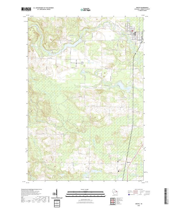 2022 Crivitz2022 Print · USGSMarinette County’s central lowlands are captured here in the early twenty-first century, centered on the settlement of Crivitz along the Peshtigo River. Local history researchers can trace five distinct burial grounds including Gissenaas Cem and the Saint Paul Burial Plot.
 - 2022 Map of Coleman, 2022 Print
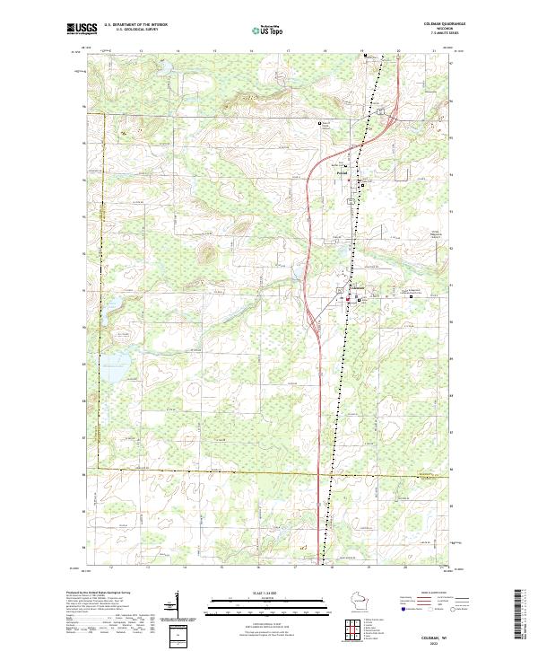 2022 Coleman2022 Print · USGSMarinette County's rural landscape is captured here in the early twenty-first century, centered on the villages of Pound and Coleman. Genealogists and historians can trace family ties at the Town of Pound Old Cem, Saint Johns Cem, and Beaver Cem.
 - 2023 Map of Kelly Lake, 2023 Print
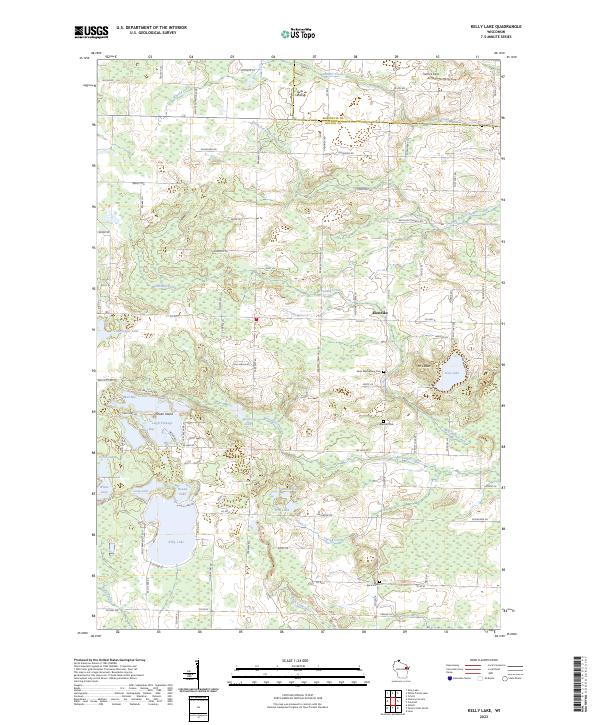 2023 Kelly Lake2023 Print · USGSOconto County, Wisconsin, is mapped here in the early 2020s, showing a landscape of glacial lakes and rural settlements. Researchers can pinpoint historic burial sites like Saint Wenceslaus Cem and Spruce Cem or trace the drainage of South Branch Beaver Creek through the community of Klondike.
End of results
Showing maps 1-6 of 6
Top cities near Beaver
- Stiles historical maps
- Crivitz historical maps
- Spruce historical maps
- Coleman historical maps
- Athelstane historical maps
- Wausaukee historical maps
See more
Frequently asked questions
- What are the different types of historical maps available for Beaver?
- What is the oldest map of Beaver?
- Where can I purchase historical maps of Beaver for my home or office?
- Where can I download high-res historical maps of Beaver?
- Are there historical topographic maps available for Beaver?
- Is there historical aerial imagery available for Beaver?
- Where are historical maps of Beaver sourced from?