Old Maps of Bay View, Milwaukee
Explore 31 old maps of Bay View, spanning from 1891 to today. These high-resolution historic maps reveal how streets, neighborhoods, landmarks, and natural features evolved over time — perfect for genealogy, metal detecting, research, and local history exploration.
What you can do with these maps:
- See how Bay View changed over time: Compare historical maps to modern-day views to trace roads, homesites, rail lines & more.
- View detailed metadata: Each map includes creators, publishers, year, scale, and archive source.
- Overlay maps with satellite & LiDAR: Visualize the past alongside modern tools to explore terrain & human change.
- Trusted historical sources: Maps sourced from the USGS, Library of Congress, and other archives.
- Access maps your way: View online, download high-res files, or order prints for personal or research use.
Start exploring old maps of Bay View to uncover forgotten places, hidden landmarks, and the deep history beneath your feet.
Bay View, Milwaukee maps
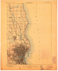
(31)- 1891 Map of Bayview
 1891 Bayview1891 Print · USGSSouthern Wisconsin at the close of the nineteenth century reveals a landscape of burgeoning rail corridors and quiet farming townships along the Lake Michigan shore. Genealogists and local historians can trace early settlements like Paynesville, Caledonia, and Franksville.2 unique versions available
 - 1892 Map of Milwaukee
 1892 Milwaukee1892 Print · USGSWisconsin’s industrial heartland is documented here during a period of rapid rail expansion and urban growth along the western shore of Lake Michigan. Genealogists and historians can trace the early rail junctions and settlements such as Schwartzburg Junction, Mequon Sta., and Thiensville.2 unique versions available
 - 1901 Map of Milwaukee
 1901 Milwaukee1901 Print · USGSThe Milwaukee lakefront and surrounding townships are shown here as a burgeoning industrial and rail corridor at the start of the 1900s. Trace early property and rail development at Whitefish Bay, Wauwatosa, and the defunct Dillman Sta. depot.
 - 1901 Map of Bayview
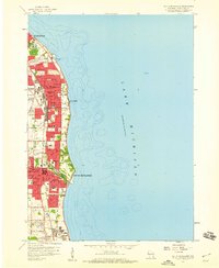
 1901 Bayview1901 Print · USGSThe Lake Michigan shoreline south of Milwaukee comes alive in the late Victorian era as industry and rail lines expand. Trace early coastal growth in Cudahy and South Milwaukee, or locate old interior settlements like New Coeln, Kilbournville, and Lamberton P.O..4 unique versions available
 - 1906 Map of Milwaukee
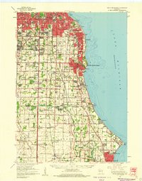
 1906 Milwaukee1906 Print · USGSThe Milwaukee lakefront and its surrounding townships show the height of early twentieth-century rail and river development. Researchers can trace ancestral property near National Home or locate vanished stops along the Lake Shore Line and Chicago Milwaukee and St Paul RR.4 unique versions available
 - 1954 Map of Milwaukee, 1967 Print
 1954 Milwaukee1967 Print · USGSCoastal life and maritime commerce across Lake Michigan are seen here during the mid-fifties, bridging Wisconsin's industrial hubs and Michigan's timberlands. Genealogists and historians can trace the rail lines of the Grand Trunk Western and find long-established ports like Ludington, Port Washington, and Muskegon.3 unique versions available
 - 1958 Map of Milwaukee
 1958 Milwaukee1958 Print · USGSThe shorelines of Lake Michigan in the late fifties reveal a landscape of bustling ferry ports and growing industrial suburbs. Genealogists and historians can trace rail networks like the Chesapeake & Ohio and locate landmarks such as Little Sable Point and Holy Cross Church.
 - 1958 Map of Milwaukee, 1960 Print
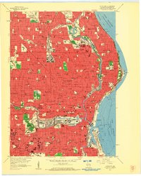 1958 Milwaukee1960 Print · USGSMid-century Milwaukee is a landscape of dense neighborhoods, massive rail yards, and industrial lakefronts during its peak urban era. Genealogists and historians can trace the city's growth through dozens of parochial schools like St Marys Sch and large burial grounds including Wanderers Rest Cemetery and Forest Home Cemetery.3 unique versions available
 - 1958 Map of Milwaukee, 1960 Print
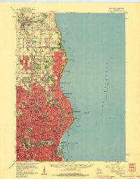 1958 Milwaukee1960 Print · USGSGreater Milwaukee and the Ozaukee County border appear here at the end of the fifties, when the city’s residential and academic core was firmly established. Genealogists can locate family-named institutions like St Rose Sch & Ch, trace the lakefront in Whitefish Bay, and find old rail lines such as the Chicago and North Western.3 unique versions available
 - 1958 Map of Greendale, 1960 Print
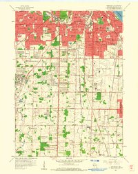 1958 Greendale1960 Print · USGSSouthern Milwaukee and its neighbors are seen here in the late fifties, as suburban expansion begins to surround major hubs. Genealogists can trace family plots across Forest Home Cemetery and St Adalberts Cemetery, or locate vanished landmarks like the County House of Correction.3 unique versions available
 - 1958 Map of South Milwaukee, 1960 Print
 1958 South Milwaukee1960 Print · USGSThe Milwaukee lakefront in the late fifties shows a dense corridor of industry and education stretching from St Francis down to Carrollville. Researchers can trace the development of numerous schools and churches, including St Pauls Sch, Holy Sepulchre Cemetery, and the lakefront Powerplant.4 unique versions available
 - 1958 Map of South Milwaukee, 1960 Print
 1958 South Milwaukee1960 Print · USGSCoastal Milwaukee County and northern Racine County show a landscape of rapid mid-century development and heavy industry along Lake Michigan. Researchers can trace the layout of family-named roads and rural schools like Caddy Vista Sch, alongside major landmarks like General Mitchell Field and Paynesville Chapel.2 unique versions available
 - 1958 Map of Racine, 1971 Print
 1958 Racine1971 Print · USGSThe Lake Michigan shoreline in the late fifties was a study in contrasts between the industrial bustle of Kenosha and the quiet woods of the Allegan State Forest. Genealogists and historians can trace the urban footprint of Evanston or locate strategic sites like Fort Sheridan and the Wind Point Light.3 unique versions available
 - 1962 Map of Racine
 1962 Racine1962 Print · USGSThe Lake Michigan shoreline in the early sixties reveals a fascinating contrast between the dense industrial rail hubs of RACINE and CHICAGO and the forested dunes of Michigan. Local historians can trace military installations like Fort Sheridan or explore the numerous inland retreats around Paw Paw Lake and Sister Lakes.
 - 1980 Map of Milwaukee, 1981 Print
 1980 Milwaukee1981 Print · USGSThe Lake Michigan shoreline and Milwaukee's urban sprawl are captured here at the start of the 1980s. Local researchers can trace family landmarks like Graceland Cemetery, educational sites like Milwaukee-Downer College, and the northern rail lines of the Chicago and North Western.
 - 1980 Map of Racine, 1981 Print
 1980 Racine1981 Print · USGSThe Lake Michigan shoreline at the start of the 1980s reveals a bustling industrial corridor from Milwaukee to Kenosha. Genealogists and local historians can trace family roots through numerous sites like Forest Home Cem or locate former rail stops along the C & N W and C M St P & P lines.
 - 2010 Map of Milwaukee, 2010 Print
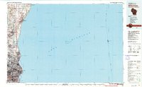
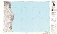
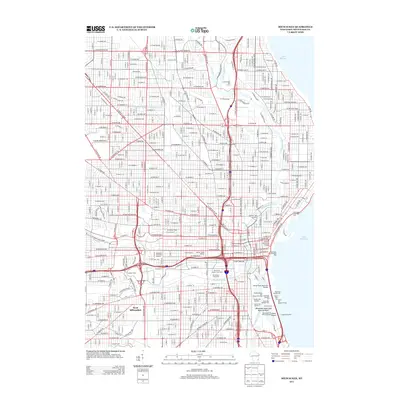
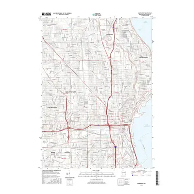
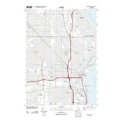 2010 Milwaukee2010 Print · USGSCovers Bay View, including Milwaukee, West Allis, and other nearby areas
 - 2010 Map of Greendale, 2010 Print
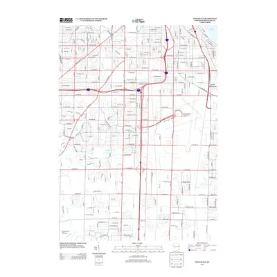
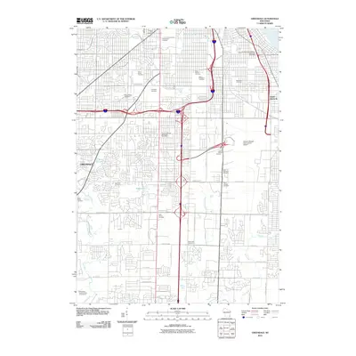 2010 Greendale2010 Print · USGSCovers Bay View, including Milwaukee, West Allis, and other nearby areas
 - 2010 Map of South Milwaukee, 2010 Print
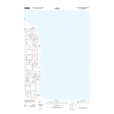
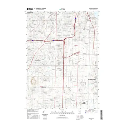
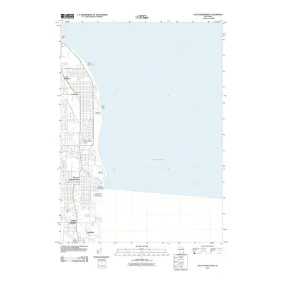 2010 South Milwaukee2010 Print · USGSCovers Bay View, including Milwaukee, Oak Creek, and other nearby areas
 - 2013 Map of South Milwaukee, 2013 Print
 2013 South Milwaukee2013 Print · USGSCovers Bay View, including Milwaukee, Oak Creek, and other nearby areas
 - 2013 Map of Milwaukee, 2013 Print
 2013 Milwaukee2013 Print · USGSCovers Bay View, including Milwaukee, West Allis, and other nearby areas
 - 2013 Map of Greendale, 2013 Print
 2013 Greendale2013 Print · USGSCovers Bay View, including Milwaukee, West Allis, and other nearby areas
 - 2016 Map of Greendale, 2016 Print
 2016 Greendale2016 Print · USGSCovers Bay View, including Milwaukee, West Allis, and other nearby areas
 - 2016 Map of South Milwaukee, 2016 Print
 2016 South Milwaukee2016 Print · USGSCovers Bay View, including Milwaukee, Oak Creek, and other nearby areas
 - 2016 Map of Milwaukee, 2016 Print
 2016 Milwaukee2016 Print · USGSCovers Bay View, including Milwaukee, West Allis, and other nearby areas
Showing maps 1-25 of 31
Frequently asked questions
- What are the different types of historical maps available for Bay View?
- What is the oldest map of Bay View?
- Where can I purchase historical maps of Bay View for my home or office?
- Where can I download high-res historical maps of Bay View?
- Are there historical topographic maps available for Bay View?
- Is there historical aerial imagery available for Bay View?
- Where are historical maps of Bay View sourced from?