Old Maps of Oneida County, Wisconsin
Explore 86 old maps of Oneida County, spanning from 1928 to today. These high-resolution historic maps reveal how streets, neighborhoods, landmarks, and natural features evolved over time — perfect for genealogy, metal detecting, research, and local history exploration.
What you can do with these maps:
- See how Oneida County changed over time: Compare historical maps to modern-day views to trace roads, homesites, rail lines & more.
- View detailed metadata: Each map includes creators, publishers, year, scale, and archive source.
- Overlay maps with satellite & LiDAR: Visualize the past alongside modern tools to explore terrain & human change.
- Trusted historical sources: Maps sourced from the USGS, Library of Congress, and other archives.
- Access maps your way: View online, download high-res files, or order prints for personal or research use.
Start exploring old maps of Oneida County to uncover forgotten places, hidden landmarks, and the deep history beneath your feet.
Oneida County, WI maps
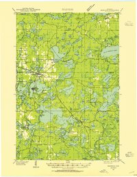
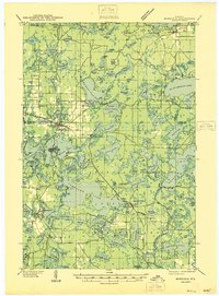
(86)- 1928 Map of Three Lakes
 1928 Three Lakes1928 Print · USGSCovers Oneida County, including Three Lakes, Sugar Camp, and other nearby areas
 - 1930 Map of Robbins
 1930 Robbins1930 Print · USGSCovers Oneida County, including Newbold, Sugar Camp, and other nearby areas2 unique versions available
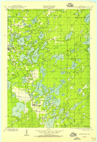
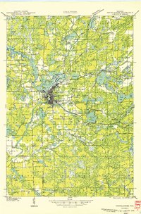
 - 1938 Map of Minocqua, 1955 Print
 1938 Minocqua1955 Print · USGSCovers Oneida County, including Minocqua, Newbold, and other nearby areas2 unique versions available
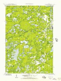
 - 1938 Map of Three Lakes, 1956 Print
 1938 Three Lakes1956 Print · USGSCovers Oneida County, including Three Lakes, Sugar Camp, and other nearby areas2 unique versions available
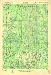
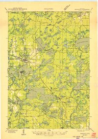
 - 1938 Map of Robbins, 1957 Print
 1938 Robbins1957 Print · USGSCovers Oneida County, including Newbold, Sugar Camp, and other nearby areas2 unique versions available
 - 1938 Map of Lac Du Flambeau, 1959 Print
 1938 Lac Du Flambeau1959 Print · USGSCovers Oneida County, including Minocqua, Lac du Flambeau, and other nearby areas2 unique versions available
 - 1939 Map of Lac Du Flambeau
 1939 Lac Du Flambeau1939 Print · USGSCovers Oneida County, including Minocqua, Lac du Flambeau, and other nearby areas
 - 1939 Map of Mc Cord
 1939 Mc Cord1939 Print · USGSCovers Oneida County, including Minocqua, Bradley, and other nearby areas3 unique versions available
 - 1939 Map of Cassian, 1946 Print
 1939 Cassian1946 Print · USGSCovers Oneida County, including Rhinelander, Newbold, and other nearby areas4 unique versions available
 - 1940 Map of Parrish
 1940 Parrish1940 Print · USGSCovers Oneida County, including Elcho, Harrison, and other nearby areas
 - 1940 Map of Monico, 1955 Print
 1940 Monico1955 Print · USGSCovers Oneida County, including Three Lakes, Sugar Camp, and other nearby areas
 - 1940 Map of Rhinelander, 1961 Print
 1940 Rhinelander1961 Print · USGSCovers Oneida County, including Rhinelander, Newbold, and other nearby areas
 - 1941 Map of Pike Lake, 1952 Print
 1941 Pike Lake1952 Print · USGSCovers Oneida County, including Minocqua, Lac du Flambeau, and other nearby areas3 unique versions available
 - 1941 Map of Brantwood, 1971 Print
 1941 Brantwood1971 Print · USGSCovers Oneida County, including Minocqua, Worcester, and other nearby areas
 - 1942 Map of Pike Lake
 1942 Pike Lake1942 Print · USGSCovers Oneida County, including Minocqua, Lac du Flambeau, and other nearby areas
 - 1942 Map of Cassian
 1942 Cassian1942 Print · USGSCovers Oneida County, including Rhinelander, Newbold, and other nearby areas
 - 1942 Map of Elcho
 1942 Elcho1942 Print · USGSCovers Oneida County, including Elcho, Nashville, and other nearby areas
 - 1943 Map of Brantwood
 1943 Brantwood1943 Print · USGSCovers Oneida County, including Minocqua, Worcester, and other nearby areas2 unique versions available
 - 1945 Map of Three Lakes, 1946 Print
 1945 Three Lakes1946 Print · USGSCovers Oneida County, including Three Lakes, Sugar Camp, and other nearby areas3 unique versions available
 - 1945 Map of Robbins, 1946 Print
 1945 Robbins1946 Print · USGSCovers Oneida County, including Newbold, Sugar Camp, and other nearby areas
 - 1946 Map of Minocqua
 1946 Minocqua1946 Print · USGSCovers Oneida County, including Minocqua, Newbold, and other nearby areas
 - 1946 Map of Lac Du Flambeau
 1946 Lac Du Flambeau1946 Print · USGSCovers Oneida County, including Minocqua, Lac du Flambeau, and other nearby areas
 - 1947 Map of Mc Cord
 1947 Mc Cord1947 Print · USGSCovers Oneida County, including Minocqua, Bradley, and other nearby areas
 - 1949 Map of Rhinelander
 1949 Rhinelander1949 Print · USGSCovers Oneida County, including Rhinelander, Newbold, and other nearby areas
 - 1949 Map of Minocqua
 1949 Minocqua1949 Print · USGSCovers Oneida County, including Minocqua, Newbold, and other nearby areas
Showing maps 1-25 of 86
Top cities of Oneida County
- Rhinelander historical maps
- Minocqua historical maps
- Newbold historical maps
- Three Lakes historical maps
- Sugar Camp historical maps
- Hazelhurst historical maps
See more
Frequently asked questions
- What are the different types of historical maps available for Oneida County?
- What is the oldest map of Oneida County?
- Where can I purchase historical maps of Oneida County for my home or office?
- Where can I download high-res historical maps of Oneida County?
- Are there historical topographic maps available for Oneida County?
- Is there historical aerial imagery available for Oneida County?
- Where are historical maps of Oneida County sourced from?