Old Maps of Saukville, Wisconsin for Genealogy
Trace your family roots with 36 historic maps of Saukville. These high-res maps reveal old neighborhoods, homesites, landmarks, and streets — helping you uncover where your ancestors lived and how the area evolved over time.
- Explore historic neighborhoods: Identify where your relatives may have lived in the 1800s or 1900s.
- Compare maps over time: Trace the changes in streets, buildings, and landmarks for multi-generational research.
- Perfect for genealogy & ancestry research: Used by family historians and researchers to map out lineage and migration.
These maps are an incredible resource for exploring your personal connection to Saukville's past.
Saukville, WI maps
(36)- 1892 Map of Port Washington
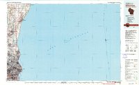
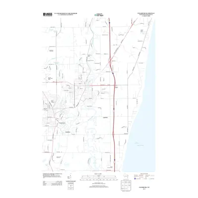
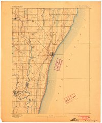 1892 Port Washington1892 Print · USGSOzaukee County’s lakefront and river valleys are captured here during the 1890s as the railroad era transformed the Wisconsin coast. Researchers can trace historic property locations and vanished stops like Ulao Station, Deekers, and Hamilton along the banks of the Milwaukee River.
 - 1904 Map of West Bend
 1904 West Bend1904 Print · USGSWashington County at the turn of the century was a landscape of thriving river towns and vital rail corridors. Genealogists and local historians can trace the early footprints of West Bend and Barton, or locate smaller rural junctions like Kirchhayn and Rockfield.3 unique versions available
 - 1904 Map of Port Washington
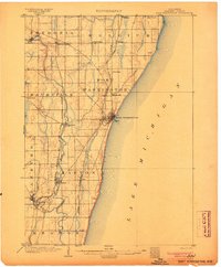 1904 Port Washington1904 Print · USGSOzaukee County’s lakefront and river valleys are captured here at the dawn of the twentieth century, showing a bustling landscape of rail-connected towns. Researchers can trace family roots in early settlements like Holy Cross, Belgium, and Ulao, or locate the specific rail depots and harbor works at Port Washington.2 unique versions available
 - 1954 Map of Milwaukee, 1967 Print
 1954 Milwaukee1967 Print · USGSCoastal life and maritime commerce across Lake Michigan are seen here during the mid-fifties, bridging Wisconsin's industrial hubs and Michigan's timberlands. Genealogists and historians can trace the rail lines of the Grand Trunk Western and find long-established ports like Ludington, Port Washington, and Muskegon.3 unique versions available
 - 1957 Map of Madison, 1967 Print
 1957 Madison1967 Print · USGSSouth-central Wisconsin in the mid-fifties reveals a landscape of industrial hubs and glacial lakes linked by a dense rail and highway network. Genealogists and historians can trace the development of lakeside communities and find notable sites like Badger Ordnance Works and the Horicon National Wildlife Refuge.3 unique versions available
 - 1958 Map of Milwaukee
 1958 Milwaukee1958 Print · USGSThe shorelines of Lake Michigan in the late fifties reveal a landscape of bustling ferry ports and growing industrial suburbs. Genealogists and historians can trace rail networks like the Chesapeake & Ohio and locate landmarks such as Little Sable Point and Holy Cross Church.
 - 1959 Map of Port Washington West, 1960 Print
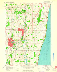
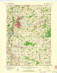
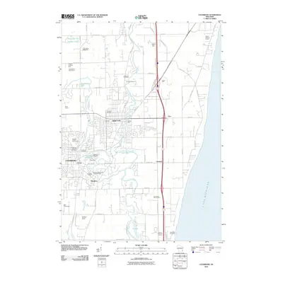
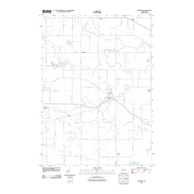
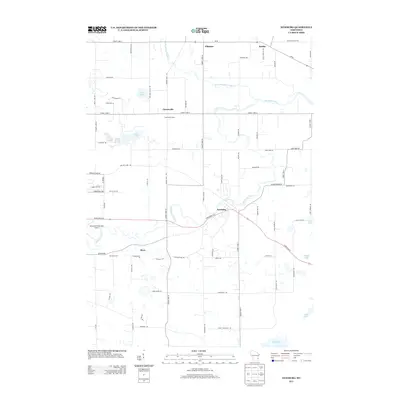
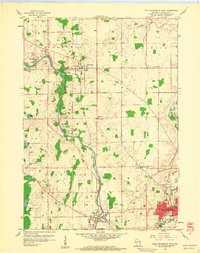 1959 Port Washington West1960 Print · USGSOzaukee County in the late fifties reveals a landscape of river-bend hamlets and busy rail corridors before the height of modern suburbanization. Trace local family roots at Holden Cem, locate the old Grandview Sch, or study the industrial footprint of Saukville and Fredonia.3 unique versions available
 - 1959 Map of Cedarburg, 1960 Print
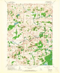
 1959 Cedarburg1960 Print · USGSOzaukee County during the late fifties shows a landscape of growing river towns and lakeside bluffs as the Milwaukee suburbs expanded. Genealogists can trace family names through numerous sites like Old Settlers Rest Cem, Hacker Sch, and Hamilton.4 unique versions available
 - 1959 Map of West Bend, 1960 Print
 1959 West Bend1960 Print · USGSWashington and Ozaukee counties are shown here in the late fifties, as the Milwaukee River corridor supported both industry and recreation. Trace local history through family-named landmarks like Last Home Cem and rail hubs at Rugby Junction.
 - 1959 Map of Port Washington, 1960 Print
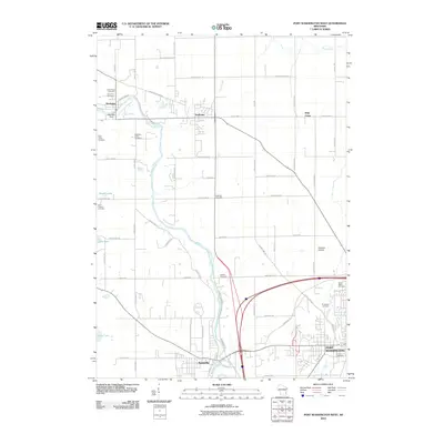
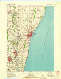 1959 Port Washington1960 Print · USGSOzaukee County’s shoreline and river valleys are captured here in the late fifties, showing the area just as suburban expansion began to reach northward from Milwaukee. Genealogists can trace family names through landmarks like Waubeka Union Cem, the Lighthouse at the harbor, and rural schools such as McKinley Sch.
 - 1959 Map of Newburg, 1964 Print
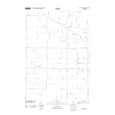
 1959 Newburg1964 Print · USGSThe river valleys of Washington and Ozaukee counties are captured here in the late fifties, showing a rural landscape defined by parish life and the Milwaukee River. Genealogists can trace family roots through sites like St Finbars Ch, Myra, and the extensive Cedarburg Bog.4 unique versions available
 - 1959 Map of Five Corners, 1964 Print
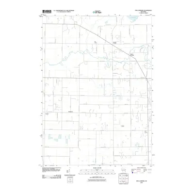
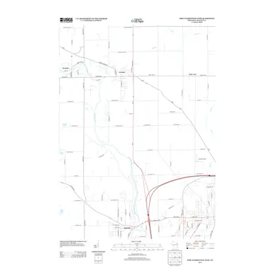
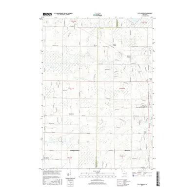
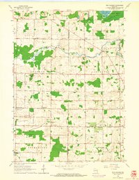 1959 Five Corners1964 Print · USGSOzaukee and Washington Counties are captured in the late fifties as a network of rural farming townships and crossroads communities. Genealogists can trace family footprints near Kirchhayn, Decker Corner, and country schools like South Center Sch or Trinity Sch.4 unique versions available
 - 1960 Map of Madison
 1960 Madison1960 Print · USGSCentral and Southern Wisconsin are captured in the late fifties, showing the region as its rail-and-river network matured. Trace the paths of the Soo Line RR or locate family roots near Lake Mendota and Horicon National Wildlife Refuge.2 unique versions available
 - 1980 Map of Milwaukee, 1981 Print
 1980 Milwaukee1981 Print · USGSThe Lake Michigan shoreline and Milwaukee's urban sprawl are captured here at the start of the 1980s. Local researchers can trace family landmarks like Graceland Cemetery, educational sites like Milwaukee-Downer College, and the northern rail lines of the Chicago and North Western.
 - 1984 Map of Oconomowoc, 1985 Print
 1984 Oconomowoc1985 Print · USGSSoutheast Wisconsin in the mid-eighties shows a landscape defined by its glacial heritage and expanding metropolitan corridors. Genealogists and historians can trace the development of lakeside communities like Oconomowoc and Pewaukee, or find established settlements such as Watertown and Beaver Dam.
 - 1991 Map of Oconomowoc
 1991 Oconomowoc1991 Print · USGSSoutheastern Wisconsin in the early nineties shows a landscape of glacial lakes and growing suburbs. Trace local history through Aztalan State Park, Carroll College, and the sprawling Horicon Marsh State Wildlife Area.
 - 2010 Map of Cedarburg, 2010 Print
 2010 Cedarburg2010 Print · USGSCovers Saukville, including Mequon, Grafton, and other nearby areas
 - 2010 Map of Port Washington West, 2010 Print
 2010 Port Washington West2010 Print · USGSCovers Saukville, including Port Washington, Fredonia, and other nearby areas
 - 2010 Map of Five Corners, 2010 Print
 2010 Five Corners2010 Print · USGSCovers Saukville, including Mequon, Germantown, and other nearby areas
 - 2010 Map of Newburg, 2010 Print
 2010 Newburg2010 Print · USGSCovers Saukville, including West Bend, Newburg, and other nearby areas
 - 2013 Map of Five Corners, 2013 Print
 2013 Five Corners2013 Print · USGSCovers Saukville, including Mequon, Germantown, and other nearby areas
 - 2013 Map of Newburg, 2013 Print
 2013 Newburg2013 Print · USGSCovers Saukville, including West Bend, Newburg, and other nearby areas
 - 2013 Map of Port Washington West, 2013 Print
 2013 Port Washington West2013 Print · USGSCovers Saukville, including Port Washington, Fredonia, and other nearby areas
 - 2013 Map of Cedarburg, 2013 Print
 2013 Cedarburg2013 Print · USGSCovers Saukville, including Mequon, Grafton, and other nearby areas
 - 2015 Map of Five Corners, 2015 Print
 2015 Five Corners2015 Print · USGSCovers Saukville, including Mequon, Germantown, and other nearby areas
Showing maps 1-25 of 36
Top cities near Saukville
- Milwaukee historical maps
- Menomonee Falls historical maps
- West Bend historical maps
- Mequon historical maps
- Germantown historical maps
- Brown Deer historical maps
See more
Frequently asked questions
- What are the different types of historical maps available for Saukville?
- What is the oldest map of Saukville?
- Where can I purchase historical maps of Saukville for my home or office?
- Where can I download high-res historical maps of Saukville?
- Are there historical topographic maps available for Saukville?
- Is there historical aerial imagery available for Saukville?
- Where are historical maps of Saukville sourced from?