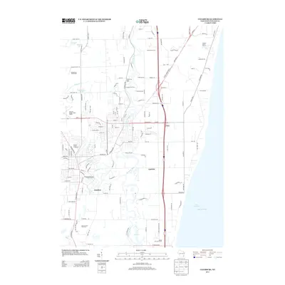
2013 Map of Cedarburg
USGS Topo · Published 2013About this map
The Milwaukee River and its tributary Cedar Cr anchor this portion of Ozaukee County, shaping the development of settlements like Hamilton and Lakefield. The landscape reflects a transition from traditional agricultural legacies, such as the Oakland Stock Farm and Evergreen Stock Farm, to modern recreational and civic uses. Along the coastline of Lake Michigan, the small community of Ulao sits near the bluff's edge, while further inland, the Ozaukee County Fairgrounds serves as a regional landmark. Aviation history is particularly well-represented across this terrain, with several private airfields including the Ashenfelter Aerodrome, SSS Aerodrome, and the Flying S Ranch Airport. This distribution of small-scale airstrips and established farmsteads illustrates the suburban-rural character of the area during the early 21st century, where large estates and residential developments like Stonecroft Dr began to intermingle with historic agricultural properties.
Find a feature on this map
123 named features on this map. Tap any name to fly to it.
Don’t see what you’re looking for? This feature index may not catch every label — zoom into the map to look around manually.
Map Details
Editions of this 2013 Cedarburg Map
This is the sole edition of this map. No revisions or reprints were ever made.
Other maps of this area

1892 · Milwaukee
USGS Topo · 1:62,500

1892 · Waukesha
USGS Topo · 1:62,500

1892 · Port Washington
USGS Topo · 1:62,500

1901 · Milwaukee
USGS Topo · 1:62,500

1901 · Waukesha
USGS Topo · 1:62,500

1904 · West Bend
USGS Topo · 1:62,500

1904 · Port Washington
USGS Topo · 1:62,500

1906 · Waukesha
USGS Topo · 1:62,500

1906 · Milwaukee
USGS Topo · 1:62,500

1954 · Milwaukee
USGS Topo · 1:250,000