2000s (21st Century) Maps of Eisenstein, Wisconsin
Explore 22 historic maps of Eisenstein from the 2000s (21st Century). These maps offer a rare glimpse into what life looked like during the 2000s — showing old roads, neighborhoods, homes, and landmarks that have changed or disappeared over time.
Whether you're researching your family's past, planning a metal detecting trip, or studying how Eisenstein's landscape evolved across the 2000s, these high-resolution maps are a powerful tool for exploring the history of this region.
- Focus on a specific era: All maps on this page are from the 2000s, giving you a focused view of this time period.
- See what’s changed: Compare century-old streets, trails, and buildings to today's modern landscape using overlays and satellite layers.
- Research with precision: Use these maps for genealogy, historical research, land use analysis, or educational projects.
- View, download, or print: Maps are fully viewable online in high resolution, and can be downloaded or printed for your own records.
Start exploring Eisenstein's history through authentic maps from the 2000s. This is your window into the past.
Eisenstein, WI maps
(22)- 2005 Map of Blockhouse Lake, 2006 Print
 2005 Blockhouse Lake2006 Print · USGSWisconsin's Northwoods are captured here at the turn of the millennium, showing a landscape defined by managed wilderness and river drainage. You can trace the South Fork Flambeau River through its many rapids or locate quiet landings at Blockhouse Lake and Wintergreen Lake.
 - 2005 Map of Pike Lake NW, 2006 Print
 2005 Pike Lake NW2006 Print · USGSThe Northwoods of Price and Iron Counties are captured here in the early 2000s, showcasing a landscape of timber-era springs and river rapids. Trace local history at the Riley Creek Forest Work Camp or locate secluded landmarks like Newman Springs and Smith Rapids.
 - 2010 Map of Park Falls, 2010 Print
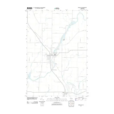 2010 Park Falls2010 Print · USGSCovers Eisenstein, including Park Falls, Fifield, and other nearby areas
 - 2010 Map of Butternut Lake, 2010 Print
 2010 Butternut Lake2010 Print · USGSCovers Eisenstein, including Chippewa, Lake, and other nearby areas
 - 2011 Map of Pike Lake NW, 2011 Print
 2011 Pike Lake NW2011 Print · USGSCovers Eisenstein, including Fifield, Sherman, and other nearby areas
 - 2011 Map of Blockhouse Lake, 2011 Print
 2011 Blockhouse Lake2011 Print · USGSCovers Eisenstein, including Fifield, Agenda, and other nearby areas
 - 2013 Map of Blockhouse Lake, 2013 Print
 2013 Blockhouse Lake2013 Print · USGSCovers Eisenstein, including Fifield, Agenda, and other nearby areas
 - 2013 Map of Butternut Lake, 2013 Print
 2013 Butternut Lake2013 Print · USGSCovers Eisenstein, including Chippewa, Lake, and other nearby areas
 - 2013 Map of Pike Lake NW, 2013 Print
 2013 Pike Lake NW2013 Print · USGSCovers Eisenstein, including Fifield, Sherman, and other nearby areas
 - 2013 Map of Park Falls, 2013 Print
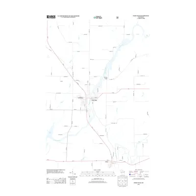 2013 Park Falls2013 Print · USGSCovers Eisenstein, including Park Falls, Fifield, and other nearby areas
 - 2015 Map of Blockhouse Lake, 2015 Print
 2015 Blockhouse Lake2015 Print · USGSCovers Eisenstein, including Fifield, Agenda, and other nearby areas
 - 2015 Map of Park Falls, 2015 Print
 2015 Park Falls2015 Print · USGSCovers Eisenstein, including Park Falls, Fifield, and other nearby areas
 - 2015 Map of Pike Lake NW, 2015 Print
 2015 Pike Lake NW2015 Print · USGSCovers Eisenstein, including Fifield, Sherman, and other nearby areas
 - 2015 Map of Butternut Lake, 2015 Print
 2015 Butternut Lake2015 Print · USGSCovers Eisenstein, including Chippewa, Lake, and other nearby areas
 - 2018 Map of Pike Lake NW, 2018 Print
 2018 Pike Lake NW2018 Print · USGSCovers Eisenstein, including Fifield, Sherman, and other nearby areas
 - 2018 Map of Park Falls, 2018 Print
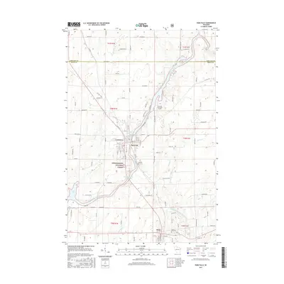
 2018 Park Falls2018 Print · USGSCovers Eisenstein, including Park Falls, Fifield, and other nearby areas
 - 2018 Map of Blockhouse Lake, 2018 Print
 2018 Blockhouse Lake2018 Print · USGSCovers Eisenstein, including Fifield, Agenda, and other nearby areas
 - 2018 Map of Butternut Lake, 2018 Print
 2018 Butternut Lake2018 Print · USGSCovers Eisenstein, including Chippewa, Lake, and other nearby areas
 - 2022 Map of Pike Lake NW, 2022 Print
 2022 Pike Lake NW2022 Print · USGSPrice County, Wisconsin, is shown here as a dense forest and lake district within the Chequamegon National Forest. Researchers can trace the complex network of backcountry trails and river features including the South Fork Flambeau River, Smith Rapids, and the Springstead Airport.
 - 2022 Map of Blockhouse Lake, 2022 Print
 2022 Blockhouse Lake2022 Print · USGSThe Northwoods of Price and Ashland counties are shown here in the early 2020s, centered on the Chequamegon National Forest. Researchers can trace the winding South Fork Flambeau River past Forest Rapids and find quiet retreats at Blockhouse Lake and Iodine Lake.
 - 2022 Map of Butternut Lake, 2022 Print
 2022 Butternut Lake2022 Print · USGSIn the lakes region of northern Wisconsin, this contemporary survey captures a landscape of dense wetlands and deep-water retreats. Researchers can trace the path of the Tuscobia State Trail as it winds past Butternut Lake and the Mill Pond.
 - 2022 Map of Park Falls, 2022 Print
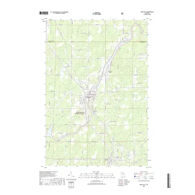
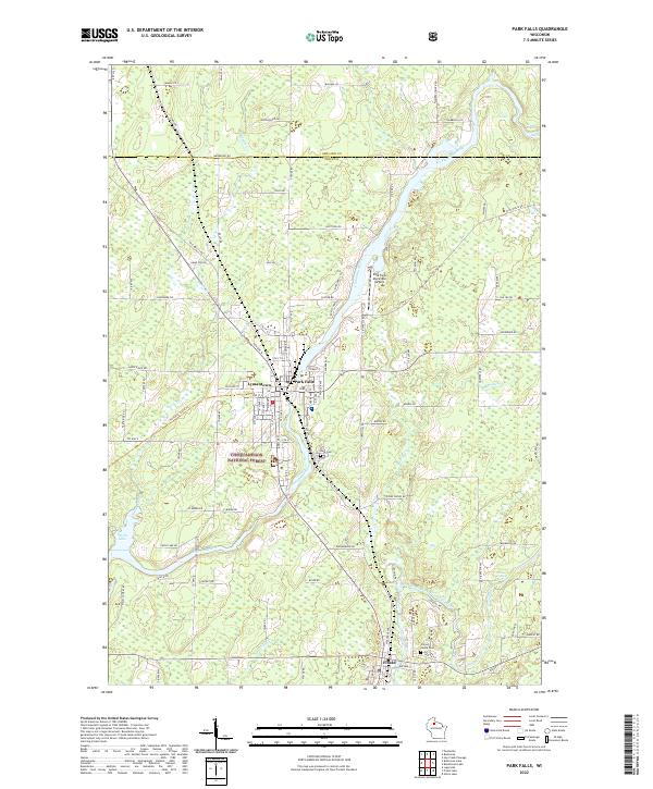 2022 Park Falls2022 Print · USGSPrice County timber and river history come alive in this survey of the Northwoods during the early twenty-first century. Researchers can trace the layout of Park Falls, find family plots in Nola Cem, and follow the Flambeau River past Divine Rapids.
End of results
Showing maps 1-22 of 22
Top cities near Eisenstein
Frequently asked questions
- What are the different types of historical maps available for Eisenstein?
- What is the oldest map of Eisenstein?
- Where can I purchase historical maps of Eisenstein for my home or office?
- Where can I download high-res historical maps of Eisenstein?
- Are there historical topographic maps available for Eisenstein?
- Is there historical aerial imagery available for Eisenstein?
- Where are historical maps of Eisenstein sourced from?