Old Maps of Sawyer County, Wisconsin for Hiking & Exploration
Hike through history with 120 historic maps of Sawyer County. Explore old trails, ghost towns, and forgotten backroads — perfect for outdoor adventurers and local explorers.
- Rediscover forgotten places: Map out old mining camps, roads, and footpaths that no longer exist on modern maps.
- Layer with modern tools: Combine with LiDAR or satellite views to plan hikes through historical terrain.
- Made for exploration: Popular among hikers, overlanders, and local history lovers.
Use these maps to find adventure and explore the hidden past of Sawyer County.
Sawyer County, WI maps
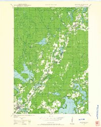
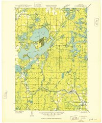
(120)- 1941 Map of Kennan, 1952 Print
 1941 Kennan1952 Print · USGSIn the early 1940s, the rail-and-river corridor of Price and Rusk Counties supported a network of small timber and farm towns. Researchers can trace family-named landmarks and rural education hubs like Martins Hill Sch, the Harmony church, and the Soo Line railroad.2 unique versions available
 - 1941 Map of Kennedy, 1959 Print
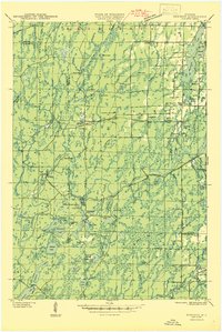
 1941 Kennedy1959 Print · USGSIn the early 1940s, this portion of Price and Sawyer counties was a landscape of timber management and rail-side settlements. Genealogists can locate rural schoolhouses like Poplar Hill Sch and trace industrial sites such as Pixley Dam or the Old Mill Dam.2 unique versions available
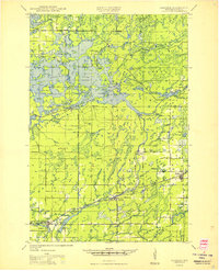
 - 1942 Map of Clam Lake, 1959 Print
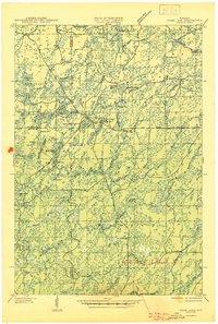
 1942 Clam Lake1959 Print · USGSNorthern Wisconsin's deep woods are captured here during the early 1940s, showing the early infrastructure of the Chequamegon National Forest. Researchers can locate the Clam Lake CCC Camp, the NYA Camp, and the Clam Lake Fire Tower among dozens of named lakes and streams.2 unique versions available
 - 1943 Map of Namekagon Lake, 1960 Print
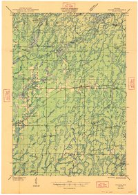
 1943 Namekagon Lake1960 Print · USGSUpper Wisconsin’s lake country is captured here during the mid-1940s, showing a landscape of glacial waters and early forest infrastructure. Researchers can locate remote schools and camps like Spider Lake Sch and the Sawyer CCC Camp or trace the early shoreline of Lost Land Lake.2 unique versions available
 - 1944 Map of Exeland, 1952 Print
 1944 Exeland1952 Print · USGSNorthern Wisconsin's river country is captured in the mid-1940s as rural life centered on local schools and the rail line. Genealogists can trace family footprints near Exeland or at one of many country schoolhouses like Murry Sch and Laurel Hill Sch.2 unique versions available
 - 1944 Map of Draper, 1952 Print
 1944 Draper1952 Print · USGSLogging and rail transport dominated the Sawyer County timberlands during the mid-forties. Genealogists and historians can locate former homesteads and work sites like Old Le May Camp, Loretta Cem, and the Barber Lake Sch.2 unique versions available
 - 1944 Map of Couderay, 1956 Print
 1944 Couderay1956 Print · USGSSawyer County’s lake country is captured here during the 1940s, showing the intersection of tribal lands and rail-driven settlements. Genealogists and historians can trace old homesteads near Reserve, the village of Couderay, and rural schools like Boylan Sch.2 unique versions available
 - 1944 Map of Radisson, 1957 Print
 1944 Radisson1957 Print · USGSSawyer County in the mid-1940s shows a landscape of timber and rail along the Chippewa River. Local historians can trace the Chicago and North Western Railway through Radisson or locate rural landmarks like Hunter Sch and New Post.2 unique versions available
 - 1944 Map of Hayward, 1965 Print
 1944 Hayward1965 Print · USGSHayward and the northern Wisconsin lake country are captured here at the close of the Second World War. Researchers can trace the Chicago St Paul Minneapolis and Omaha rail line to find vanished schoolhouses like Sabin Sch and the Indian Sch.
 - 1945 Map of Kennedy
 1945 Kennedy1945 Print · USGSThe Wisconsin Northwoods come alive in the 1940s, showing a landscape of timber, rail, and remote settlements. Genealogists and local historians can trace rural schoolhouses like Arnold Sch and family landmarks near Lugerville and Kaiser.2 unique versions available
 - 1945 Map of Namekagon Lake
 1945 Namekagon Lake1945 Print · USGSThe National Forest of northern Wisconsin is shown here in the mid-1940s as a landscape of timber trails and remote camps. Researchers can locate the Sawyer CCC Camp, the Lost Land Lake Club, and local landmarks like the West Fork Fire Tower.2 unique versions available
 - 1945 Map of Clam Lake
 1945 Clam Lake1945 Print · USGSThe Northwoods of Ashland and Bayfield Counties are captured here in the mid-1940s, centered on the Clam Lake community. Genealogists and historians can locate federal project sites like the Clam Lake CCC Camp and NYA Camp alongside the Clam Lake Fire Tower.2 unique versions available
 - 1945 Map of Kennan
 1945 Kennan1945 Print · USGSPrice and Rusk counties appear here in the mid-1940s, showing the Northwoods at the height of its rail-and-timber era. Genealogists and local historians can trace family locations near village centers like Kennan and Hawkins or find rural landmarks like Forest Vale Sch and Kraft Camp.
 - 1945 Map of Meteor, 1961 Print
 1945 Meteor1961 Print · USGSNorthern Wisconsin's timber and lake country is captured here just after the war, showing the area as small settlements like Edgewater and Meteor grew. You can trace the Old RR Grade and find historic rural schools like Glendale Sch and Frontier Sch.2 unique versions available
 - 1945 Map of Ingram, 1967 Print
 1945 Ingram1967 Print · USGSThe Flambeau River basin comes into sharp focus in the mid-1940s, revealing a landscape of remote camps and early state forestry. Researchers can trace the rail corridor through Ingram or locate vanished sites like the CCC Rusk Camp (Abandoned) and Pioneer Sch.
 - 1947 Map of Exeland
 1947 Exeland1947 Print · USGSNorthwest Wisconsin's river country comes into focus in the 1940s as rural school districts and small homesteads still defined the landscape. Genealogists can locate family-named landmarks like Reppert School or Murry School and trace the original course of the Chippewa River.
 - 1947 Map of Ingram
 1947 Ingram1947 Print · USGSIn the Wisconsin Northwoods after the war, the Flambeau River basin was a landscape of timber management and hydroelectric power. Researchers can locate the CCC Rusk Camp, the Big Falls Dam, and rural landmarks like the Swedish Lutheran Cem.
 - 1947 Map of Draper
 1947 Draper1947 Print · USGSSawyer County is captured here in the late 1940s as its logging history gives way to reforestation and rural settlement. Genealogists can trace family footprints at Loretta Cem, Barber Lake Sch, and various sites like Old Savord Camp.2 unique versions available
 - 1947 Map of Chittamo, 1956 Print
 1947 Chittamo1956 Print · USGSNorthwest Wisconsin's lake country is captured in the mid-1940s, showing a land of dense wetlands and winding river systems. Genealogists and historians can locate rural schoolhouses like Chittamo Sch and trace the original paths of the Totagatic River and Claire River.2 unique versions available
 - 1948 Map of Couderay
 1948 Couderay1948 Print · USGSSawyer County at the end of the Second World War shows a landscape defined by its great lakes and a dense network of early railroads. Genealogists and local historians can trace family-named sites and rural centers like Hauer, Whitefish Ch, and Kinnamon Sch.
 - 1948 Map of Stone Lake, 1958 Print
 1948 Stone Lake1958 Print · USGSWashburn and Sawyer counties are captured here in the late 1940s, showing a landscape defined by glacial lakes and intersecting railroads. Researchers can trace rural school locations like Edgewood Sch, the Evergreen Cem, and landmarks like the Potato Lake Fire Tower.2 unique versions available
 - 1949 Map of Chittamo
 1949 Chittamo1949 Print · USGSNorthwestern Wisconsin at the end of the 1940s shows a landscape of scattered settlements and winding rivers before modern development. Genealogists and historians can trace family locations near Chittamo Sch, Stanberry, and the Totagatic Dam.
 - 1949 Map of Radisson
 1949 Radisson1949 Print · USGSSawyer County's timber and rail landscape is captured here in the mid-1940s, showing the early development of the Chippewa River valley. Researchers can trace historic local sites like New Post, the Bishop Bridge Sch, and the Chicago and North Western rail line.
 - 1949 Map of Meteor
 1949 Meteor1949 Print · USGSRusk and Sawyer Counties show a landscape of timber and early rail development in the late 1940s. Genealogists can locate family schoolhouses like Sentinel Ash Sch or Frontier Sch and trace the paths of the Old RR Grade and Edgewater shoreline.
 - 1949 Map of Rice Lake, 1961 Print
 1949 Rice Lake1961 Print · USGSIn the Wisconsin Northwoods after the war, the lakeside communities and rural schools of Barron and Washburn counties remained tightly knit. Genealogists can find family landmarks like Loveland Corners, Evergreen Ch, and the many rural schools including Lincoln Sch.
Showing maps 1-25 of 120
Top cities of Sawyer County
- Hayward historical maps
- Edgewater historical maps
- Weirgor historical maps
- Winter historical maps
- Ojibwa historical maps
- Radisson historical maps
See more
Frequently asked questions
- What are the different types of historical maps available for Sawyer County?
- What is the oldest map of Sawyer County?
- Where can I purchase historical maps of Sawyer County for my home or office?
- Where can I download high-res historical maps of Sawyer County?
- Are there historical topographic maps available for Sawyer County?
- Is there historical aerial imagery available for Sawyer County?
- Where are historical maps of Sawyer County sourced from?