1970s Maps of Sawyer County, Wisconsin
Explore 34 historic maps of Sawyer County from the 1970s. These maps offer a rare glimpse into what life looked like during the 1970s — showing old roads, neighborhoods, homes, and landmarks that have changed or disappeared over time.
Whether you're researching your family's past, planning a metal detecting trip, or studying how Sawyer County's landscape evolved across the 1970s, these high-resolution maps are a powerful tool for exploring the history of this region.
- Focus on a specific era: All maps on this page are from the 1970s, giving you a focused view of this time period.
- See what’s changed: Compare century-old streets, trails, and buildings to today's modern landscape using overlays and satellite layers.
- Research with precision: Use these maps for genealogy, historical research, land use analysis, or educational projects.
- View, download, or print: Maps are fully viewable online in high resolution, and can be downloaded or printed for your own records.
Start exploring Sawyer County's history through authentic maps from the 1970s. This is your window into the past.
Sawyer County, WI maps
(34)- 1970 Map of Oxbo, 1972 Print
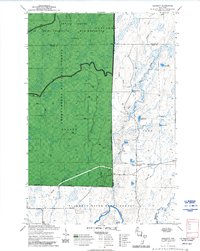
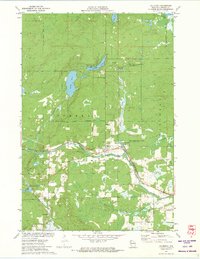
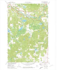
 1970 Oxbo1972 Print · USGSThe Flambeau River country comes alive in this 1970s record of Sawyer and Price counties. Trace the river's path past Barnaby Rapids and Oxbo, or locate mid-century landmarks like the Connors Lake Lookout Tower and Mason Lake Landing Field.2 unique versions available
 - 1970 Map of Kennedy, 1972 Print
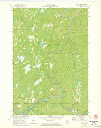
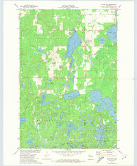
 1970 Kennedy1972 Print · USGSSawyer and Ashland counties are shown in the early 1970s as centers of Wisconsin timber and recreation. Researchers can locate the settlement of Kennedy, follow the Tuscobia State Forest Trail, and trace the shoreline of Lake Alice.3 unique versions available
 - 1971 Map of Cable, 1973 Print
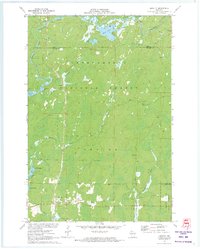
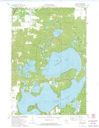
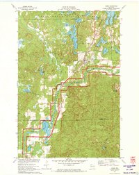 1971 Cable1973 Print · USGSBayfield County in the early seventies shows a landscape of deep forests and glacial lakes at the height of its mid-century recreational growth. Genealogists and local historians can trace the residents of Cable and Seeley or locate ancestral plots at St Anne Cem and Greenwood Cem.2 unique versions available
 - 1971 Map of Totagatic Lake, 1973 Print
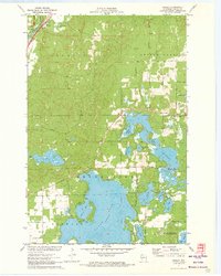
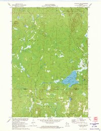 1971 Totagatic Lake1973 Print · USGSBayfield and Sawyer counties are captured here in the early seventies, a landscape of protected wetlands and thick forest at the edge of the Northwoods. Researchers can trace the courses of Hills Mill Creek and the Totagatic River or locate landmarks like the Smoky Hill Lookout Tower.2 unique versions available
 - 1971 Map of Kennan NW, 1973 Print
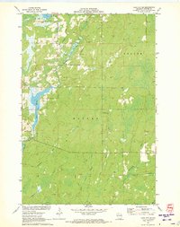
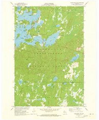
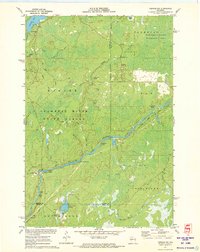 1971 Kennan NW1973 Print · USGSSawyer County's Northwoods are captured here in the early 1970s, showcasing the winding South Fork Flambeau River and its many rapids. Researchers can locate family landmarks and recreational sites like Connors Lake, Camp Flambeau, and the Cranberry Bog.2 unique versions available
 - 1971 Map of Couderay, 1973 Print
 1971 Couderay1973 Print · USGSSawyer County’s river-fed lowlands and protected wildlands are captured here in the early seventies. Local historians and genealogists can trace the early layout of Couderay and Lemington, or locate landmarks like the Cemetery and the Tuscobia-Park Falls State Trail.2 unique versions available
 - 1971 Map of Ingram NE, 1973 Print
 1971 Ingram NE1973 Print · USGSSawyer County's northern timberlands are captured in the early 1970s, dominated by the winding river corridor and legacy logging routes. Researchers can trace the path of the Old Railroad Grade or locate numerous river features like Flambeau Falls Rapids and Dades Island.2 unique versions available
 - 1971 Map of Chittamo NE, 1973 Print
 1971 Chittamo NE1973 Print · USGSThe northwoods of Douglas and Bayfield counties are shown here in the early seventies, a landscape defined by complex river systems and township boundaries. Genealogists and outdoorsmen can trace the Totagatic River through the Totagatic River State Wildlife Management Area or locate landmarks like Goose Lake and Frog Creek Road.
 - 1971 Map of Loretta, 1973 Print
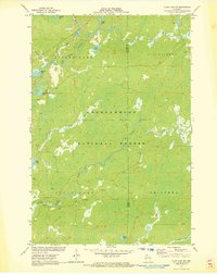
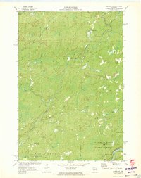
 1971 Loretta1973 Print · USGSNorthern Sawyer County was a haven for timber and recreation in the early seventies, dominated by the sprawling Chequamegon National Forest. Researchers can locate historic structures in Loretta and Draper, or trace the winding course of the Brunet River and the Snowmobile Trail.2 unique versions available
 - 1971 Map of Seeley, 1973 Print
 1971 Seeley1973 Print · USGSSawyer County’s lake country is captured here in the early 1970s, just as modern conservation areas were being formalized. Researchers can locate the Seeley settlement and Chicago and North Western railroad alongside the Namekagon River.2 unique versions available
 - 1971 Map of Hayward, 1973 Print
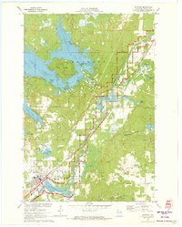 1971 Hayward1973 Print · USGSThe Hayward area and the upper Namekagon River are shown here in the early 1970s as timber and tourism defined the region. Genealogists and local historians can locate the Indian Cemetery, Trinity Cemetery, and the old rail path of the Chicago and North Western railroad.2 unique versions available
 - 1971 Map of Babbs Island, 1973 Print
 1971 Babbs Island1973 Print · USGSSawyer County's deep woods and river systems are documented here in the early seventies. Trace the Old Railroad Grade and explore the remote river junctions at Babbs Island and the South Fork Flambeau River.
 - 1971 Map of Lake Winter, 1973 Print
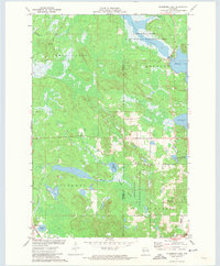
 1971 Lake Winter1973 Print · USGSSawyer County's northern forests are captured here in the early 1970s, showing a landscape defined by its rivers and emerging recreation trails. You can trace the path of the Brunet River past the Winter Lookout Tower or locate fishing spots along Lake Winter and South Barber Lake.2 unique versions available
 - 1971 Map of Clam Lake SW, 1973 Print
 1971 Clam Lake SW1973 Print · USGSSawyer and Ashland Counties are shown in the early seventies, a period when the timberlands and waterways remained largely undeveloped. Genealogists and outdoorsmen can trace the drainage of the West Fork Chippewa River past Shanagolden and Kelly Lake.2 unique versions available
 - 1971 Map of Lake Tahkodah, 1973 Print
 1971 Lake Tahkodah1973 Print · USGSThe Northwoods of Bayfield and Sawyer counties are captured here in the early seventies, dominated by the Namekagon River. You can trace the development of recreation at Mount Telemark or locate remote camps on Star Lake and Lake Tahkodah.
 - 1971 Map of Chief Lake, 1973 Print
 1971 Chief Lake1973 Print · USGSSawyer County’s glacial lake country is captured here in the early 1970s, showcasing the intersection of tribal lands and Northwoods recreation. Genealogists and local historians can locate the Round Lake Cem and trace old routes like Trepania Road and Gurno Road.
 - 1971 Map of Namekagon Lake, 1973 Print
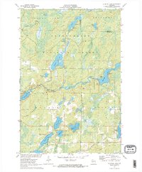
 1971 Namekagon Lake1973 Print · USGSBayfield and Sawyer counties are captured in the early 1970s, showcasing the dense woods and glaciated waters of the Chequamegon National Forest. Researchers can trace the irregular shorelines of Namekagon Lake and find landmarks like Missionary Point or the small settlement at Namekagon.2 unique versions available
 - 1971 Map of Ingram NW, 1973 Print
 1971 Ingram NW1973 Print · USGSSawyer County in the early 1970s is a landscape of dense forests and river networks just as modern conservation boundaries were being solidified. You can trace old logging routes like the Bissell Grade and locate historical sites such as Old Weaver Camp and Hay-Stack Corner.2 unique versions available
 - 1971 Map of Stanberry East, 1973 Print
 1971 Stanberry East1973 Print · USGSWashburn and Sawyer Counties are captured here in the early 1970s, showing a landscape defined by Northwoods water systems and the Soo Line rail corridor. Local researchers can trace the settlement at Stanberry, find the Greenwood Cemetery, or explore the expansive Totagatic River Flowage.
 - 1971 Map of Blaisdell Lake, 1973 Print
 1971 Blaisdell Lake1973 Print · USGSSawyer County’s Northwoods were a secluded network of glacial lakes and river bends in the early seventies. Genealogists and local historians can trace legacy sites like the Wa-Ha-Kee Church Camp and Glenwood Camp or the path of the regional Snowmobile Trail.2 unique versions available
 - 1971 Map of Spider Lake, 1973 Print
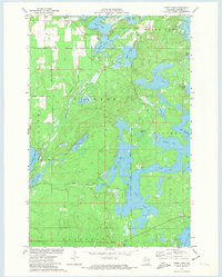
 1971 Spider Lake1973 Print · USGSSawyer County’s glacial lakeland is shown in detail during the early 1970s, as the Chequamegon National Forest was being managed for conservation and recreation. Local researchers can trace family-named landmarks like Davies Lake and Currier Lake or locate the historic Townhall and Tiger Cat Dam.
 - 1971 Map of Hauer, 1973 Print
 1971 Hauer1973 Print · USGSSawyer County’s lake-country landscape is documented here in the early 1970s, as traditional rail corridors began their transition to conservation trails. Researchers can locate the Wayside Chapel, trace the Soo Line railroad, and explore the vast Billy Boy Flowage.
 - 1971 Map of Bean Lake, 1974 Print
 1971 Bean Lake1974 Print · USGSWashburn and Sawyer Counties were defined by protected wetlands and water-powered history in the early seventies. Trace the Chicago and North Western rail line near the Namekagon River or explore the marshy Cranberry Bog.
 - 1971 Map of Stone Lake, 1974 Print
 1971 Stone Lake1974 Print · USGSThe Northwoods of Washburn and Sawyer Counties are captured here in the early 1970s, as the railroad and timber landscape began shifting toward lakeside recreation. Genealogists and local historians can trace the Stone Lake settlement, the Evergreen Cem, and the path of the Soo Line rail corridor.
 - 1971 Map of Reserve, 1974 Print
 1971 Reserve1974 Print · USGSThe Northwoods of Sawyer County come to life in the early seventies, centered on the historic settlement of Reserve. Genealogists and historians can locate rural landmarks like St Francis Solanus Mission and the shoreline cottages of Northwoods Beach.2 unique versions available
Showing maps 1-25 of 34
Top cities of Sawyer County
- Hayward historical maps
- Edgewater historical maps
- Weirgor historical maps
- Winter historical maps
- Ojibwa historical maps
- Radisson historical maps
See more
Frequently asked questions
- What are the different types of historical maps available for Sawyer County?
- What is the oldest map of Sawyer County?
- Where can I purchase historical maps of Sawyer County for my home or office?
- Where can I download high-res historical maps of Sawyer County?
- Are there historical topographic maps available for Sawyer County?
- Is there historical aerial imagery available for Sawyer County?
- Where are historical maps of Sawyer County sourced from?