1900s (20th Century) Maps of Lyndon, Wisconsin
Explore 10 historic maps of Lyndon from the 1900s (20th Century). These maps offer a rare glimpse into what life looked like during the 1900s — showing old roads, neighborhoods, homes, and landmarks that have changed or disappeared over time.
Whether you're researching your family's past, planning a metal detecting trip, or studying how Lyndon's landscape evolved across the 1900s, these high-resolution maps are a powerful tool for exploring the history of this region.
- Focus on a specific era: All maps on this page are from the 1900s, giving you a focused view of this time period.
- See what’s changed: Compare century-old streets, trails, and buildings to today's modern landscape using overlays and satellite layers.
- Research with precision: Use these maps for genealogy, historical research, land use analysis, or educational projects.
- View, download, or print: Maps are fully viewable online in high resolution, and can be downloaded or printed for your own records.
Start exploring Lyndon's history through authentic maps from the 1900s. This is your window into the past.
Lyndon, WI maps
(10)- 1954 Map of Sheboygan Falls, 1956 Print
 1954 Sheboygan Falls1956 Print · USGSCoastal Sheboygan and Ozaukee counties appear here in the mid-1950s, showing a landscape of dairy farms, mill ponds, and emerging industrial centers. Genealogists can trace family names at St Patrick Ch, find rural schoolhouses like Hoard Sch, or locate the lakefront Sauk Trail Beach.2 unique versions available
 - 1954 Map of Milwaukee, 1967 Print
 1954 Milwaukee1967 Print · USGSCoastal life and maritime commerce across Lake Michigan are seen here during the mid-fifties, bridging Wisconsin's industrial hubs and Michigan's timberlands. Genealogists and historians can trace the rail lines of the Grand Trunk Western and find long-established ports like Ludington, Port Washington, and Muskegon.3 unique versions available
 - 1955 Map of Kewaskum, 1957 Print
 1955 Kewaskum1957 Print · USGSMid-century eastern Wisconsin comes alive in this survey of the glacial Kettle Moraine region. Genealogists and historians can locate rural landmarks like Conners Mill, the Parnell Lookout Tower, and old schools including Mitchell Sch and Hillside Sch.4 unique versions available
 - 1957 Map of Madison, 1967 Print
 1957 Madison1967 Print · USGSSouth-central Wisconsin in the mid-fifties reveals a landscape of industrial hubs and glacial lakes linked by a dense rail and highway network. Genealogists and historians can trace the development of lakeside communities and find notable sites like Badger Ordnance Works and the Horicon National Wildlife Refuge.3 unique versions available
 - 1958 Map of Milwaukee
 1958 Milwaukee1958 Print · USGSThe shorelines of Lake Michigan in the late fifties reveal a landscape of bustling ferry ports and growing industrial suburbs. Genealogists and historians can trace rail networks like the Chesapeake & Ohio and locate landmarks such as Little Sable Point and Holy Cross Church.
 - 1960 Map of Madison
 1960 Madison1960 Print · USGSCentral and Southern Wisconsin are captured in the late fifties, showing the region as its rail-and-river network matured. Trace the paths of the Soo Line RR or locate family roots near Lake Mendota and Horicon National Wildlife Refuge.2 unique versions available
 - 1974 Map of Cascade, 1977 Print
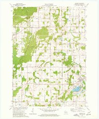 1974 Cascade1977 Print · USGSSheboygan County's glacial terrain is on full display in the mid-1970s, from the summits of the moraine to the village of Cascade. Genealogists and hikers can trace the Parnell Esker, locate St Michael Ch, or find family plots at Union Cem.2 unique versions available
 - 1974 Map of Plymouth South, 1977 Print
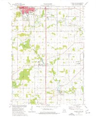 1974 Plymouth South1977 Print · USGSSheboygan County's agricultural heartland was well-established by the mid-seventies, centered on the river-fed villages of Waldo and Hingham. Researchers can trace historic family landmarks like Lyndon Cem, rural schools such as Willow Glen Academy, and the milling heritage found at Hingham Mill Pond.2 unique versions available
 - 1980 Map of Fond Du Lac
 1980 Fond Du Lac1980 Print · USGSThe Fox River Valley and Horicon Marsh meet here during the late twentieth century, showing a transition from lakeside industry to glacial conservation. Genealogists can locate family sites at Estabrook Cem or trace the rail lines through Ripon and Waupun.
 - 1989 Map of Sheboygan, 1990 Print
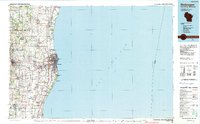 1989 Sheboygan1990 Print · USGSCoastal Wisconsin thrived in the late eighties as the industrial corridor between Sheboygan and Belgium expanded along the lake. Genealogists and local researchers can trace old township lines and small settlements like Howards Grove, Hingham, and Gibbsville.
End of results
Showing maps 1-10 of 10
Top cities near Lyndon
- Sheboygan historical maps
- West Bend historical maps
- Plymouth historical maps
- Town of Sheboygan historical maps
- Sheboygan Falls historical maps
- Howards Grove historical maps
See more
Frequently asked questions
- What are the different types of historical maps available for Lyndon?
- What is the oldest map of Lyndon?
- Where can I purchase historical maps of Lyndon for my home or office?
- Where can I download high-res historical maps of Lyndon?
- Are there historical topographic maps available for Lyndon?
- Is there historical aerial imagery available for Lyndon?
- Where are historical maps of Lyndon sourced from?