2020s Maps of Arcadia, Wisconsin
Explore 6 historic maps of Arcadia from the 2020s. These maps offer a rare glimpse into what life looked like during the 2020s — showing old roads, neighborhoods, homes, and landmarks that have changed or disappeared over time.
Whether you're researching your family's past, planning a metal detecting trip, or studying how Arcadia's landscape evolved across the 2020s, these high-resolution maps are a powerful tool for exploring the history of this region.
- Focus on a specific era: All maps on this page are from the 2020s, giving you a focused view of this time period.
- See what’s changed: Compare century-old streets, trails, and buildings to today's modern landscape using overlays and satellite layers.
- Research with precision: Use these maps for genealogy, historical research, land use analysis, or educational projects.
- View, download, or print: Maps are fully viewable online in high resolution, and can be downloaded or printed for your own records.
Start exploring Arcadia's history through authentic maps from the 2020s. This is your window into the past.
Arcadia, WI maps
(6)- 2022 Map of Swinns Valley, 2022 Print
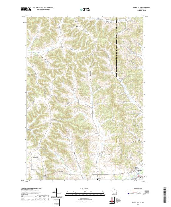 2022 Swinns Valley2022 Print · USGSThe coulees and ridges of the Wisconsin Driftless Area are shown here in modern detail, from the height of Montana Ridge down to the Trempealeau River. Researchers can locate the Lower Montana Ridge Cem, the city of Arcadia, and the winding Swinns Valley.
 - 2022 Map of Ettrick, 2022 Print
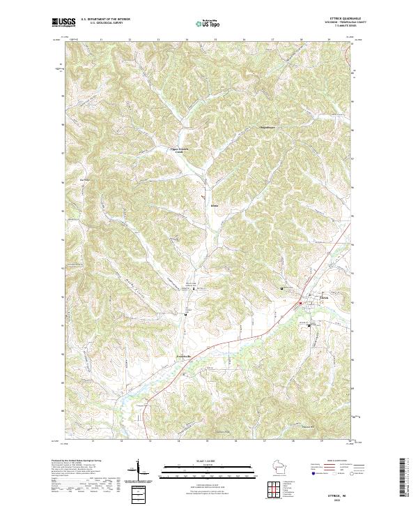 2022 Ettrick2022 Print · USGSWisconsin’s coulee country is mapped here in the early twenty-first century, showing the rural landscape around Ettrick. Researchers can locate several historical burial sites, including the French Creek Lutheran Cem and Vor Frelsers Cem near Frenchville.
 - 2022 Map of Independence, 2022 Print
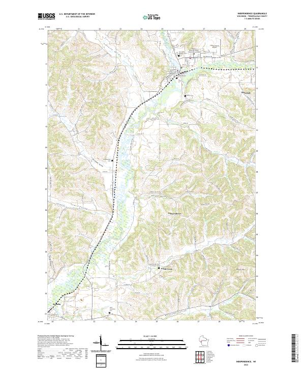 2022 Independence2022 Print · USGSIndependence and the Trempealeau River valley are shown here in recent detail, documenting the modern footprint of this rural Wisconsin community. Researchers can locate many local burial grounds, such as Greenwood Cem and Williamsburg Cem, or trace the path of the Trempealeau River through Traverse Valley.
 - 2022 Map of Whitehall, 2022 Print
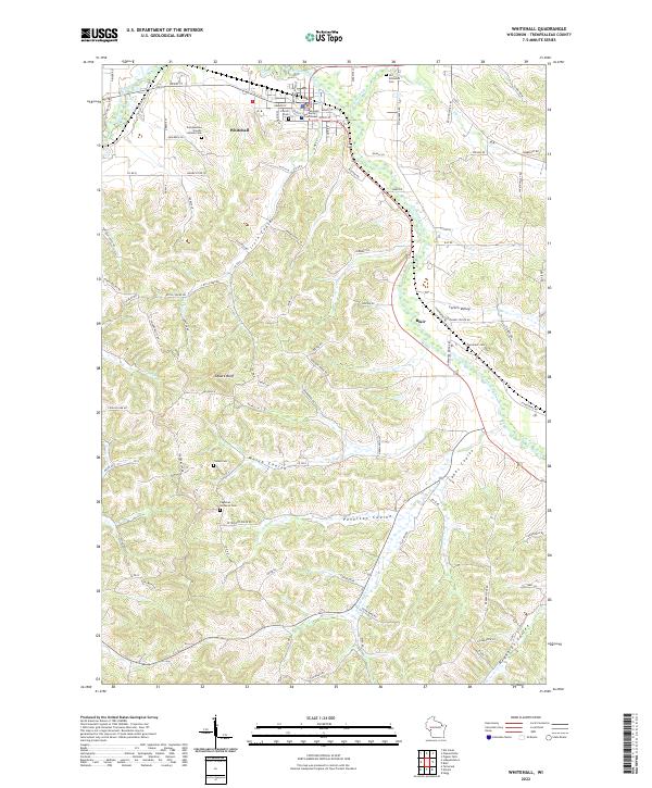 2022 Whitehall2022 Print · USGSWhitehall and the Trempealeau River valley are shown here in the early 2020s, highlighting the unique coulee and ridge terrain of western Wisconsin. Researchers can trace historic farmstead roads and locate several cemeteries including Tinnes Cem and the Old Whitehall Cem.
 - 2022 Map of Dodge, 2022 Print
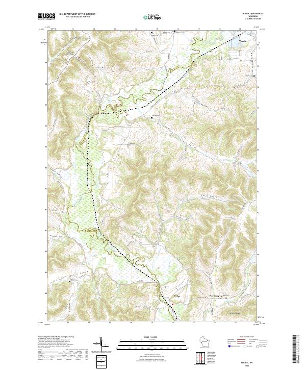 2022 Dodge2022 Print · USGSThe coulee country along the Buffalo and Trempealeau county border is shown here in the modern era. Family historians can trace local landmarks across Buehler Valley and Arcadia Ridge, or locate burial sites like Cortland Cem and Sacred Heart Cem.
 - 2022 Map of Tamarack, 2022 Print
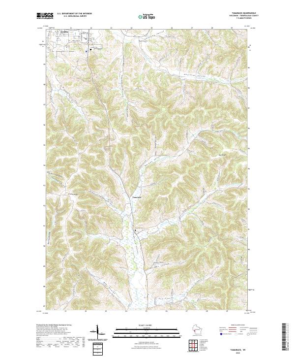 2022 Tamarack2022 Print · USGSThe rolling coulees of Trempealeau County are shown here in recent years, centered on the communities of Arcadia and Tamarack. Local researchers can trace family landmarks and rural homesteads through Bear Coulee, Norway Valley, and the Arcadia Cem.
End of results
Showing maps 1-6 of 6
Top cities near Arcadia
- Winona historical maps
- Holmen historical maps
- Arcadia historical maps
- Goodview historical maps
- Whitehall historical maps
- Independence historical maps
See more
Top neighborhoods of Arcadia
Frequently asked questions
- What are the different types of historical maps available for Arcadia?
- What is the oldest map of Arcadia?
- Where can I purchase historical maps of Arcadia for my home or office?
- Where can I download high-res historical maps of Arcadia?
- Are there historical topographic maps available for Arcadia?
- Is there historical aerial imagery available for Arcadia?
- Where are historical maps of Arcadia sourced from?