1970s Maps of Washburn County, Wisconsin
Explore 9 historic maps of Washburn County from the 1970s. These maps offer a rare glimpse into what life looked like during the 1970s — showing old roads, neighborhoods, homes, and landmarks that have changed or disappeared over time.
Whether you're researching your family's past, planning a metal detecting trip, or studying how Washburn County's landscape evolved across the 1970s, these high-resolution maps are a powerful tool for exploring the history of this region.
- Focus on a specific era: All maps on this page are from the 1970s, giving you a focused view of this time period.
- See what’s changed: Compare century-old streets, trails, and buildings to today's modern landscape using overlays and satellite layers.
- Research with precision: Use these maps for genealogy, historical research, land use analysis, or educational projects.
- View, download, or print: Maps are fully viewable online in high resolution, and can be downloaded or printed for your own records.
Start exploring Washburn County's history through authentic maps from the 1970s. This is your window into the past.
Washburn County, WI maps
(9)- 1971 Map of Chittamo NE, 1973 Print
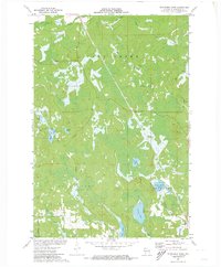
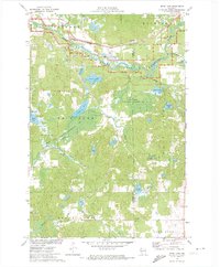
 1971 Chittamo NE1973 Print · USGSThe northwoods of Douglas and Bayfield counties are shown here in the early seventies, a landscape defined by complex river systems and township boundaries. Genealogists and outdoorsmen can trace the Totagatic River through the Totagatic River State Wildlife Management Area or locate landmarks like Goose Lake and Frog Creek Road.
 - 1971 Map of Stanberry West, 1973 Print
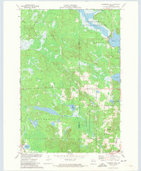
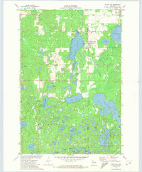
 1971 Stanberry West1973 Print · USGSWashburn County's lake country is captured here during the early seventies, showing a landscape of dense wetlands and timber management. Researchers can trace the Soo Line railroad through Stanberry or locate remote points along Mc Intosh Road and Gull Lake.
 - 1971 Map of Chittamo, 1973 Print
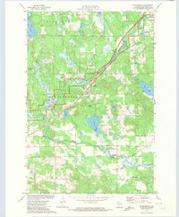
 1971 Chittamo1973 Print · USGSNorthwestern Wisconsin at the start of the 1970s is revealed as a dense patchwork of waterways and forest at the Douglas and Washburn county line. Genealogists and historians can trace the Soo Line tracks through Chittamo or explore the wild edges of Sauntrys Pocket and the Ounce River.
 - 1971 Map of Stanberry East, 1973 Print
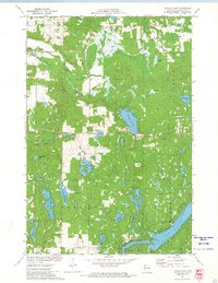
 1971 Stanberry East1973 Print · USGSWashburn and Sawyer Counties are captured here in the early 1970s, showing a landscape defined by Northwoods water systems and the Soo Line rail corridor. Local researchers can trace the settlement at Stanberry, find the Greenwood Cemetery, or explore the expansive Totagatic River Flowage.
 - 1971 Map of Springbrook, 1974 Print
 1971 Springbrook1974 Print · USGSWashburn County's river valleys and rail corridors are captured here in the early 1970s. Local researchers can trace family roots at St Lukes Cem or explore the wetlands around Gull Lake and the Bean Brook State Wildlife Management Area.
 - 1971 Map of Potato Lake, 1974 Print
 1971 Potato Lake1974 Print · USGSWashburn County's lake country is captured in the early 1970s, showcasing a dense network of glacial waters and wetlands. Researchers can trace family-named landmarks like Westenberg Spring, locate the local Townhall, or find former structures like the Lookout Tower.
 - 1971 Map of Bean Lake, 1974 Print
 1971 Bean Lake1974 Print · USGSWashburn and Sawyer Counties were defined by protected wetlands and water-powered history in the early seventies. Trace the Chicago and North Western rail line near the Namekagon River or explore the marshy Cranberry Bog.
 - 1971 Map of Stone Lake, 1974 Print
 1971 Stone Lake1974 Print · USGSThe Northwoods of Washburn and Sawyer Counties are captured here in the early 1970s, as the railroad and timber landscape began shifting toward lakeside recreation. Genealogists and local historians can trace the Stone Lake settlement, the Evergreen Cem, and the path of the Soo Line rail corridor.
 - 1975 Map of Stillwater
 1975 Stillwater1975 Print · USGSThe Twin Cities and the St. Croix Valley are captured in the mid-seventies, showing the urban growth of Minneapolis and St Paul. Researchers can trace old rail corridors of the Northern Pacific RR and locate tribal lands at the Mille Lacs Indian Reservation.2 unique versions available
End of results
Showing maps 1-9 of 9
Top cities of Washburn County
- Spooner historical maps
- Shell Lake historical maps
- Trego historical maps
- Beaver Brook historical maps
- Minong historical maps
- Springbrook historical maps
See more
Frequently asked questions
- What are the different types of historical maps available for Washburn County?
- What is the oldest map of Washburn County?
- Where can I purchase historical maps of Washburn County for my home or office?
- Where can I download high-res historical maps of Washburn County?
- Are there historical topographic maps available for Washburn County?
- Is there historical aerial imagery available for Washburn County?
- Where are historical maps of Washburn County sourced from?