1900s (20th Century) Maps of Waukesha County, Wisconsin
Explore 43 historic maps of Waukesha County from the 1900s (20th Century). These maps offer a rare glimpse into what life looked like during the 1900s — showing old roads, neighborhoods, homes, and landmarks that have changed or disappeared over time.
Whether you're researching your family's past, planning a metal detecting trip, or studying how Waukesha County's landscape evolved across the 1900s, these high-resolution maps are a powerful tool for exploring the history of this region.
- Focus on a specific era: All maps on this page are from the 1900s, giving you a focused view of this time period.
- See what’s changed: Compare century-old streets, trails, and buildings to today's modern landscape using overlays and satellite layers.
- Research with precision: Use these maps for genealogy, historical research, land use analysis, or educational projects.
- View, download, or print: Maps are fully viewable online in high resolution, and can be downloaded or printed for your own records.
Start exploring Waukesha County's history through authentic maps from the 1900s. This is your window into the past.
Waukesha County, WI maps
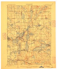
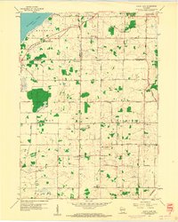
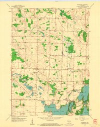
(43)- 1901 Map of Waukesha
 1901 Waukesha1901 Print · USGSSoutheastern Wisconsin at the turn of the century shows a landscape transitioning from rural townships to a complex rail-linked corridor. Genealogists and historians can trace the exact locations of early communities like Freistadt, Fussville, and Brookfield P.O. along the Menomonee River.
 - 1901 Map of Muskego
 1901 Muskego1901 Print · USGSSoutheastern Wisconsin at the close of the nineteenth century was a landscape of budding dairy hubs and interconnected glacial lakes. Researchers can trace early rural life across these townships, finding legacy sites like Union Church, the path of the Wisconsin Central Railroad, and original footprints for Tess Corners and Big Bend.4 unique versions available
 - 1903 Map of Whitewater
 1903 Whitewater1903 Print · USGSSoutheastern Wisconsin at the turn of the century reveals a landscape of thriving rail towns and glacial lake systems. Trace the early routes of the Chicago Milwaukee and St Paul railroad between Whitewater and Palmyra, or locate old lakeside settlements like Heart Prairie.5 unique versions available
 - 1906 Map of Eagle
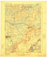
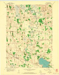
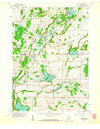
 1906 Eagle1906 Print · USGSSoutheastern Wisconsin's glaciated terrain is remarkably detailed in this early century survey of the Fox River valley. Genealogists and local historians can trace the early rail-stop settlements of Genesee Depot, North Prairie, and Eagleville alongside landmarks like Lake Beulah and Honey Creek.6 unique versions available
 - 1906 Map of Waukesha
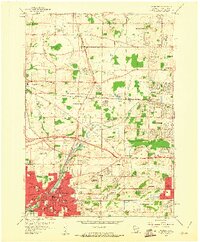
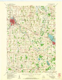
 1906 Waukesha1906 Print · USGSWaukesha and the Milwaukee outskirts thrive at the turn of the century during a height of rail connectivity. Genealogists can trace family footprints in early settlements like Freistadt, Lannon, and the neighborhoods of Wauwatosa.4 unique versions available
 - 1909 Map of Oconomowoc
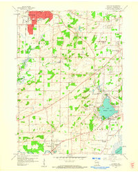
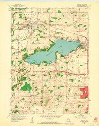
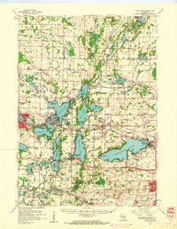
 1909 Oconomowoc1909 Print · USGSThe Lake Country of Waukesha County is captured here at the height of its early resort era. You can trace family roots in Oconomowoc, locate the historic Nashotah Mission, and find long-lost stops like Waukesha Beach and Lakeside Sta.6 unique versions available
 - 1924 Map of Whitewater
 1924 Whitewater1924 Print · USGSSoutheastern Wisconsin at the turn of the century shows a landscape of glacial lakes and thriving rail-side towns. Genealogists and historians can trace old homesteads near Heaths Mills, the station at Palmyra, and the early township centers of Rome and Lagrange.4 unique versions available
 - 1954 Map of Rockford
 1954 Rockford1954 Print · USGSThe Rock River valley and the Illinois-Wisconsin borderlands are captured here in the mid-1950s during a period of robust industrial and agricultural activity. Genealogists and historians can trace rail-era corridors like the Illinois Central RR and locate landmarks from Big Foot Prairie to Lake Geneva.
 - 1955 Map of Rockford
 1955 Rockford1955 Print · USGSThe Rock River valley and southern Wisconsin dairy country are shown here in the mid-fifties as the region's manufacturing centers grew. Genealogists and historians can trace the paths of the Chicago and North Western RR and Illinois Central RR through hubs like Rockford and Beloit.
 - 1957 Map of Madison, 1967 Print
 1957 Madison1967 Print · USGSSouth-central Wisconsin in the mid-fifties reveals a landscape of industrial hubs and glacial lakes linked by a dense rail and highway network. Genealogists and historians can trace the development of lakeside communities and find notable sites like Badger Ordnance Works and the Horicon National Wildlife Refuge.3 unique versions available
 - 1958 Map of Wauwatosa, 1961 Print
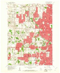 1958 Wauwatosa1961 Print · USGSMilwaukee's western suburbs expanded rapidly during the late fifties as residential neighborhoods grew around long-standing institutions and rail lines. Local historians can trace the footprint of Wisconsin County Institutions, the Zoological Park, and Mount Mary College.4 unique versions available
 - 1958 Map of Menomonee Falls, 1961 Print
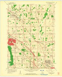 1958 Menomonee Falls1961 Print · USGSIn the late fifties, the rural townships north of Milwaukee were transitioning from gravel mining and farming to suburban life. Genealogists and local historians can trace legacy sites like Fussville, Holy Cross Ch, and St Marys Cem amidst the growing network of roads.4 unique versions available
 - 1958 Map of Rockford, 1974 Print
 1958 Rockford1974 Print · USGSNorthern Illinois and southern Wisconsin are shown here in the mid-twentieth century as rail-dependent industrial towns began to interface with growing lakefront communities. Genealogists can trace family roots through settlements like Saylesville and Tess Corners or locate historical landmarks like the Rockford Ordnance Depot.4 unique versions available
 - 1959 Map of North Cape, 1960 Print
 1959 North Cape1960 Print · USGSSoutheast Wisconsin farming townships at the end of the fifties show a landscape of small rural crossroads and family homesteads. Genealogists can locate legacy sites like Union Church, Oak Grove Cem, and several local schools from Apple Sch to Garfield Sch.3 unique versions available
 - 1959 Map of Hales Corners, 1960 Print
 1959 Hales Corners1960 Print · USGSThe suburban and rural landscape southwest of Milwaukee is frozen in time during the late fifties, as traditional farms meet post-war growth. Researchers can trace the legacy of local institutions and small hubs like St Martins, Tess Corners, and the Sacred Heart Monastery.4 unique versions available
 - 1959 Map of Muskego, 1960 Print
 1959 Muskego1960 Print · USGSWaukesha County at the end of the fifties shows a landscape of developing towns and rural school districts before heavy suburbanization. Genealogists can locate family sites near Prairie Home Cemetery, Prospect Hill Sch, and the old Vernon Ch.4 unique versions available
 - 1959 Map of Waterford, 1960 Print
 1959 Waterford1960 Print · USGSWaterford and the surrounding Fox River valley are captured in the late fifties as lakeside communities and rural drainage networks reshaped the terrain. Genealogists and local historians can trace family ties at Rural Home Cem, visit the site of the Colonel Heg Sch, or explore the mid-century streets of Tichigan.4 unique versions available
 - 1959 Map of Hartland, 1961 Print
 1959 Hartland1961 Print · USGSWaukesha County during the late fifties shows a landscape of glacial lakes and growing lakeside communities. Genealogists and local historians can trace family-named schools and rural parishes like Zion Sch, Bark River Cem, and Little Tabernacle Ch.4 unique versions available
 - 1959 Map of Ixonia, 1961 Print
 1959 Ixonia1961 Print · USGSIxonia and the surrounding dairy country are captured in the late fifties as the local economy balanced rail transport with emerging mid-century developments. Genealogists can trace family roots through sites like New Ashippun, the Monastery on Lac La Belle, and several rural schoolhouses.2 unique versions available
 - 1959 Map of Oconomowoc East, 1961 Print
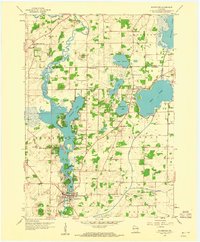
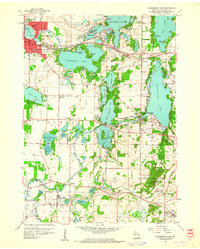 1959 Oconomowoc East1961 Print · USGSWaukesha County's lake country is captured here in the late fifties, showcasing a landscape of glacial waters and growing towns. Local historians can locate St Johns Military Academy, the Wisconsin School for Boys, and family sites near Holy Innocents Cem.5 unique versions available
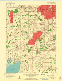
 - 1959 Map of Waukesha, 1961 Print
 1959 Waukesha1961 Print · USGSMid-century Waukesha and Brookfield are caught in a moment of transition from rural dairy and quarry land to suburban hubs. Genealogists and historians can locate family landmarks like Rose Hill Cemetery or trace institutional roots at Carroll College and the Wisconsin Industrial School.5 unique versions available
 - 1959 Map of Stonebank, 1961 Print
 1959 Stonebank1961 Print · USGSWaukesha County's lake country is captured here during a transition from quiet rural townships to popular lakeside retreats in the late fifties. Genealogists and historians can trace community roots through numerous country schools and cemeteries, including Mapleton Sch, Mt Hope Cem, and St Paul Ch.4 unique versions available
 - 1959 Map of Hartland, 1961 Print
 1959 Hartland1961 Print · USGSWaukesha County at the close of the 1950s shows a landscape defined by glacial lakes and a maturing rail network. Genealogists and historians can trace old community hubs like Stonebank and Merton, identifying local landmarks from St Olaf Ch to University Lake Sch.
 - 1959 Map of Watertown, 1961 Print
 1959 Watertown1961 Print · USGSJefferson and Dodge Counties are captured in the late fifties as a thriving agricultural and rail corridor. Genealogists can trace family roots through numerous sites like Old Lebanon, St Bernard Cem, and rural schoolhouses including High Lawn Sch.3 unique versions available
 - 1959 Map of Merton, 1961 Print
 1959 Merton1961 Print · USGSThe glacial lakelands of Waukesha and Washington Counties are shown in the late 1950s as quiet rural communities began to evolve. Genealogists and historians can trace family locations near Holy Hill, the village of Merton, and numerous historic sites like St Johns Cemetery and Center Oak School.4 unique versions available
Showing maps 1-25 of 43
Top cities of Waukesha County
- Waukesha historical maps
- Brookfield historical maps
- New Berlin historical maps
- Menomonee Falls historical maps
- Muskego historical maps
- Oconomowoc historical maps
See more
Frequently asked questions
- What are the different types of historical maps available for Waukesha County?
- What is the oldest map of Waukesha County?
- Where can I purchase historical maps of Waukesha County for my home or office?
- Where can I download high-res historical maps of Waukesha County?
- Are there historical topographic maps available for Waukesha County?
- Is there historical aerial imagery available for Waukesha County?
- Where are historical maps of Waukesha County sourced from?