Old Maps of Little Hope, Dayton for Academic Research
Study the evolution of Little Hope with 10 high-resolution historic maps. Whether you're teaching, researching, or modeling changes in land use, these maps provide essential visual documentation of urban, environmental, and geographic change.
- Analyze long-term change: Track patterns in development, transportation, and natural features.
- Ideal for environmental or urban studies: Support academic projects with primary historical map data.
- Use in the classroom or lab: Educators and researchers rely on these maps to bring historical context to life.
These maps are a powerful tool for teaching, research, and visualizing how Little Hope has changed over the decades.
Little Hope, Dayton maps
(10)- 1955 Map of Green Bay, 1968 Print
 1955 Green Bay1968 Print · USGSCentral and Eastern Wisconsin are captured here in the mid-fifties, showing the industrial growth of the Fox Valley and Wisconsin River corridors. Genealogists and historians can trace rail lines like the Green Bay and Western through settlements like Weyauwega, Clintonville, and Pulaski.2 unique versions available
 - 1957 Map of Waupaca, 1959 Print
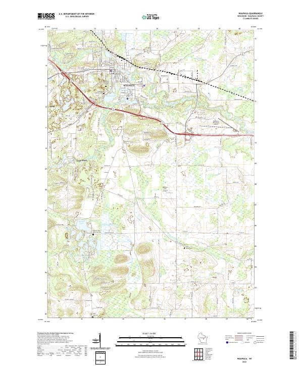
 1957 Waupaca1959 Print · USGSWaupaca and the famous Chain O' Lakes are captured in the late fifties, showing a landscape of small lakeside settlements and rural schoolhouses. Researchers can find Waupaca Boys Camp, trace the old Green Bay and Western line, or locate King and Rural.2 unique versions available
 - 1969 Map of Waupaca, 1972 Print
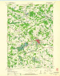
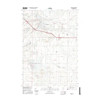
 1969 Waupaca1972 Print · USGSWaupaca and its surrounding townships are captured in the late sixties as the area balanced its river-based industry with growing recreational lakefronts. Genealogists and local researchers can locate St Mary Magdalene Cem, the settlement of Little Hope, and the path of the Soo Line railroad.
 - 1985 Map of Wisconsin Rapids
 1985 Wisconsin Rapids1985 Print · USGSCentral Wisconsin in the mid-eighties shows a landscape of engineered waterways and active rail corridors between Wisconsin Rapids and Waupaca. Genealogists and researchers can trace local landmarks like Roche A Cri State Park, the SOO LINE, and small settlements like Coddington or Rudolph.2 unique versions available
 - 1992 Map of Waupaca, 1995 Print
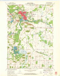
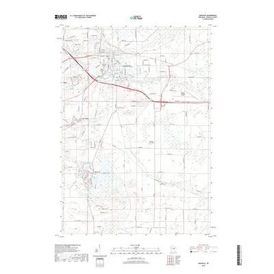
 1992 Waupaca1995 Print · USGSWaupaca and its surrounding glacial lake country are captured here during the early nineties, showing the city's relationship with the local river systems. Researchers can trace family roots at Lakeside Cem or locate old community centers like Little Hope and Lind Center.
 - 2010 Map of Waupaca, 2010 Print
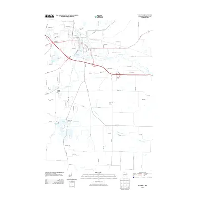
 2010 Waupaca2010 Print · USGSCovers Little Hope, including Waupaca, Lind, and other nearby areas
 - 2013 Map of Waupaca, 2013 Print
 2013 Waupaca2013 Print · USGSCovers Little Hope, including Waupaca, Lind, and other nearby areas
 - 2015 Map of Waupaca, 2015 Print
 2015 Waupaca2015 Print · USGSCovers Little Hope, including Waupaca, Lind, and other nearby areas
 - 2018 Map of Waupaca, 2018 Print
 2018 Waupaca2018 Print · USGSCovers Little Hope, including Waupaca, Lind, and other nearby areas
 - 2022 Map of Waupaca, 2022 Print
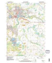
 2022 Waupaca2022 Print · USGSWaupaca and its surrounding glacial lakes are shown here in the early twenty-first century as a well-developed regional center. Genealogists and historians can trace local family landmarks through Saint Mary Magdalene Cem, Lind Center Cem, and the prominent Waupaca County Courthouse.
End of results
Showing maps 1-10 of 10
Top cities near Little Hope
- Waupaca historical maps
- Wautoma historical maps
- Weyauwega historical maps
- Manawa historical maps
- Iola historical maps
- Amherst historical maps
See more
Frequently asked questions
- What are the different types of historical maps available for Little Hope?
- What is the oldest map of Little Hope?
- Where can I purchase historical maps of Little Hope for my home or office?
- Where can I download high-res historical maps of Little Hope?
- Are there historical topographic maps available for Little Hope?
- Is there historical aerial imagery available for Little Hope?
- Where are historical maps of Little Hope sourced from?