2020s Maps of Big Horn County, Wyoming
Explore 84 historic maps of Big Horn County from the 2020s. These maps offer a rare glimpse into what life looked like during the 2020s — showing old roads, neighborhoods, homes, and landmarks that have changed or disappeared over time.
Whether you're researching your family's past, planning a metal detecting trip, or studying how Big Horn County's landscape evolved across the 2020s, these high-resolution maps are a powerful tool for exploring the history of this region.
- Focus on a specific era: All maps on this page are from the 2020s, giving you a focused view of this time period.
- See what’s changed: Compare century-old streets, trails, and buildings to today's modern landscape using overlays and satellite layers.
- Research with precision: Use these maps for genealogy, historical research, land use analysis, or educational projects.
- View, download, or print: Maps are fully viewable online in high resolution, and can be downloaded or printed for your own records.
Start exploring Big Horn County's history through authentic maps from the 2020s. This is your window into the past.
Big Horn County, WY maps
(84)- 2020 Map of Bear Hole, 2020 Print
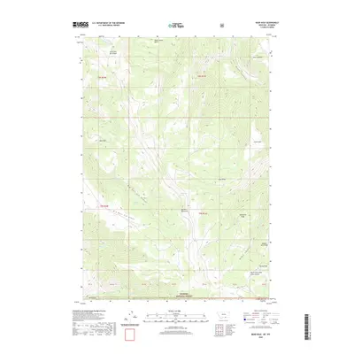 2020 Bear Hole2020 Print · USGSCovers Big Horn County, including Sheridan County, United States, and other nearby areas
 - 2020 Map of Mystery Cave, 2020 Print
 2020 Mystery Cave2020 Print · USGSCovers Big Horn County, including Carbon County, United States, and other nearby areas
 - 2020 Map of Two Point, 2020 Print
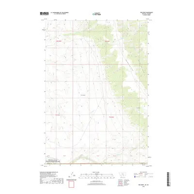 2020 Two Point2020 Print · USGSCovers Big Horn County, including United States, Montana, and other nearby areas
 - 2020 Map of Red Pryor Mountain, 2020 Print
 2020 Red Pryor Mountain2020 Print · USGSCovers Big Horn County, including Carbon County, United States, and other nearby areas
 - 2020 Map of Hillsboro, 2020 Print
 2020 Hillsboro2020 Print · USGSCovers Big Horn County, including Hillsboro, Carbon County, and other nearby areas
 - 2020 Map of Bear Canyon, 2020 Print
 2020 Bear Canyon2020 Print · USGSCovers Big Horn County, including Park County, Carbon County, and other nearby areas
 - 2021 Map of Emblem, 2021 Print
 2021 Emblem2021 Print · USGSBig Horn County ranching and irrigation systems are clearly visible in this recent survey of the Wyoming high plains. Genealogists and local historians can trace water rights and land use through Emblem Bench, the Dry Cr Lateral Bench Canal, and the community of Emblem.
 - 2021 Map of Jones Reservoir, 2021 Print
 2021 Jones Reservoir2021 Print · USGSBig Horn County at the start of the 2020s remains a landscape of high-plains hydrology and remote ranching infrastructure. Map researchers and geologists can trace water management at Jones Reservoir or locate the unique geothermal activity at Short Geyser.
 - 2021 Map of Gilmore Hill SE, 2021 Print
 2021 Gilmore Hill SE2021 Print · USGSBig Horn and Park counties meet in this high-desert landscape, captured in a recent survey that preserves the path of the historic Jim Bridger Trl. Trace the rugged topography around Johnson Reservoir Number 2 and the winding reaches of Coon Creek.
 - 2021 Map of Allen Draw, 2021 Print
 2021 Allen Draw2021 Print · USGSBig Horn County at the start of the 2020s remains a landscape of high-country drainage and wildlife habitat. Researchers can trace the trails and seasonal roads through Medicine Lodge Canyon, Allen Draw, and the Bighorn National Forest.
 - 2021 Map of Shell, 2021 Print
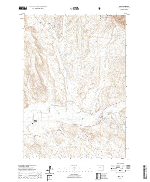 2021 Shell2021 Print · USGSThe Shell Creek valley comes into focus in this recent study of Big Horn County's ranching landscape. Trace family roots at Shell Cem or follow irrigation history along Whaley Ditch and the Shell Canal.
 - 2021 Map of Manderson SE, 2021 Print
 2021 Manderson SE2021 Print · USGSBig Horn County ranchlands are captured here in the early twenty-first century, showing the vital irrigation networks along the Nowood River. Researchers can trace the paths of the Avent Ditch, locate the high vantage of Blue Ridge, and explore the drainage patterns of Coyote Gulch.
 - 2021 Map of Orchard Bench, 2021 Print
 2021 Orchard Bench2021 Print · USGSBig Horn County at the start of the 2020s shows the structured growth of Basin alongside the vital Big Horn Canal. Researchers can trace the intersection of water and transport through family-named routes like Orchard Bench Road and landmarks such as Dobie Butte.
 - 2021 Map of Manderson NE, 2021 Print
 2021 Manderson NE2021 Print · USGSBig Horn County in the early 2020s remains a landscape of prominent ridges and deep gulches shaped by the elements. Local history enthusiasts can trace the paths of Red Gulch Rd and find landmarks like Fox Mtn and Potato Ridge.
 - 2021 Map of Boyd Ridge, 2021 Print
 2021 Boyd Ridge2021 Print · USGSThe Bighorn Mountains on the Sheridan and Big Horn county line are shown here in the early 2020s. Hikers and historians can trace high-altitude routes like Lodge Grass Trail past landmarks such as Boyd Ridge and Crater Spring.
 - 2021 Map of Weintz Draw, 2021 Print
 2021 Weintz Draw2021 Print · USGSBig Horn and Washakie counties meet in this 2021 survey of the Nowood River valley as the modern ranching landscape continues to evolve. Researchers can trace intricate water systems like Anita Ditch and identify livestock reservoirs including H G Reservoir and Brewster Reservoir.
 - 2021 Map of Schuster Flats NW, 2021 Print
 2021 Schuster Flats NW2021 Print · USGSBig Horn and Washakie counties meet in this high desert landscape during the early twenty-first century. Researchers can trace the rugged drainage patterns of Fivemile Cr and North Fork Fifteemile Creek or locate the landmark of Red Butte.
 - 2021 Map of Kane, 2021 Print
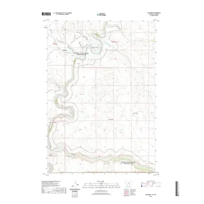
 2021 Kane2021 Print · USGSBig Horn County at the modern turn of the decade shows a landscape shaped by the Bighorn River and reclamation projects. Researchers can trace the layout of the Kane settlement near the Bighorn Lake shoreline and find local landmarks like Katys Nipple and Little Sheep Mtn.
 - 2021 Map of Gould Butte, 2021 Print
 2021 Gould Butte2021 Print · USGSBig Horn County's ranching landscape is captured here in the early twenty-first century, showing the complex water systems of the Greybull River valley. Genealogists and researchers can trace local landmarks like Gould Butte, Emblem Bench, and the Dorsey Creek Ranch Airport.
 - 2021 Map of Manderson, 2021 Print
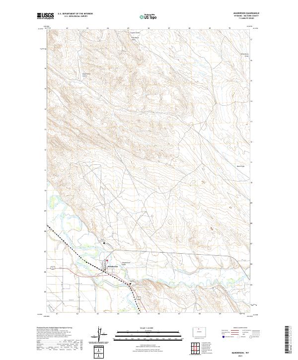 2021 Manderson2021 Print · USGSThe confluence of the Bighorn and Nowood Rivers defines this Big Horn County settlement area as it appeared in recent years. Researchers can locate specific local landmarks like the Smith Family Cemetery, the Manderson Cemetery, and the historic Big Horn Canal network.
 - 2021 Map of Byron, 2021 Print
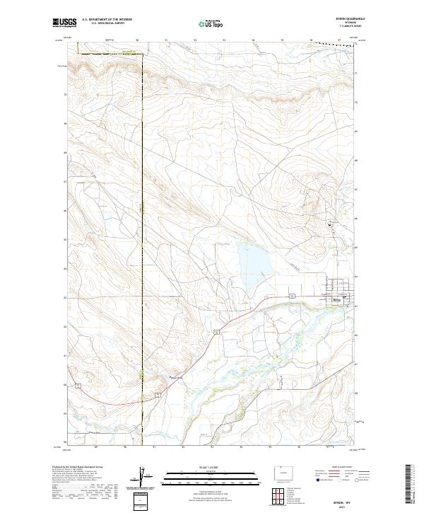 2021 Byron2021 Print · USGSByron and the Shoshone River valley are shown here in the early twenty-first century, highlighting the vital irrigation networks of the Big Horn Basin. Researchers can trace local landmarks like Byron Cem and the routes of the Sidon Canal and Elk Lovell Canal.
 - 2021 Map of Dead Indian Hill, 2021 Print
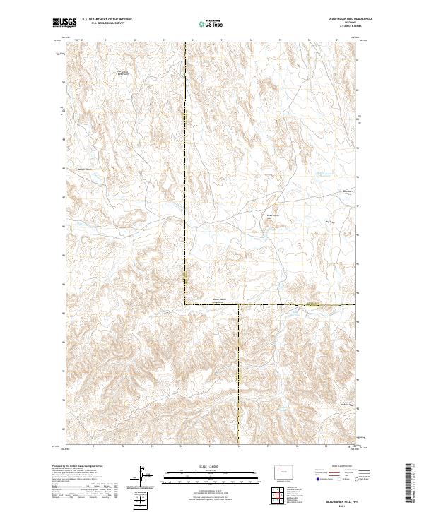 2021 Dead Indian Hill2021 Print · USGSRanching history and water rights converge in this high-desert region of Wyoming. Trace the land use of local families through landmarks like Horseshoe Bedground, Hunt Reservoir, and Dead Indian Hill.
 - 2021 Map of White Sulphur Spring, 2021 Print
 2021 White Sulphur Spring2021 Print · USGSBig Horn County's high-desert terrain is documented here in the early twenty-first century, showing a landscape of deep canyons and isolated water sources. Researchers can trace the path of Red Gulch Rd past White Sulphur Spring and the steep drop-offs at Devils Leap.
 - 2021 Map of Tatman Mountain, 2021 Print
 2021 Tatman Mountain2021 Print · USGSThe Bighorn Basin comes into sharp focus during the early 2020s, revealing a landscape of prominent peaks and deep erosional draws. Local historians can trace the remote county line and navigate the high terrain surrounding Tatman Mtn, Fenton Pass, and Sheets Mtn.
 - 2021 Map of Sykes Spring, 2021 Print
 2021 Sykes Spring2021 Print · USGSBig Horn County, Wyoming, is captured here in the early 21st century, showing the transition from the high Pryor Mountains to Bighorn Canyon. Researchers can trace the Dew and Duffield Ditch and historic routes like the Yellowtail Mining Road.
Showing maps 1-25 of 84
Top cities of Big Horn County
- Lovell historical maps
- Greybull historical maps
- Basin historical maps
- Cowley historical maps
- Byron historical maps
- Burlington historical maps
See more
Frequently asked questions
- What are the different types of historical maps available for Big Horn County?
- What is the oldest map of Big Horn County?
- Where can I purchase historical maps of Big Horn County for my home or office?
- Where can I download high-res historical maps of Big Horn County?
- Are there historical topographic maps available for Big Horn County?
- Is there historical aerial imagery available for Big Horn County?
- Where are historical maps of Big Horn County sourced from?