Old Maps of Big Horn County, Wyoming for Genealogy
Trace your family roots with 233 historic maps of Big Horn County. These high-res maps reveal old neighborhoods, homesites, landmarks, and streets — helping you uncover where your ancestors lived and how the area evolved over time.
- Explore historic neighborhoods: Identify where your relatives may have lived in the 1800s or 1900s.
- Compare maps over time: Trace the changes in streets, buildings, and landmarks for multi-generational research.
- Perfect for genealogy & ancestry research: Used by family historians and researchers to map out lineage and migration.
These maps are an incredible resource for exploring your personal connection to Big Horn County's past.
Big Horn County, WY maps
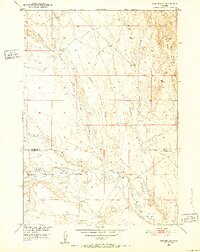
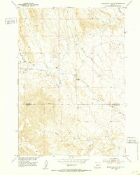
(233)- 1894 Map of St. Xavier
 1894 St. Xavier1894 Print · USGSThe Crow Indian Reservation in the 1890s is captured here just as the frontier era was closing. Researchers can trace the path of the Old Bozeman Military Road past St. Xavier Mission and the Site of Old Fort C. F. Smith.
 - 1895 Map of Dayton
 1895 Dayton1895 Print · USGSSheridan County and the Bighorn foothills are captured here in the late nineteenth century as ranching and transit began to define the region. Genealogists and researchers can trace the early road networks connecting Dayton, Ohlman, and the ranching hub at Beckton.
 - 1898 Map of Bald Mountain, 1957 Print
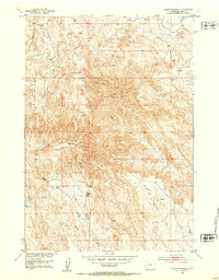
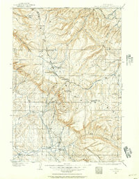 1898 Bald Mountain1957 Print · USGSThe northern Bighorn Mountains appear in the 1890s as a frontier of high-altitude ranching and mining. Trace the early trails leading to the Fortunatus Mill, remote landmarks like Sheldons Ranch, and the isolated settlement of Cloverly.2 unique versions available
 - 1899 Map of Cloud peak, 1960 Print
 1899 Cloud peak1960 Print · USGSThe high wilderness of the Big Horn Mountains is captured here at the end of the century, showing the remote crest and early county boundaries. Hikers and historians can trace the paths to Lake Helen, the outposts at Soldier Park, and the heights of Cloud Pk.
 - 1901 Map of Cloud Peak
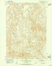
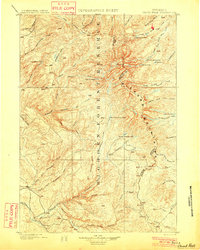 1901 Cloud Peak1901 Print · USGSThe high alpine country of the Big Horn range is captured here at the turn of the century just after its designation as a Forest Reserve. Researchers can trace the rugged headwaters of the Powder River and find remote landmarks like Lake Solitude, Black Butte, and Cloud Peak Lake.7 unique versions available
 - 1901 Map of Dayton
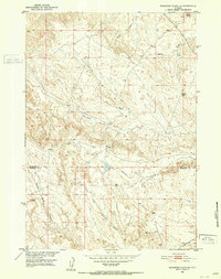
 1901 Dayton1901 Print · USGSSheridan County and the Montana borderlands are captured here at the turn of the century as the railroad reshapes the valley. Researchers can trace early settlements and ranching outposts like Slack, Beckton, and the Morrow Ranch along the Tongue River.5 unique versions available
 - 1901 Map of St. Xavier
 1901 St. Xavier1901 Print · USGSBig Horn County at the turn of the century shows a frontier landscape shaped by military history and the early years of the Crow Reservation. Researchers can trace the path of the Old Bozeman Military Road past the Site of Old Fort C. F. Smith and the St. Xavier Mission.4 unique versions available
 - 1901 Map of Bald Mountain
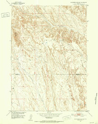
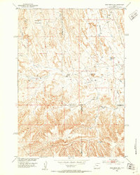
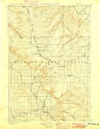 1901 Bald Mountain1901 Print · USGSNorthern Wyoming's high peaks and timber reserves are captured here at the turn of the century. Researchers can trace early industrial sites like Fortunatus Mill and the isolated settlement of Cloverly near the Shell Creek drainage.4 unique versions available
 - 1951 Map of Burlington, 1952 Print
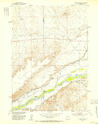
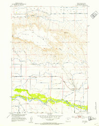
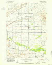 1951 Burlington1952 Print · USGSBig Horn County irrigation and ranching are in full view during the early fifties, showing how the river was harnessed to green the basin. Researchers can trace the water lines of the Bench Canal and St Joe Canal or find the Avent School and Emblem Cemetery.3 unique versions available
 - 1951 Map of Sucker Dam, 1952 Print
 1951 Sucker Dam1952 Print · USGSBig Horn and Washakie counties are shown in the early fifties during a period of Missouri River Basin development. Researchers can locate family-named landmarks like the Rex Mueller Cabin (Aban'd) and the namesake Sucker Dam.2 unique versions available
 - 1951 Map of Schuster Flats NE, 1952 Print
 1951 Schuster Flats NE1952 Print · USGSBig Horn and Washakie counties meet in this drainage basin during the early fifties energy boom. Genealogists and historians can trace old trails and resource development through labeled Oil Well sites and local landmarks like Dobie Butte and Alamo Creek.3 unique versions available
 - 1951 Map of Schuster Flats NW, 1952 Print
 1951 Schuster Flats NW1952 Print · USGSThe arid lands of the Bighorn Basin are captured here in the early fifties, straddling the Big Horn Co and Washakie Co line. Researchers can trace the intricate drainages of Fivemile Creek and the landmark Red Butte.2 unique versions available
 - 1951 Map of Y U Bench NE, 1953 Print
 1951 Y U Bench NE1953 Print · USGSIn the early 1950s, this portion of the Greybull River valley showcases the intensive irrigation systems vital to Wyoming ranching. Researchers can trace historic water rights and family holdings like Thayer Ranch, the Renner-Sims site, and the Fenton School.3 unique versions available
 - 1951 Map of Sheep Mountain, 1953 Print
 1951 Sheep Mountain1953 Print · USGSBig Horn County, Wyoming, is shown here in the early fifties as a landscape of high ridges and developing water infrastructure. Genealogists and historians can trace local landmarks like Tatman Mountain, the St Joe Canal, and Neres Reservoir.2 unique versions available
 - 1951 Map of Tatman Mountain, 1953 Print
 1951 Tatman Mountain1953 Print · USGSThe Bighorn Basin high country is captured here in the early fifties, showing the upland terrain between Park and Big Horn counties. Local historians can trace early routes through Fenton Pass and across landmarks like Tatman Mountain and Sheets Mountain.2 unique versions available
 - 1951 Map of Wardel Reservoir, 1953 Print
 1951 Wardel Reservoir1953 Print · USGSBig Horn County irrigation and water management are captured here in the early fifties during the Missouri River Basin development era. Genealogists and historians can trace the vital network of the Joe Canal and Fairview Ditch near Wardel Reservoir.
 - 1951 Map of Otto, 1953 Print
 1951 Otto1953 Print · USGSThe Greybull River valley in the early fifties shows a landscape transformed by irrigation. Researchers can trace the homestead-era roots of Otto and Webster, and find the location of the Stringtown School and several family-named ditches.2 unique versions available
 - 1951 Map of Dead Indian Hill, 1953 Print
 1951 Dead Indian Hill1953 Print · USGSThe high grazing lands of Park and Big Horn Counties are captured here in the early fifties, showing a remote landscape of canyons and livestock bedgrounds. Researchers can locate specific family landmarks and homesteads like the Mc Donald Cabins, Johnson Cabin, and the Sales Place.2 unique versions available
 - 1951 Map of Dutch Nick Flat NW, 1953 Print
 1951 Dutch Nick Flat NW1953 Print · USGSThe Big Horn Basin rangeland is captured here in the early fifties, showing a landscape defined by seasonal watercourses and remote ranching outposts. Researchers can trace the path of Fenton Pass Road and locate landmarks like Mueller Cabin or Rock Waterhole Creek.2 unique versions available
 - 1954 Map of Billings, 1963 Print
 1954 Billings1963 Print · USGSThe Yellowstone valley during the mid-fifties shows a landscape of thriving rail towns and high-mountain outposts. Genealogists and historians can trace old homesteads and mining routes near Red Lodge, Bearcreek, and along the Bighorn River.4 unique versions available
 - 1954 Map of Hardin, 1964 Print
 1954 Hardin1964 Print · USGSSoutheastern Montana is documented here during the mid-fifties, showing the vast tribal lands and historic battle sites before modern highway expansion. Researchers can trace the Chicago Burlington and Quincy rail line through Hardin or locate the Custer National Cemetery and Museum.2 unique versions available
 - 1955 Map of Cody, 1969 Print
 1955 Cody1969 Print · USGSThe Bighorn Basin and Absaroka Range meet in the mid-fifties, capturing a landscape defined by mountain wilderness and burgeoning oil fields. Trace family roots in Cody or Meeteetse, and locate industrial landmarks like the Elk Basin Oil and Gas Field and the Chicago Burlington and Quincy RR.2 unique versions available
 - 1955 Map of Sheridan, 1973 Print
 1955 Sheridan1973 Print · USGSThe Bighorn Mountains meet the Powder River Basin in the 1950s, a period when cattle ranching and coal mining defined the regional economy. Genealogists and historians can trace local landmarks like the Fort Mackenzie Veteran Hospital, the Monarch Coal Mine, and legacy operations such as the Beckton Stock Farm.2 unique versions available
 - 1957 Map of Hardin
 1957 Hardin1957 Print · USGSSoutheastern Montana in the mid-fifties reveals a landscape shaped by tribal lands and the historic Bighorn river valleys. Researchers can trace the Chicago Burlington and Quincy RR through Hardin and locate the National Cemetery and Custer Battlefield Monument.
 - 1957 Map of Billings
 1957 Billings1957 Print · USGSThe Yellowstone River valley and the rugged Beartooth Mountains meet in the mid-1950s near the growing hub of Billings. Genealogists and researchers can trace rail and ranching history through river towns like Columbus, the mining heritage of Red Lodge, and the vast Crow Indian Reservation.
Showing maps 1-25 of 233
Top cities of Big Horn County
- Lovell historical maps
- Greybull historical maps
- Basin historical maps
- Cowley historical maps
- Byron historical maps
- Burlington historical maps
See more
Frequently asked questions
- What are the different types of historical maps available for Big Horn County?
- What is the oldest map of Big Horn County?
- Where can I purchase historical maps of Big Horn County for my home or office?
- Where can I download high-res historical maps of Big Horn County?
- Are there historical topographic maps available for Big Horn County?
- Is there historical aerial imagery available for Big Horn County?
- Where are historical maps of Big Horn County sourced from?