1990s Maps of Big Horn County, Wyoming
Explore 27 historic maps of Big Horn County from the 1990s. These maps offer a rare glimpse into what life looked like during the 1990s — showing old roads, neighborhoods, homes, and landmarks that have changed or disappeared over time.
Whether you're researching your family's past, planning a metal detecting trip, or studying how Big Horn County's landscape evolved across the 1990s, these high-resolution maps are a powerful tool for exploring the history of this region.
- Focus on a specific era: All maps on this page are from the 1990s, giving you a focused view of this time period.
- See what’s changed: Compare century-old streets, trails, and buildings to today's modern landscape using overlays and satellite layers.
- Research with precision: Use these maps for genealogy, historical research, land use analysis, or educational projects.
- View, download, or print: Maps are fully viewable online in high resolution, and can be downloaded or printed for your own records.
Start exploring Big Horn County's history through authentic maps from the 1990s. This is your window into the past.
Big Horn County, WY maps
(27)- 1993 Map of Hidden Tepee Creek, 1997 Print
 1993 Hidden Tepee Creek1997 Print · USGSHigh in the Bighorn Mountains during the early nineties, this survey documents the rugged cattle country and high-altitude trails on the county line. Trace the path of the Medicine Wheel Passage Scenic Byway and find remote landmarks like Horse Creek Cow Camp and Sunlight Mesa.
 - 1993 Map of Spanish Point, 1997 Print
 1993 Spanish Point1997 Print · USGSBig Horn County's high-country wilderness is documented here in the early 1990s, highlighting the intersection of game management and national forest lands. Researchers can locate the historic Paint Rock Lodge, the Hyatt Ranch, and remote paths like the Medicine Lodge Trail.
 - 1993 Map of Lake Helen, 1997 Print
 1993 Lake Helen1997 Print · USGSThe high Bighorn Mountains are captured here in the early nineties, centered on the high-altitude wilderness of Cloud Peak. Hikers and historians can trace the paths of the Solitude Trail through Florence Pass and locate remote outposts like West Tensleep.
 - 1993 Map of Mexican Hill, 1997 Print
 1993 Mexican Hill1997 Print · USGSThe high wilderness of Big Horn County is captured here in the early 1990s, showcasing the dramatic drainage systems and alpine basins. Researchers can trace seasonal land use at Cow Camp and find landmarks like Bucking Mule Falls and Mexican Hill.
 - 1993 Map of Shell Lake, 1997 Print
 1993 Shell Lake1997 Print · USGSThe high Bighorn Mountains come into sharp focus in the early nineties, showcasing the alpine lakes and trail systems of the Bighorn National Forest. Backcountry travelers and researchers can trace the historic Edelman Trail through Dutch Oven Pass to remote waters like Little Shell Lake and Lake Geneva.
 - 1993 Map of Lake Solitude, 1997 Print
 1993 Lake Solitude1997 Print · USGSBig Horn County during the 1990s reveals a high-altitude landscape defined by seasonal ranching and protected wilderness. Researchers can trace the trails and seasonal outposts of a working backcountry, from Hyatt Cow Camp to the shores of Lake Solitude and Lily Lake.
 - 1993 Map of Cloud Peak, 1997 Print
 1993 Cloud Peak1997 Print · USGSThe Bighorn Mountains reach their pinnacle in the early 1990s as federal agencies map the high alpine wilderness of Johnson County. Researchers can trace the paths of the Solitude Trail through glacial basins to Lake Geneva, Black Tooth Mountain, and Kearny Reservoir.
 - 1993 Map of Ice Creek, 1997 Print
 1993 Ice Creek1997 Print · USGSThe Bighorn Mountains in the early nineties were a landscape of primitive roads and river headwaters near the county line. Researchers can trace the path of the Medicine Wheel Passage Scenic Byway past Burgess Overlook and the Tongue River.
 - 1993 Map of Meadowlark Lake, 1997 Print
 1993 Meadowlark Lake1997 Print · USGSBighorn National Forest high country comes to life in the early nineties as recreation and forestry intersect. Outdoor historians and genealogists can trace family-named sites and mountain outposts like Meadowlark Lodge, the Tyrell Ranger Sta, and St Christopher in the Bighorn.
 - 1993 Map of Brokenback Narrows, 1997 Print
 1993 Brokenback Narrows1997 Print · USGSThe Big Horn National Forest high country during the 1990s reveals a landscape of administrative outposts and deep canyons. Researchers can trace remote trails to Soldier Creek Camp, the Brokenback Narrows, and isolated landmarks like Lone Tree Spring.2 unique versions available
 - 1993 Map of Black Mountain, 1997 Print
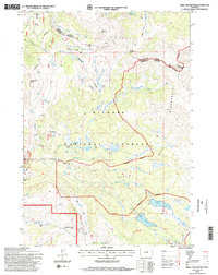
 1993 Black Mountain1997 Print · USGSBig Horn County's high-country terrain is captured here in the early nineties, showcasing the intersection of canyon roads and national forest lands. Local historians can trace landmarks like Trapper Lodge Ranch, the Iowa State Univ Geology Camp, and the winding Shell Canyon Scenic Byway.
 - 1993 Map of Granite Pass, 1997 Print
 1993 Granite Pass1997 Print · USGSThe high ridges of the Bighorn Mountains come into focus in the early 1990s as this survey documents the boundary between Sheridan and Big Horn Counties. Researchers can trace the path of the Bighorn Scenic Byway and locate high-altitude landmarks like Granite Pass and Cedar Mountain.
 - 1993 Map of Shell Falls, 1997 Print
 1993 Shell Falls1997 Print · USGSThe high Bighorn National Forest comes alive in the 1990s as this survey traces the deep cut of Shell Canyon. Researchers can locate legacy forestry sites like the Shell Ranger Station and early recreation at Antelope Butte Ski Area.
 - 1993 Map of Bald Mountain, 1997 Print
 1993 Bald Mountain1997 Print · USGSBighorn National Forest's high peaks and ancient landmarks are surveyed here in the early nineties, straddling the line between Big Horn and Sheridan Counties. Researchers can locate the Bald Mountain City (Site) and the Medicine Wheel, or trace old roads to Cow Camp and Sheep Camp.
 - 1993 Map of Boyd Ridge, 1997 Print
 1993 Boyd Ridge1997 Print · USGSThe high ridges of the Bighorn Mountains come into focus in the 1990s as this survey traces the rugged boundary of Sheridan and Big Horn Counties. Researchers can locate remote high-country infrastructure including the Marble Quarry, a lone mountain Cem, and seasonal outposts like Cow Camp.
 - 1993 Map of Allen Draw, 1997 Print
 1993 Allen Draw1997 Print · USGSBig Horn County ranching and wildlife management are well-documented in the 1990s as the high-country landscape supported seasonal grazing and winter habitat. Trace early range infrastructure and mountain roads like Greers Cow Camp, Paintrock Ten Sleep Rd, and Cold Springs.2 unique versions available
 - 1993 Map of Dome Lake, 1997 Print
 1993 Dome Lake1997 Print · USGSHigh-altitude watersheds and granite peaks of the Bighorn Mountains are documented here in the early nineties. Researchers can trace historic water management at Dome Lake Reservoir and Weston Reservoir, or locate landmarks like Saddle Mountain and Preacher Rock.
 - 1993 Map of Leavitt Reservoir, 1997 Print
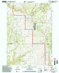
 1993 Leavitt Reservoir1997 Print · USGSHigh-country ranching and forest management are central to this part of the Bighorn Mountains in the early nineties. Researchers can trace historic access routes like the Beaver Creek Trail and locate family-named landmarks such as the Leavitt Ranch and Leavitt Reservoir.
 - 1993 Map of Shell, 1997 Print
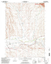 1993 Shell1997 Print · USGSIn the Big Horn Basin during the early nineties, the ranching community of Shell remains centered around its vital water rights and forest access. Genealogists and local historians can trace family-named landmarks like Flitners Corner and Whaley Cem.
 - 1993 Map of Woodrock, 1997 Print
 1993 Woodrock1997 Print · USGSBighorn National Forest at the start of the 1990s reveals a high-altitude landscape of timber heritage and remote mountain camps. Genealogists and historians can locate old sites like Woodrock, the Taylor Mine, and the unique Tie Flum logging relic.2 unique versions available
 - 1993 Map of Shell Reservoir, 1997 Print
 1993 Shell Reservoir1997 Print · USGSBighorn National Forest remains a wild landscape of high peaks and alpine lakes in the early nineties. Researchers can trace the Adelaide Trail to Shell Reservoir or locate the remote Ranger Creek Ranch and Dome Peak.2 unique versions available
 - 1993 Map of Cottonwood Canyon, 1997 Print
 1993 Cottonwood Canyon1997 Print · USGSBig Horn County at the edge of the mountains comes into focus during the early nineties, showing where public forest land meets the open range. Researchers can trace historic water rights and land use via High Ditch, Melody Falls, and numerous Prospects.
 - 1993 Map of Medicine Wheel, 1997 Print
 1993 Medicine Wheel1997 Print · USGSBig Horn, Wyoming, in the early 1990s reflects a landscape of sacred sites and heavy transit infrastructure. Researchers can locate the Medicine Wheel National Historic Landmark, high-altitude Cow Camp sites, and multiple runaway truck ramps.2 unique versions available
 - 1993 Map of Bear Creek Ranch, 1997 Print
 1993 Bear Creek Ranch1997 Print · USGSBig Horn County's high ranching country and forest fringe are captured here in the early nineties. Genealogists and local historians can trace the reach of Bear Creek Ranch and locate remote landmarks like Lampman Reservoirs and Black Butte.
 - 1996 Map of Mystery Cave, 1999 Print
 1996 Mystery Cave1999 Print · USGSThe Pryor Mountains during the mid-nineties show a landscape defined by wild horse management and national forest boundaries. Researchers can trace land use patterns through mines, prospects, and landmarks like Mystery Cave and Devil Canyon Overlook.
Showing maps 1-25 of 27
Top cities of Big Horn County
- Lovell historical maps
- Greybull historical maps
- Basin historical maps
- Cowley historical maps
- Byron historical maps
- Burlington historical maps
See more
Frequently asked questions
- What are the different types of historical maps available for Big Horn County?
- What is the oldest map of Big Horn County?
- Where can I purchase historical maps of Big Horn County for my home or office?
- Where can I download high-res historical maps of Big Horn County?
- Are there historical topographic maps available for Big Horn County?
- Is there historical aerial imagery available for Big Horn County?
- Where are historical maps of Big Horn County sourced from?