1960s Maps of Big Horn County, Wyoming
Explore 68 historic maps of Big Horn County from the 1960s. These maps offer a rare glimpse into what life looked like during the 1960s — showing old roads, neighborhoods, homes, and landmarks that have changed or disappeared over time.
Whether you're researching your family's past, planning a metal detecting trip, or studying how Big Horn County's landscape evolved across the 1960s, these high-resolution maps are a powerful tool for exploring the history of this region.
- Focus on a specific era: All maps on this page are from the 1960s, giving you a focused view of this time period.
- See what’s changed: Compare century-old streets, trails, and buildings to today's modern landscape using overlays and satellite layers.
- Research with precision: Use these maps for genealogy, historical research, land use analysis, or educational projects.
- View, download, or print: Maps are fully viewable online in high resolution, and can be downloaded or printed for your own records.
Start exploring Big Horn County's history through authentic maps from the 1960s. This is your window into the past.
Big Horn County, WY maps
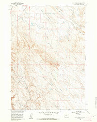
(68)- 1960 Map of Shell Falls, 1962 Print
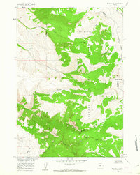
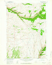
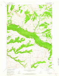 1960 Shell Falls1962 Print · USGSBighorn National Forest at the start of the 1960s shows a landscape geared toward recreation and resource management. Researchers can trace the mid-century forest infrastructure, from the Shell Creek Ranger Sta to remote sites like Snowshoe Pass and Cabin Creek Campground.2 unique versions available
 - 1960 Map of White Sulphur Spring, 1962 Print
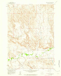
 1960 White Sulphur Spring1962 Print · USGSBig Horn County in the early sixties is a landscape of high basins and critical water sources. Researchers can trace the drainage patterns of Webber Canyon or locate natural landmarks like Devils Leap and White Sulphur Spring.
 - 1960 Map of Black Mountain, 1962 Print
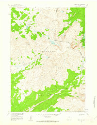
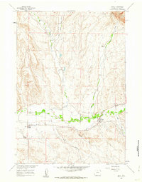
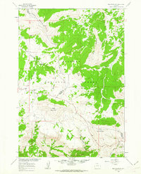
 1960 Black Mountain1962 Print · USGSThe Bighorn National Forest high country comes into focus in the early sixties, showing the rugged ranching and research outposts of the era. Locate remote landmarks like the Iowa State Univ Geology Camp, Trapper Lodge Ranch, and the Post Creek Picnic Area.3 unique versions available
 - 1960 Map of Medicine Wheel, 1962 Print
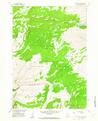
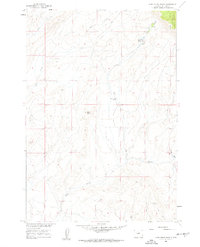
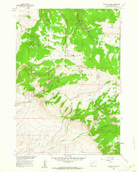 1960 Medicine Wheel1962 Print · USGSBig Horn, Wyoming, in the early sixties is captured here as a landscape of high-country summits and ancient sites. Researchers can locate the Medicine Wheel (Archeological Site) and trace watercourses like Porcupine Creek or the path to Five Springs Campground.3 unique versions available
 - 1960 Map of Shell Lake, 1962 Print
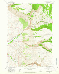
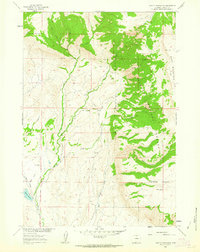
 1960 Shell Lake1962 Print · USGSBighorn National Forest in the early sixties remained a backcountry expanse accessible primarily by pack trails and mountain passes. Trace the old routes through Dutch Oven Pass and locate remote landmarks like the Lake Geneva Campground and Teepee Pole Flats.4 unique versions available
 - 1960 Map of Lake Solitude, 1962 Print
 1960 Lake Solitude1962 Print · USGSBig Horn, Wyoming, in the early sixties is a landscape of high-country grazing and alpine basins. Trace the old seasonal work sites of the Bighorn Mountains at Hyatt Cow Camp and Buck Creek Cow Camp or follow the trails to Lake Solitude.4 unique versions available
 - 1960 Map of Manderson, 1962 Print
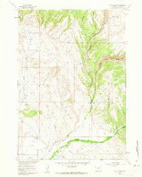
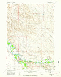 1960 Manderson1962 Print · USGSManderson was a bustling hub of river, rail, and refinery operations at the start of the 1960s. Researchers can trace the legacy of the regional energy boom through the Manderson Field and Sulphur Plant, or locate family sites near the Manderson Cem.2 unique versions available
 - 1960 Map of Flitner Reservoir, 1962 Print
 1960 Flitner Reservoir1962 Print · USGSBig Horn County ranching and water rights are captured here in the early sixties as the Missouri River Basin project modernized the West. Trace the legacy of the Walters Ranch and remote water infrastructure like the Anita Ditch and Flitner Reservoir.
 - 1960 Map of Spanish Point, 1962 Print
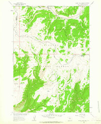
 1960 Spanish Point1962 Print · USGSBig Horn County, Wyoming, is shown here in the early 1960s as a landscape of high-country grazing and forest management. Researchers can locate remote outposts like Taylor Cow Camp, trace the Edelman Trail, and find the historic Paint Rock Lodge.4 unique versions available
 - 1960 Map of Boyd Ridge, 1962 Print
 1960 Boyd Ridge1962 Print · USGSHigh in the northern Bighorns during the late fifties, this area was a landscape of remote resource extraction and steep drainages. Researchers can trace the industrial footprint of the Marble Quarry and follow the high-country paths of Boyd Ridge and Wagon Box Creek.3 unique versions available
 - 1960 Map of Mexican Hill, 1962 Print
 1960 Mexican Hill1962 Print · USGSThe high country of the Big Horn Mountains comes alive in this early 1960s survey of the county line. Trace remote footpaths and landmarks like Cow Camp, Bucking Mule Falls, and the steep terrain of Devils Canyon.2 unique versions available
 - 1960 Map of Hyatt Ranch, 1962 Print
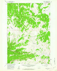
 1960 Hyatt Ranch1962 Print · USGSBig Horn County ranching and rugged canyons are captured in this early 1960s survey during the development of the Missouri River Basin. Genealogists and historians can locate family holdings like Taylor Ranch or trace the early paths leading to the Hyattville Cem and Medicine Lodge Canyon.4 unique versions available
 - 1960 Map of Granite Pass, 1962 Print
 1960 Granite Pass1962 Print · USGSHigh in the Bighorn Mountains during the early sixties, this terrain shows the divide between Sheridan and Big Horn counties. Trace high-altitude landmarks and water sources like Granite Pass, Copemans Tomb, and Three Springs.2 unique versions available
 - 1960 Map of Manderson NE, 1962 Print
 1960 Manderson NE1962 Print · USGSBig Horn County at the start of the sixties shows a landscape of petroleum prospecting and high-desert terrain. You can trace early drilling sites at various Oil Well locations and follow the winding Jeep Trails across Potato Ridge.
 - 1960 Map of Hidden Tepee Creek, 1962 Print
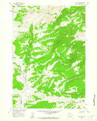
 1960 Hidden Tepee Creek1962 Print · USGSHigh in the Big Horn Mountains during the early sixties, this terrain showcases a landscape defined by livestock grazing and forest management. Researchers can find seasonal outposts like Horse Creek Cow Camp and trace the winding paths of Hunt Mountain Road and Hidden Tepee Creek.2 unique versions available
 - 1960 Map of Bush Butte, 1962 Print
 1960 Bush Butte1962 Print · USGSBig Horn County's high-country terrain is documented in the early 1960s, showing a landscape shaped by deep canyons and remote springs. Genealogists and historians can trace old routes via jeep trails past Bush Butte, Sheep Springs, and Trapper Creek Canyon.3 unique versions available
 - 1960 Map of Devils Kitchen, 1962 Print
 1960 Devils Kitchen1962 Print · USGSBig Horn County at the start of the 1960s reveals a landscape defined by industrial clay mining and intricate irrigation. Researchers can trace water systems like the Scharen Thompson Aqueduct and locate landmarks such as Devils Kitchen and Lot 39.2 unique versions available
 - 1960 Map of Shell, 1962 Print
 1960 Shell1962 Print · USGSBig Horn County ranching and irrigation are central to this early 1960s study of the Bighorn foothills. Genealogists and historians can trace family land at Flitners Corner, locate Whaley Cem, and map the vital Shell Canal network.2 unique versions available
 - 1960 Map of Manderson SE, 1962 Print
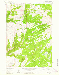
 1960 Manderson SE1962 Print · USGSThe Big Horn County landscape near the Nowood River comes into focus in the early sixties, showing a period of active land surveying and energy exploration. Trace the path of the Shafer Ditch or locate early Oil Wells and the Jeep Trail across Basin Flats.
 - 1960 Map of Bear Creek Ranch, 1962 Print
 1960 Bear Creek Ranch1962 Print · USGSBig Horn County's high country is captured in the early 1960s, showing a landscape of forest management and ranching. Researchers can trace the network of Jeep Trails leading to Bear Creek Ranch and locate remote water sources like Lampman Reservoirs.2 unique versions available
 - 1960 Map of Wild Horse Flats, 1962 Print
 1960 Wild Horse Flats1962 Print · USGSThe Big Horn Basin was a landscape of energy and irrigation during the early sixties. Researchers can trace the footprint of the petroleum industry at Torchlight Field and locate water infrastructure like the Shell Canal and Carey Reservoir.2 unique versions available
 - 1960 Map of Bald Mountain, 1962 Print
 1960 Bald Mountain1962 Print · USGSThe high Bighorn Mountains at the start of the 1960s reveal a landscape of remote ranger stations and alpine camps. Researchers can locate the historic Bald Mountain City (Site) or trace the Sheep Mountain Road past Rooster Hill and Bald Mountain.3 unique versions available
 - 1960 Map of Leavitt Reservoir, 1963 Print
 1960 Leavitt Reservoir1963 Print · USGSBig Horn County at the start of the 1960s showcases a high-desert landscape managed for ranching and water storage. Researchers can locate the Leavitt Ranch, trace the path of the London Ditch, and explore the terrain of Hunt Mountain and Horse Creek Mesa.3 unique versions available
 - 1962 Map of Sheridan
 1962 Sheridan1962 Print · USGSThe Big Horn Mountains and Powder River country are captured here in the early sixties as energy production and ranching shaped northern Wyoming. Researchers can locate specific sites like the Kleenburn Coal Tipple, Eaton Bros Ranch, and the Fort McKenzie Veteran Hospital.
 - 1962 Map of Cody
 1962 Cody1962 Print · USGSBig Horn Basin energy and agriculture define this mid-century look at Wyoming’s northern frontier. Local historians can trace the irrigation and rail networks connecting Cody and Powell to major energy sites like the Oregon Basin Oil Field.
Showing maps 1-25 of 68
Top cities of Big Horn County
- Lovell historical maps
- Greybull historical maps
- Basin historical maps
- Cowley historical maps
- Byron historical maps
- Burlington historical maps
See more
Frequently asked questions
- What are the different types of historical maps available for Big Horn County?
- What is the oldest map of Big Horn County?
- Where can I purchase historical maps of Big Horn County for my home or office?
- Where can I download high-res historical maps of Big Horn County?
- Are there historical topographic maps available for Big Horn County?
- Is there historical aerial imagery available for Big Horn County?
- Where are historical maps of Big Horn County sourced from?