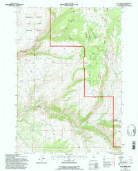
1993 Map of Allen Draw
USGS Topo · Published 1997About this map
Medicine Lodge Big Game Winter Range dominates the western slopes of this region, where the high mountain terrain transitions into managed wildlife habitat. The landscape is defined by the drainage systems of Medicine Lodge Creek and several branches of Paint Rock Creek, which carve deep canyons through the uplifted topography. Within the boundaries of the Bighorn National Forest, the map records essential range infrastructure such as Greers Cow Camp and numerous stock ponds, indicating the area's continued use for livestock grazing alongside wildlife conservation. This 1993 revision, based on photographs dating back to 1957, captures a complex network of 4WD trails and unimproved roads, including the Paintrock Ten Sleep Rd, which provided critical access for seasonal land management and ranching operations. Distinctive landmarks like Bear Mtn and The Island provide clear orientation points within this high-altitude wilderness.
Find a feature on this map
25 named features on this map. Tap any name to fly to it.
Don’t see what you’re looking for? This feature index may not catch every label — zoom into the map to look around manually.
Map Details
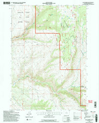
Editions of this 1993 Allen Draw Map
2 editions found
Other maps of this area

1899 · Cloud peak
USGS Topo · 1:125,000

1901 · Cloud Peak
USGS Topo · 1:125,000

1955 · Sheridan
USGS Topo · 1:250,000

1958 · Sheridan
USGS Topo · 1:250,000

1960 · Shell Lake
USGS Topo · 1:24,000

1960 · Lake Solitude
USGS Topo · 1:24,000

1960 · Spanish Point
USGS Topo · 1:24,000

1960 · Hyatt Ranch
USGS Topo · 1:24,000
1960 · Bush Butte
USGS Topo · 1:24,000

1962 · Sheridan
USGS Topo · 1:250,000