Old Maps of Savery, Wyoming for Academic Research
Study the evolution of Savery with 14 high-resolution historic maps. Whether you're teaching, researching, or modeling changes in land use, these maps provide essential visual documentation of urban, environmental, and geographic change.
- Analyze long-term change: Track patterns in development, transportation, and natural features.
- Ideal for environmental or urban studies: Support academic projects with primary historical map data.
- Use in the classroom or lab: Educators and researchers rely on these maps to bring historical context to life.
These maps are a powerful tool for teaching, research, and visualizing how Savery has changed over the decades.
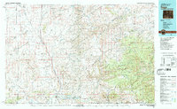
Savery, WY maps
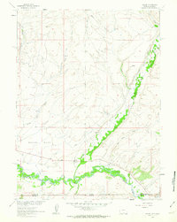
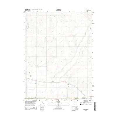
(14)- 1932 Map of Savery
 1932 Savery1932 Print · USGSSouthern Wyoming ranching and mining country meet at the edge of the Rockies in the early thirties. Genealogists and historians can locate rural schools like Ketchum Sch, the operations of Pioneer Coal Co, and the remote Tullis settlement.3 unique versions available
 - 1940 Map of Savery
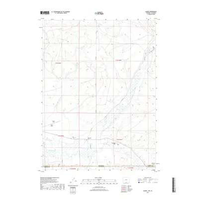
 1940 Savery1940 Print · USGSThe high country of the Wyoming-Colorado border is captured here as the ranching and forest service outposts of the early twentieth century were becoming established. Researchers can trace the remote Snake River drainage and find historic sites like Tullis, Savery, and the Rambler Ranger Sta.2 unique versions available
 - 1954 Map of Rawlins, 1968 Print
 1954 Rawlins1968 Print · USGSThe high plains and mountain ranges of southern Wyoming are shown here in the mid-1950s as the Union Pacific railroad and early highways fueled local industry. Genealogists and historians can trace old homesteads and outposts like the Overland Stage Station, the Utah Oil Refining Station, and the Hadsell Winter Headquarters.2 unique versions available
 - 1958 Map of Rawlins
 1958 Rawlins1958 Print · USGSSouthern Wyoming at the mid-century shows a landscape defined by the Union Pacific Railroad and the high basins of the Continental Divide. Researchers can trace old transportation routes near Fort Fred Steele or explore the mining history around Hanna and Medicine Bow.2 unique versions available
 - 1961 Map of Savery, 1963 Print
 1961 Savery1963 Print · USGSThe Little Snake River valley at the Wyoming-Colorado border is documented here in the early sixties. Genealogists and local historians can locate the Baker Cem and Reader Cem, while tracing the rural footprints of Savery and Slater.3 unique versions available
 - 1962 Map of Rawlins
 1962 Rawlins1962 Print · USGSSouthern Wyoming at the dawn of the sixties shows a landscape shaped by the Union Pacific and the high peaks of the Medicine Bow Mountains. Researchers can trace the path of the old stage routes through Overland Stage Station and Fort Fred Steele.
 - 1967 Map of Rawlins
 1967 Rawlins1967 Print · USGSCentral Wyoming and northern Colorado in the 1980s are defined here by the Union Pacific corridor and the high peaks of the Sierra Madre. Researchers can trace the legacy of old mining and rail towns like Carbon, Hanna, and Medicine Bow along the Overland Trail.
 - 1983 Map of Baggs
 1983 Baggs1983 Print · USGSSettlement along the Wyoming-Colorado border in the early eighties follows the path of the Little Snake River through Carbon and Moffat counties. Researchers can trace the path of the Overland Trail or locate historical mining sites like the Ferris-Haggarty Mine and Standard Mine.
 - 1988 Map of Rawlins
 1988 Rawlins1988 Print · USGSSouthern Wyoming and the Colorado borderlands are detailed here in the late eighties, featuring the intersection of the historic Overland Trail and the Union Pacific. Researchers can trace old rail towns like Medicine Bow and Wamsutter or landmark peaks like Medicine Bow Peak.
 - 2010 Map of Savery, 2010 Print
 2010 Savery2010 Print · USGSCovers Savery, including Carbon County, Moffat County, and other nearby areas
 - 2012 Map of Savery, 2012 Print
 2012 Savery2012 Print · USGSCovers Savery, including Carbon County, Moffat County, and other nearby areas
 - 2015 Map of Savery, 2015 Print
 2015 Savery2015 Print · USGSCovers Savery, including Carbon County, Moffat County, and other nearby areas
 - 2017 Map of Savery, 2017 Print
 2017 Savery2017 Print · USGSCovers Savery, including Carbon County, Moffat County, and other nearby areas
 - 2021 Map of Savery, 2021 Print
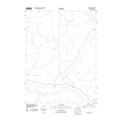
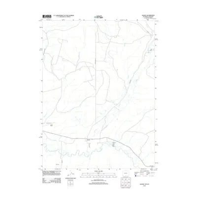
 2021 Savery2021 Print · USGSThe Carbon County borderlands near the Colorado line come into focus in this contemporary survey. Researchers can trace local lineage at Baker Cem and Reader Cem or follow the waters of the Little Snake River through the valley.
End of results
Showing maps 1-14 of 14
Top cities near Savery
Frequently asked questions
- What are the different types of historical maps available for Savery?
- What is the oldest map of Savery?
- Where can I purchase historical maps of Savery for my home or office?
- Where can I download high-res historical maps of Savery?
- Are there historical topographic maps available for Savery?
- Is there historical aerial imagery available for Savery?
- Where are historical maps of Savery sourced from?