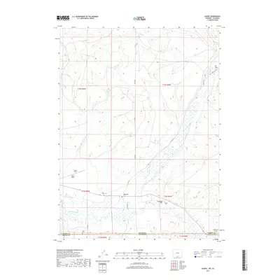
2017 Map of Savery
USGS Topo · Published 2017About this map
Savery sits at the heart of this high-country landscape, where the Little Snake River winds through the borderlands between Carbon County, Wyoming, and Moffat County, Colorado. The settlement pattern is defined by the river and its vital irrigation infrastructure, including the First Mesa Ditch and several smaller waterways like Putt Cr and Savery Cr. The terrain is marked by distinctive topographical features such as Dolan Mesa and several deep cuts into the landscape, including Big Gulch and Coal Bank Draw. Family and local history are preserved at the Baker Cem and Reader Cem, while the Dixon Airport suggests the continued modern utility of this ranching region. This survey details the complex network of county roads like CC RD 501 and Savery North RD that connect the remote valley to the broader region.
Find a feature on this map
27 named features on this map. Tap any name to fly to it.
Don’t see what you’re looking for? This feature index may not catch every label — zoom into the map to look around manually.
Map Details
Editions of this 2017 Savery Map
This is the sole edition of this map. No revisions or reprints were ever made.
Other maps of this area

1916 · Craig
USGS Topo · 1:125,000

1932 · Savery
USGS Topo · 1:96,000

1940 · Savery
USGS Topo · 1:125,000

1954 · Rawlins
USGS Topo · 1:250,000

1954 · Craig
USGS Topo · 1:250,000

1957 · Craig
USGS Topo · 1:250,000

1957 · Baggs
USGS Topo · 1:62,500

1958 · Rawlins
USGS Topo · 1:250,000

1958 · Craig
USGS Topo · 1:250,000

1960 · Craig
USGS Topo · 1:250,000