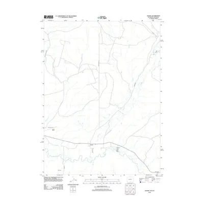
2012 Map of Savery
USGS Topo · Published 2012About this map
Savery sits at a critical junction in southern Wyoming, where the winding Little Snake River defines the landscape near the Colorado border. The settlement's connection to the surrounding high plains is marked by a network of drainage systems and irrigation works, including the First Mesa Ditch and the meandering Savery Cr. The topography is characterized by deep draws and elevated landforms like Dolan Mesa, with watercourses such as Dutch Joe Cr and Cottonwood Cr carving through the terrain. Local history is anchored by the Reader Cem and Baker Cem, while the Dixon Airport serves as a modern waypoint. This map captures the intersection of ranching life and rugged geography, from the named ravines of Coal Bank Draw to the remote track of Stock Dr.
Find a feature on this map
21 named features on this map. Tap any name to fly to it.
Don’t see what you’re looking for? This feature index may not catch every label — zoom into the map to look around manually.
Map Details
Editions of this 2012 Savery Map
This is the sole edition of this map. No revisions or reprints were ever made.
Other maps of this area

1916 · Craig
USGS Topo · 1:125,000

1932 · Savery
USGS Topo · 1:96,000

1940 · Savery
USGS Topo · 1:125,000

1954 · Rawlins
USGS Topo · 1:250,000

1954 · Craig
USGS Topo · 1:250,000

1957 · Craig
USGS Topo · 1:250,000

1957 · Baggs
USGS Topo · 1:62,500

1958 · Rawlins
USGS Topo · 1:250,000

1958 · Craig
USGS Topo · 1:250,000

1960 · Craig
USGS Topo · 1:250,000