Old Maps of Alpine Northeast, Wyoming for Genealogy
Trace your family roots with 21 historic maps of Alpine Northeast. These high-res maps reveal old neighborhoods, homesites, landmarks, and streets — helping you uncover where your ancestors lived and how the area evolved over time.
- Explore historic neighborhoods: Identify where your relatives may have lived in the 1800s or 1900s.
- Compare maps over time: Trace the changes in streets, buildings, and landmarks for multi-generational research.
- Perfect for genealogy & ancestry research: Used by family historians and researchers to map out lineage and migration.
These maps are an incredible resource for exploring your personal connection to Alpine Northeast's past.
Alpine Northeast, WY maps
(21)- 1931 Map of Jackson, 1961 Print
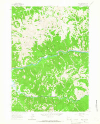
 1931 Jackson1961 Print · USGSJackson and the upper Snake River canyon are documented here in the early thirties, showcasing a wilderness era of ranching and forestry. Researchers can trace early outposts like Browns Ranch or locate family history at the Etna Cem and Johnny Counts Flat.
 - 1932 Map of Irwin
 1932 Irwin1932 Print · USGSThe Snake River corridor and the high mountain basins of eastern Idaho are captured here in the early 1930s. Researchers can trace early river crossings like Edwards Ferry or find small-community landmarks like Rainy Dale and Pumpkin Center Sch.2 unique versions available
 - 1935 Map of Irwin
 1935 Irwin1935 Print · USGSThe Idaho-Wyoming borderlands are captured here in the 1930s as the river economy and mountain ranching defined the region. Researchers can trace the early road networks and rural institutions from Edwards Ferry to local schools like Fidelity Sch and Blowout Sch.3 unique versions available
 - 1935 Map of Jackson
 1935 Jackson1935 Print · USGSThe high valleys of the Teton and Gros Ventre ranges are captured here in the mid-thirties, showing the early infrastructure of the upper Snake River region. Researchers can locate early schools and ranching outposts like Porcupine Sch, Browns Ranch, and the Jackson Mine.2 unique versions available
 - 1955 Map of Driggs, 1967 Print
 1955 Driggs1967 Print · USGSEastern Idaho and Western Wyoming appear at a mid-century crossroads as the river valleys were fully settled and the high peaks protected. Genealogists and researchers can trace the rail towns of Rexburg and Driggs or follow the Snake River from Irwin to the Palisades Reservoir.3 unique versions available
 - 1958 Map of Driggs
 1958 Driggs1958 Print · USGSThe high Teton peaks and Snake River valleys are captured here in the mid-fifties, showing the region's agricultural and wilderness boundaries. Researchers can trace the Union Pacific rail corridor through Rexburg or locate early settlements like Clementsville and Tetonia.2 unique versions available
 - 1962 Map of Driggs
 1962 Driggs1962 Print · USGSThe Idaho-Wyoming borderlands are captured here in the early sixties, showing the peaks and valleys of the northern Rockies. Genealogists and historians can trace rail lines like the Union Pacific RR and isolated outposts like the National Elk Refuge or the Fort Hall Indian Reservation.
 - 1963 Map of Ferry Peak, 1967 Print
 1963 Ferry Peak1967 Print · USGSThe Grand Canyon of the Snake River remains largely wild in the early sixties, defined by its high peaks and forest service campgrounds. Researchers can trace historic routes like the Indian Creek Trail or locate the Gaging Station near the Greys River junction.
 - 1966 Map of Alpine, 1969 Print
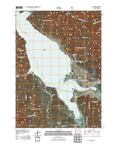
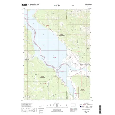
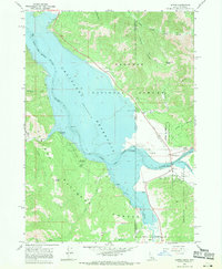 1966 Alpine1969 Print · USGSThe confluence of the Snake and Salt Rivers is captured here in the mid-1960s, just as the Palisades Reservoir shaped the modern landscape. Researchers can trace the early layout of Alpine, locate the Alpine Post Office, and find recreation sites like McCoy Creek Campground.4 unique versions available
 - 1981 Map of Jackson
 1981 Jackson1981 Print · USGSThe high valleys and peaks surrounding Jackson were undergoing subtle transitions in the early eighties. Genealogists and researchers can trace old mountain outposts like Bondurant, the location of Camp Davis, and the roads leading to Astoria Mineral Hot Springs.
 - 1986 Map of Palisades, 1987 Print
 1986 Palisades1987 Print · USGSThe Idaho-Wyoming borderlands are captured here in the mid-1980s, where the high ridges of the Caribou Range meet the vital Snake River corridor. Researchers can trace the water-management history of Palisades Reservoir or locate the Monte Cristo Mine and Evergreen Mine near the Caribou Basin.2 unique versions available
 - 1996 Map of Ferry Peak, 1998 Print
 1996 Ferry Peak1998 Print · USGSLincoln County in the mid-1990s is captured at the confluence of the Snake and Greys Rivers during a period of modern forest management. Trace topographic details from Ferry Peak to Little Jenny Lake, or locate specific sites like the Greys River Bridge Gaging Station and the Rock Quarry.2 unique versions available
 - 2011 Map of Alpine, 2011 Print
 2011 Alpine2011 Print · USGSCovers Alpine Northeast, including Alpine, Alpine Northwest, and other nearby areas
 - 2012 Map of Ferry Peak, 2012 Print
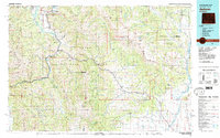
 2012 Ferry Peak2012 Print · USGSCovers Alpine Northeast, including Lincoln County, United States, and other nearby areas
 - 2015 Map of Alpine, 2015 Print
 2015 Alpine2015 Print · USGSCovers Alpine Northeast, including Alpine, Alpine Northwest, and other nearby areas
 - 2015 Map of Ferry Peak, 2015 Print
 2015 Ferry Peak2015 Print · USGSCovers Alpine Northeast, including Lincoln County, United States, and other nearby areas
 - 2017 Map of Ferry Peak, 2017 Print
 2017 Ferry Peak2017 Print · USGSCovers Alpine Northeast, including Lincoln County, United States, and other nearby areas
 - 2018 Map of Alpine, 2018 Print
 2018 Alpine2018 Print · USGSCovers Alpine Northeast, including Alpine, Alpine Northwest, and other nearby areas
 - 2021 Map of Alpine, 2021 Print
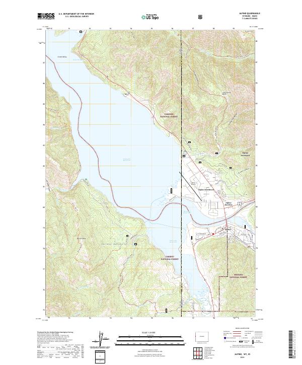 2021 Alpine2021 Print · USGSThe Idaho-Wyoming border comes alive in the early 2020s where the Snake and Salt Rivers meet the Palisades Reservoir. Researchers can trace modern settlements and forest boundaries near Alpine Junction, Alpine Hot Springs, and the Alpine Airport.
 - 2021 Map of Ferry Peak, 2021 Print
 2021 Ferry Peak2021 Print · USGSCovers Alpine Northeast, including Lincoln County, United States, and other nearby areas
 - 2023 Map of Ferry Peak, 2023 Print
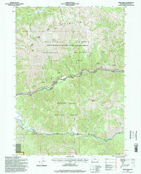
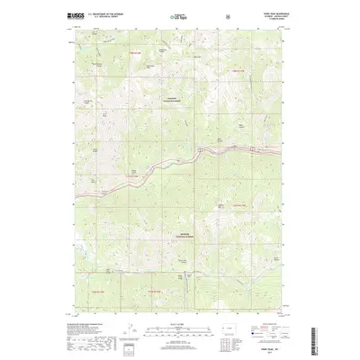
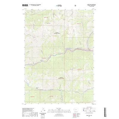
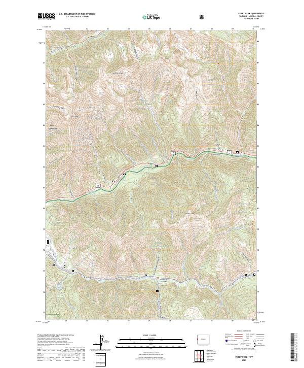 2023 Ferry Peak2023 Print · USGSLincoln County highlands and the winding Snake River corridor are captured here in the early twenty-first century. Outdoorsmen and local historians can trace wilderness routes like the Wolf Creek Trl and explore landmarks such as Ferry Peak and Sheep Gulch.
End of results
Showing maps 1-21 of 21
Top cities near Alpine Northeast
Frequently asked questions
- What are the different types of historical maps available for Alpine Northeast?
- What is the oldest map of Alpine Northeast?
- Where can I purchase historical maps of Alpine Northeast for my home or office?
- Where can I download high-res historical maps of Alpine Northeast?
- Are there historical topographic maps available for Alpine Northeast?
- Is there historical aerial imagery available for Alpine Northeast?
- Where are historical maps of Alpine Northeast sourced from?