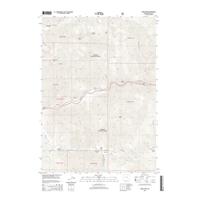
2015 Map of Ferry Peak
USGS Topo · Published 2015About this map
Ferry Peak and Bradley Mtn dominate the vertical landscape of this mountain corridor in the 2010s. The map illustrates a high-altitude wilderness divided between the Targhee National Forest and Bridger National Forest. The Greys River snakes through the southern portion of the quadrangle, serving as a primary drainage for numerous tributaries like Highy Cr and Mill Cr. Access through this complex terrain is provided by the Greys River Rd, which crosses the water at Greys River Bridge and Squaw Creek Bridge. This era shows a landscape managed for both timber and recreation, indicated by the Squaw Creek Snowmobile Trail near Squaw Flat. Steep-walled features such as Jordan Canyon, Deadhorse Canyon, and Sheep Gulch define the drainage patterns that flow toward the river valley below.
Find a feature on this map
50 named features on this map. Tap any name to fly to it.
Don’t see what you’re looking for? This feature index may not catch every label — zoom into the map to look around manually.
Map Details
Editions of this 2015 Ferry Peak Map
This is the sole edition of this map. No revisions or reprints were ever made.
Other maps of this area

1931 · Jackson
USGS Topo · 1:125,000

1932 · Irwin
USGS Topo · 1:96,000

1935 · Irwin
USGS Topo · 1:125,000

1935 · Jackson
USGS Topo · 1:125,000

1955 · Driggs
USGS Topo · 1:250,000

1958 · Driggs
USGS Topo · 1:250,000

1962 · Driggs
USGS Topo · 1:250,000

1963 · Munger Mountain
USGS Topo · 1:24,000

1963 · Observation Peak
USGS Topo · 1:24,000

1963 · Ferry Peak
USGS Topo · 1:24,000