1970s Maps of Sweetwater County, Wyoming
Explore 31 historic maps of Sweetwater County from the 1970s. These maps offer a rare glimpse into what life looked like during the 1970s — showing old roads, neighborhoods, homes, and landmarks that have changed or disappeared over time.
Whether you're researching your family's past, planning a metal detecting trip, or studying how Sweetwater County's landscape evolved across the 1970s, these high-resolution maps are a powerful tool for exploring the history of this region.
- Focus on a specific era: All maps on this page are from the 1970s, giving you a focused view of this time period.
- See what’s changed: Compare century-old streets, trails, and buildings to today's modern landscape using overlays and satellite layers.
- Research with precision: Use these maps for genealogy, historical research, land use analysis, or educational projects.
- View, download, or print: Maps are fully viewable online in high resolution, and can be downloaded or printed for your own records.
Start exploring Sweetwater County's history through authentic maps from the 1970s. This is your window into the past.
Sweetwater County, WY maps
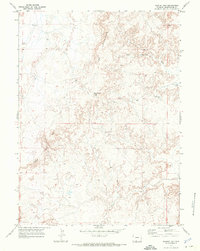
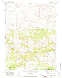
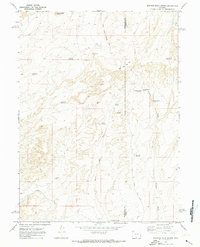
(31)- 1970 Map of South Barrel Spring, 1973 Print
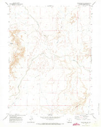
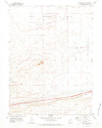
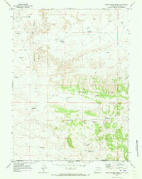
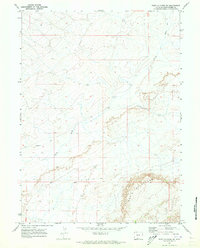
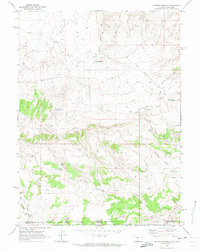
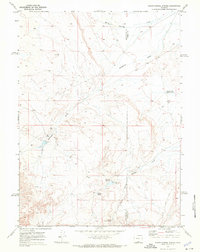 1970 South Barrel Spring1973 Print · USGSSweetwater and Carbon counties appear here in the early 1970s, characterized by isolated water sources and high-desert draws. Researchers can trace remote infrastructure like West Hangout Road and locate critical water points including South Barrel Spring and Dad Dail Reservoir.
 - 1970 Map of Red Desert SW, 1973 Print
 1970 Red Desert SW1973 Print · USGSHigh desert terrain in Sweetwater County comes into focus in 1970, showing the high plateaus of the Red Desert. Researchers can trace the Continental Divide along the prominent Delaney Rim and locate landmarks like Wells Bluff.
 - 1970 Map of Red Desert SE, 1973 Print
 1970 Red Desert SE1973 Print · USGSSweetwater County's high desert landscape is documented here during the early 1970s, showing the intersection of energy exploration and open range. Trace the path of the Continental Divide past the steep Wells Bluff Delaney Rim and isolated drill holes.
 - 1970 Map of Cow Creek Reservoir, 1973 Print
 1970 Cow Creek Reservoir1973 Print · USGSSweetwater County's high desert landscape comes into focus in the early 1970s, showing a remote network of range improvements and desert landmarks. Researchers can trace the drainage of Shell Creek and locate remote catchments like Petrified Wood Reservoir and Adobe Town Rim.
 - 1970 Map of Prehistoric Rim, 1973 Print
 1970 Prehistoric Rim1973 Print · USGSSweetwater County's high desert landscape is documented in the early 1970s, showcasing the intricate drainage of the Prehistoric Rim. Local researchers can trace early resource exploration and navigation routes through features like the drill hole and the rugged Jeep Trail.
 - 1970 Map of Powder Mountain NE, 1973 Print
 1970 Powder Mountain NE1973 Print · USGSHigh-desert ranching and survey lands in Sweetwater County are captured in the early seventies, showing a landscape defined by seasonal water and navigation. Trace historic access routes along Jeep Trails past prominent landmarks like Church Butte and Sandy Butte Reservoir.
 - 1970 Map of Kinney Spring, 1973 Print
 1970 Kinney Spring1973 Print · USGSSweetwater County's arid high-desert landscape is captured here in the early seventies, centered on the vital water source of Kinney Spring. Researchers can trace the path of Gap Road and explore the distinct topography of Adobe Town.
 - 1970 Map of Table Rock, 1973 Print
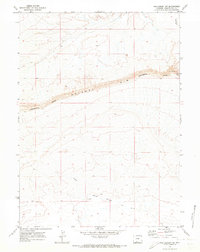
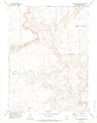
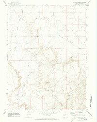
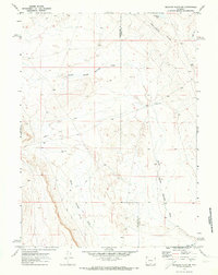
 1970 Table Rock1973 Print · USGSSweetwater County at the start of the 1970s reveals a high-desert landscape defined by the Union Pacific railroad and the energy industry. Trace the growth of Table Rock and Monell alongside vast Oil and Gas Fields and the prominent Delaney Rim.
 - 1970 Map of Red Desert NW, 1973 Print
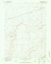
 1970 Red Desert NW1973 Print · USGSSweetwater County’s high desert landscape is captured here in the early 1970s, showing a critical transit and utility corridor. Researchers can trace the path of the Union Pacific railroad and find scattered evidence of resource work like the Gravel Pit and several Wells.
 - 1970 Map of Manuel Gap, 1973 Print
 1970 Manuel Gap1973 Print · USGSSweetwater County's high-desert terrain is captured in detail during the early seventies, showcasing a landscape of stark ridges and seasonal washes. Researchers can trace land formations like The Haystacks and Town Rim, or follow the path of Sand Creek.
 - 1970 Map of Powder Mountain, 1973 Print
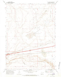
 1970 Powder Mountain1973 Print · USGSThe high desert of the Wyoming-Colorado border comes into focus in this early 1970s survey. Researchers can trace the path of the Cherokee Trail past isolated water sources like Moonshine Spring and Powder Mountain Res.
 - 1970 Map of Dripping Rock Spring, 1973 Print
 1970 Dripping Rock Spring1973 Print · USGSThe high desert of Sweetwater and Carbon counties is captured here in the early 1970s, showcasing a landscape of essential water improvements. Researchers can trace historic land use through sites like Hartt Cabin Spring, Courthouse Butte, and numerous remote Drill Hole locations.
 - 1970 Map of Upper Powder Spring, 1973 Print
 1970 Upper Powder Spring1973 Print · USGSThe high desert along the Wyoming-Colorado border in the early seventies shows a landscape defined by water management and the rugged Powder Rim. Genealogists and historians can trace essential water sources like Upper Powder Spring and remote reservoirs such as Miserable Res.
 - 1970 Map of Barrel Springs SW, 1973 Print
 1970 Barrel Springs SW1973 Print · USGSSweetwater County at the end of the sixties is defined by its arid drainage networks and essential water storage features. Researchers can trace the courses of West Haystack Wash and Sand Creek or locate isolated landmarks like Cloud Res and Sand Branch Reservoir.
 - 1970 Map of Mc Pherson Springs, 1973 Print
 1970 Mc Pherson Springs1973 Print · USGSThe high-country border of Wyoming and Colorado is documented here in the early 1970s, showing a landscape of resource extraction and ranching. Genealogists and historians can trace old stock trails and jeep trails past Mcpherson Springs and the numerous drill holes within the Cherokee Basin.2 unique versions available
 - 1970 Map of Monument Valley, 1973 Print
 1970 Monument Valley1973 Print · USGSSweetwater County at the start of the 1970s reveals a vast landscape defined by high plateau rims and livestock water management. Trace a network of named catchments like Water Can Reservoir and the rugged Jeep Trail along the Adobe Town Rim.
 - 1970 Map of J O Dugway, 1973 Print
 1970 J O Dugway1973 Print · USGSThe high desert of Sweetwater County is shown at the start of the 1970s, where the Continental Divide and Delaney Rim shape the land. Researchers can trace the path of the Union Pacific and find remote water sources like J O Spring and Delaney Spring.
 - 1970 Map of Fort La Clede NE, 1973 Print
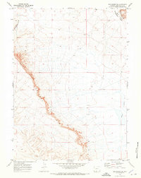
 1970 Fort La Clede NE1973 Print · USGSThe high desert of Sweetwater County is shown here in the early 1970s, dominated by the historic path of the Overland Trail. Researchers can trace this famous migration route as it winds past the striking relief of The Haystacks and across Laney Wash.
 - 1970 Map of Tipton, 1973 Print
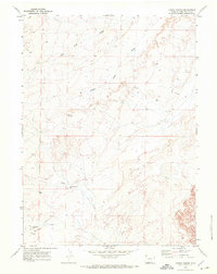
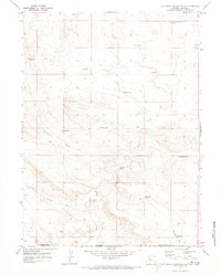
 1970 Tipton1973 Print · USGSThe high desert of Sweetwater County is captured here in the early seventies, dominated by the Continental Divide. Researchers can trace the Union Pacific rail corridor and find remote sites like Tipton and Robinson.
 - 1970 Map of Salazar Butte, 1973 Print
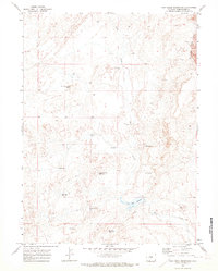
 1970 Salazar Butte1973 Print · USGSSweetwater County at the start of the 1970s shows a landscape of ranching water projects and early resource exploration. Trace the course of Willow Creek past Salazar Butte to find ranching landmarks like Willow Reservoir.
 - 1970 Map of Cow Creek Reservoir SW, 1973 Print
 1970 Cow Creek Reservoir SW1973 Print · USGSThe high-desert borderlands of Sweetwater and Moffat counties come to life in this early 1970s survey. Researchers can trace historic ranching infrastructure through water features like Espitallier Spring, High Center Res, and the Lower Shell Creek Crossing.
 - 1970 Map of Rotten Springs, 1973 Print
 1970 Rotten Springs1973 Print · USGSThe high-desert borderlands of Wyoming and Colorado are captured here in the early seventies, centered on the imposing Powder Rim. Researchers can trace the path of the Cherokee Trail Road and locate isolated water sites like MFS Homestead Wells or Rotten Springs.
 - 1970 Map of Haystack Flats, 1973 Print
 1970 Haystack Flats1973 Print · USGSThe high desert of Sweetwater County comes into focus in the early 1970s, showing a land still defined by the wagon roads of the previous century. Trace the historic Overland Trail past Dug Springs Stage Sta (Ruins) and landmarks like Man and Boy Buttes.
 - 1970 Map of Mexican Flats NW, 1973 Print
 1970 Mexican Flats NW1973 Print · USGSThe high desert of Sweetwater and Carbon counties is captured here in 1970, showing a landscape defined by western migration and resource exploration. Researchers can trace the path of the Overland Trail as it passes near Coal Bank Lake and the Continental Divide.
 - 1970 Map of Red Desert, 1973 Print
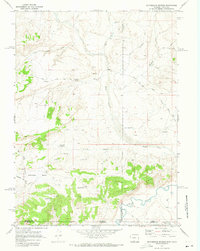
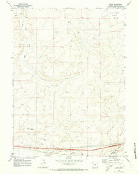
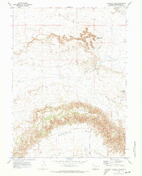
 1970 Red Desert1973 Print · USGSSweetwater County's high-desert rail corridor is captured here in the early seventies as energy infrastructure began to expand across the divide. Researchers can trace the Union Pacific line through Red Desert and find the desert basin of Frewen Lake near the Continental Divide.2 unique versions available
Showing maps 1-25 of 31
Top cities of Sweetwater County
- Rock Springs historical maps
- Green River historical maps
- North Rock Springs historical maps
- Clearview Acres historical maps
- James Town historical maps
- Reliance historical maps
See more
Frequently asked questions
- What are the different types of historical maps available for Sweetwater County?
- What is the oldest map of Sweetwater County?
- Where can I purchase historical maps of Sweetwater County for my home or office?
- Where can I download high-res historical maps of Sweetwater County?
- Are there historical topographic maps available for Sweetwater County?
- Is there historical aerial imagery available for Sweetwater County?
- Where are historical maps of Sweetwater County sourced from?