1960s Maps of Sweetwater County, Wyoming
Explore 151 historic maps of Sweetwater County from the 1960s. These maps offer a rare glimpse into what life looked like during the 1960s — showing old roads, neighborhoods, homes, and landmarks that have changed or disappeared over time.
Whether you're researching your family's past, planning a metal detecting trip, or studying how Sweetwater County's landscape evolved across the 1960s, these high-resolution maps are a powerful tool for exploring the history of this region.
- Focus on a specific era: All maps on this page are from the 1960s, giving you a focused view of this time period.
- See what’s changed: Compare century-old streets, trails, and buildings to today's modern landscape using overlays and satellite layers.
- Research with precision: Use these maps for genealogy, historical research, land use analysis, or educational projects.
- View, download, or print: Maps are fully viewable online in high resolution, and can be downloaded or printed for your own records.
Start exploring Sweetwater County's history through authentic maps from the 1960s. This is your window into the past.
Sweetwater County, WY maps
(151)- 1960 Map of Ogden
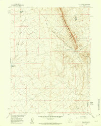
 1960 Ogden1960 Print · USGSIn the mid-1950s, this region of the American West balanced military expansion with frontier history along the Union Pacific RR. Genealogists and historians can trace old settlements like Fort Bridger, the residential growth of Washington Terrace, and industrial sites from the Hill AFB complex to the coal mines of Kemmerer.
 - 1960 Map of Salt Lake City
 1960 Salt Lake City1960 Print · USGSThe Wasatch Front and High Uintas are captured mid-century as the Salt Lake Valley underwent significant postwar expansion. Genealogists and historians can trace rail lines like the Union Pacific and locate established landmarks such as Fort Douglas, Camp Williams, and the Bingham Canyon Mine.
 - 1960 Map of Vernal
 1960 Vernal1960 Print · USGSNortheastern Utah was a rugged frontier of mineral extraction and federal conservation in the mid-twentieth century. Genealogists and historians can trace the growth of Vernal, locate Gilsonite mining operations near Bonanza, and explore the 1950s boundaries of Dinosaur National Monument.
 - 1960 Map of Red Lake, 1962 Print
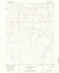
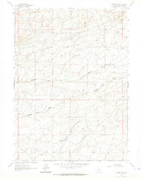
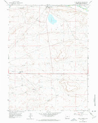
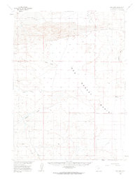 1960 Red Lake1962 Print · USGSSweetwater County's high desert landscape appears here at the dawn of the 1960s, showing a remote world of sheep camps and early energy exploration. Trace the isolated Blake Sheep Camp, follow the path of Luman Road, and locate early Gas Wells near the shifting Sand Dunes.
 - 1960 Map of Battle Spring, 1962 Print
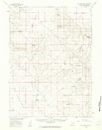
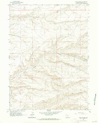
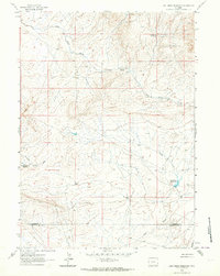
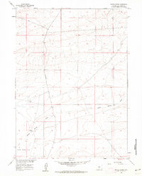 1960 Battle Spring1962 Print · USGSSweetwater County's high-desert basins were mapped in detail at the start of the 1960s, documenting a remote landscape of springs and cattle trails. Genealogists and historians can trace old routes like the Wamsutter Crooks Gap Road and locate sites such as Battle Spring and an early Prospect.2 unique versions available
 - 1960 Map of Hansen Lake NE, 1962 Print
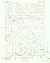
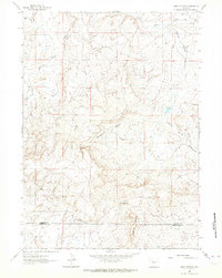
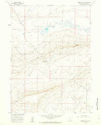 1960 Hansen Lake NE1962 Print · USGSSweetwater County's high desert terrain is captured here at the start of the sixties, showcasing the geological transition of the Chain Lakes Rim. Researchers can trace the path of the Riner Cutoff Road and locate the remote outpost of Stratton Camp.2 unique versions available
 - 1960 Map of Sooner Reservoir, 1962 Print
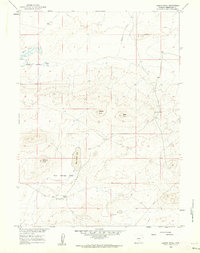
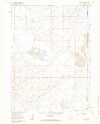
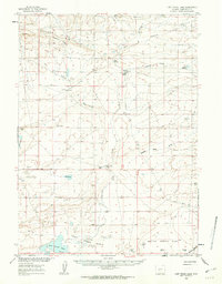
 1960 Sooner Reservoir1962 Print · USGSSweetwater County ranching country is captured here in the early sixties, showing the essential water and shelter infrastructure of the high desert. Researchers can locate the isolated Sheep Camp, the namesake Sooner Reservoir, and the paths of Stratton Draw.2 unique versions available
 - 1960 Map of Larsen Knoll, 1962 Print
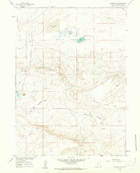
 1960 Larsen Knoll1962 Print · USGSSweetwater County ranch lands and desert basins are captured here in the early sixties, showing the isolated homesteads and vital water sources of the high plains. Researchers can locate the Larsen Ranch and trace the original Riner Cutoff Road near Mud Springs Lake.2 unique versions available
 - 1960 Map of Bull Springs, 1962 Print
 1960 Bull Springs1962 Print · USGSHigh desert water management and resource exploration define this Sweetwater County landscape during the early sixties. Researchers can trace the path of Stewart Creek between its upper and lower reservoirs or locate named sites like Bull Springs and Coyote Spring.3 unique versions available
 - 1960 Map of Lost Creek Butte, 1962 Print
 1960 Lost Creek Butte1962 Print · USGSThe high-desert ranching country of Sweetwater County is shown here in the mid-twentieth century as a landscape of remote sheep camps and sagebrush basins. Researchers can trace the layout of early livestock operations at Buzzard Sheep Camp and the Old Osborne Cabin.2 unique versions available
 - 1960 Map of Buck Draw, 1962 Print
 1960 Buck Draw1962 Print · USGSSweetwater and Carbon counties meet in this arid basin during the early sixties, as the Missouri River Basin project modernized the high plains. Researchers can trace the path of the cross-country Pipeline and locate landmarks like Mud Lake Flats and Mahoney Lakes.3 unique versions available
 - 1960 Map of Hansen Lake, 1962 Print
 1960 Hansen Lake1962 Print · USGSSweetwater County's high-desert basins are captured here in the early sixties, showing a landscape defined by seasonal water and cattle-range landmarks. Researchers can trace the route of the Wamsutter-Crooks Gap Road as it passes Coal Butte and the namesake Chain Lakes.3 unique versions available
 - 1960 Map of Chicken Spring, 1962 Print
 1960 Chicken Spring1962 Print · USGSSweetwater County ranching and water resources are documented here in the early sixties as the Missouri River Basin project progressed. Researchers can locate isolated landmarks like Hadsell Corral and follow the paths of Spring Creek and Stewart Creek.3 unique versions available
 - 1960 Map of Five Fingers Butte, 1963 Print
 1960 Five Fingers Butte1963 Print · USGSSweetwater County ranch lands and volcanic buttes are captured here during the 1960s expansion of regional water and resource management. Genealogists and historians can trace the foundations of Luman Ranch, local water sources like Niland Spring, and landmarks such as Buffalo Hump.2 unique versions available
 - 1960 Map of Lost Creek Lake, 1963 Print
 1960 Lost Creek Lake1963 Print · USGSSweetwater County ranching and mining country are documented here in the early sixties. Researchers can locate remote landmarks like the Hadsell Cabin and water sources such as Osborne Reservoir and Eagles Nest Spring.2 unique versions available
 - 1961 Map of Lander
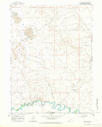
 1961 Lander1961 Print · USGSThe high peaks and desert basins of central Wyoming appear here in the early sixties, showing the landscape of the Shoshone Indian Reservation and the Wind River Range. Researchers can trace the path of the Oregon Trail and locate early settlements like Lander and the mining remains at South Pass City.2 unique versions available
 - 1961 Map of Scott Spring, 1964 Print
 1961 Scott Spring1964 Print · USGSSweetwater County at the start of the sixties reveals a landscape shaped by the deep incisions of Scott Canyon. Researchers can trace the path of Blue Rim Rd or locate the remote Scott Spr tucked away in the canyon floor.2 unique versions available
 - 1961 Map of Osborne Well, 1964 Print
 1961 Osborne Well1964 Print · USGSSweetwater County's high desert landscape comes into focus during the early sixties, highlighting the vital water and mining infrastructure of the Wyoming interior. Researchers can trace the path of Osborne Draw or locate specific sites like Osborne Well and the Crooked Well Reservoir.2 unique versions available
 - 1961 Map of Lost Creek Reservoir, 1964 Print
 1961 Lost Creek Reservoir1964 Print · USGSThe high plains along the Fremont and Sweetwater county line come into focus during the early sixties, showing a landscape defined by water scarcity and mineral hunt. Researchers can trace remote mining prospects and isolated water sources like Stinking Springs and Lost Creek Reservoir.2 unique versions available
 - 1961 Map of Olson Springs, 1964 Print
 1961 Olson Springs1964 Print · USGSFremont and Sweetwater Counties in the early 1960s reveal a landscape shaped by energy exploration and ranching water sources. Researchers can trace early energy development at the Bison Basin Oil Field and locate water points like Olson Springs and Smiley Springs.
 - 1961 Map of Blue Point, 1964 Print
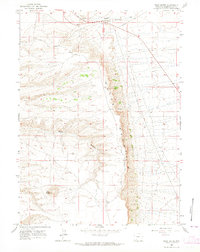
 1961 Blue Point1964 Print · USGSSweetwater County at the start of the 1960s reveals a landscape defined by historic migration and modern industry. Trace the overlap of the Emigrant Trail and Overland Trail near Eckes Homestead and the Soda Ash Wells.3 unique versions available
 - 1961 Map of Little America, 1964 Print
 1961 Little America1964 Print · USGSSweetwater County during the early 1960s shows a landscape where historic pioneer routes met the industrial expansion of the post-war era. Researchers can trace the path of the Overland Trail or locate mid-century mining sites like Westvaco Shaft No 3 and Little America Well.2 unique versions available
 - 1961 Map of Peru, 1964 Print
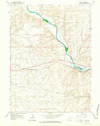 1961 Peru1964 Print · USGSThe high desert of Sweetwater County comes into focus in the early sixties as the railroad and river shape local industry. Researchers can trace the path of the Overland Trail or locate family landmarks like Shaul Ranch and the community of James Town.3 unique versions available
 - 1961 Map of Sevenmile Gulch, 1964 Print
 1961 Sevenmile Gulch1964 Print · USGSPioneer history and industrial utility meet in this early 1960s survey of Sweetwater County, Wyoming. Trace the historic paths of the Emigrant Trail and Overland Trail as they navigate the landscape near Sevenmile Gulch.2 unique versions available
 - 1961 Map of Pilot Butte, 1964 Print
 1961 Pilot Butte1964 Print · USGSSweetwater County ranching and transit patterns are preserved here during the early sixties. Researchers can trace historic routes like Chiltons Cutoff or locate landmarks such as Fourteenmile Ranch and Pilot Butte.3 unique versions available
Showing maps 1-25 of 151
Top cities of Sweetwater County
- Rock Springs historical maps
- Green River historical maps
- North Rock Springs historical maps
- Clearview Acres historical maps
- James Town historical maps
- Reliance historical maps
See more
Frequently asked questions
- What are the different types of historical maps available for Sweetwater County?
- What is the oldest map of Sweetwater County?
- Where can I purchase historical maps of Sweetwater County for my home or office?
- Where can I download high-res historical maps of Sweetwater County?
- Are there historical topographic maps available for Sweetwater County?
- Is there historical aerial imagery available for Sweetwater County?
- Where are historical maps of Sweetwater County sourced from?