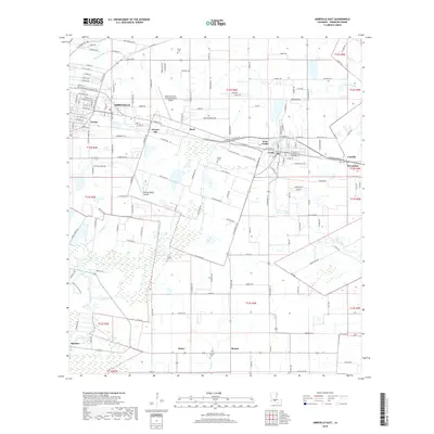
2018 Map of Abbeville East
USGS Topo · Published 2018About this map
The Vermilion River snakes through the southwestern corner of this Vermilion Parish landscape, defining the rural character of the region just east of Abbeville. The area is a mosaic of agriculture and small settlements, including Grosse Isle, Mack, and Henry, connected by a network of farm-to-market roads like LA Highway 82. The map reveals the critical importance of drainage in this low-lying coastal prairie, marked by numerous coulees such as Youngs South Coulee and Laports Coulee. For genealogists and local historians, several family-named burial sites are preserved here, including the Trahan Cem, Bares Cem, and Landry Cem. Industry and infrastructure are anchored by the Abbeville Chris Crusta Memorial Airport and the neighboring towns of Erath and Delcambre to the east.
Find a feature on this map
155 named features on this map. Tap any name to fly to it.
Don’t see what you’re looking for? This feature index may not catch every label — zoom into the map to look around manually.
Map Details
Editions of this 2018 Abbeville East Map
This is the sole edition of this map. No revisions or reprints were ever made.
Other maps of this area

1932 · Abbeville SW
USGS Topo · 1:31,680

1932 · Abbeville SE
USGS Topo · 1:31,680

1932 · Abbeville NE
USGS Topo · 1:31,680

1932 · Abbeville NW
USGS Topo · 1:31,680

1937 · Derouen
USGS Topo · 1:62,500

1939 · St. Martinsville
USGS Topo · 1:62,500

1945 · New Orleans
USGS Topo · 1:250,000

1946 · Milton
USGS Topo · 1:31,680

1946 · Leroy
USGS Topo · 1:31,680

1952 · Lake Charles
USGS Topo · 1:250,000