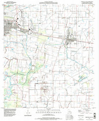
1994 Map of Abbeville East
USGS Topo · Published 1998About this map
The Vermilion River and a complex network of man-made waterways define this low-lying landscape in south-central Louisiana during the mid-1990s. The transition from the urban edge of Abbeville to the industrial and agricultural heart of the parish is evident in the sprawling Erath Oil and Gas Field and the Tigre Lagoon Oil and Gas Field. Small, family-named settlements like Grosse Isle, Mack, and Camille dot the plains between the river and Bayou Tigre, often organized around historical property lines and drainage levees.
Find a feature on this map
31 named features on this map. Tap any name to fly to it.
Don’t see what you’re looking for? This feature index may not catch every label — zoom into the map to look around manually.
Map Details
Editions of this 1994 Abbeville East Map
This is the sole edition of this map. No revisions or reprints were ever made.
Other maps of this area

1932 · Abbeville SW
USGS Topo · 1:31,680

1932 · Abbeville SE
USGS Topo · 1:31,680

1932 · Abbeville NE
USGS Topo · 1:31,680

1932 · Abbeville NW
USGS Topo · 1:31,680

1937 · Derouen
USGS Topo · 1:62,500

1939 · St. Martinsville
USGS Topo · 1:62,500

1945 · New Orleans
USGS Topo · 1:250,000

1946 · Milton
USGS Topo · 1:31,680

1946 · Leroy
USGS Topo · 1:31,680

1952 · Lake Charles
USGS Topo · 1:250,000